Some links on this site are affiliate links. If you book through one, Tokyo Trailhead earns a commission at no extra cost to you. It never decides what appears here.
The Rock Garden is the reason most people walk past the shrine on Mount Mitake instead of turning around at it.
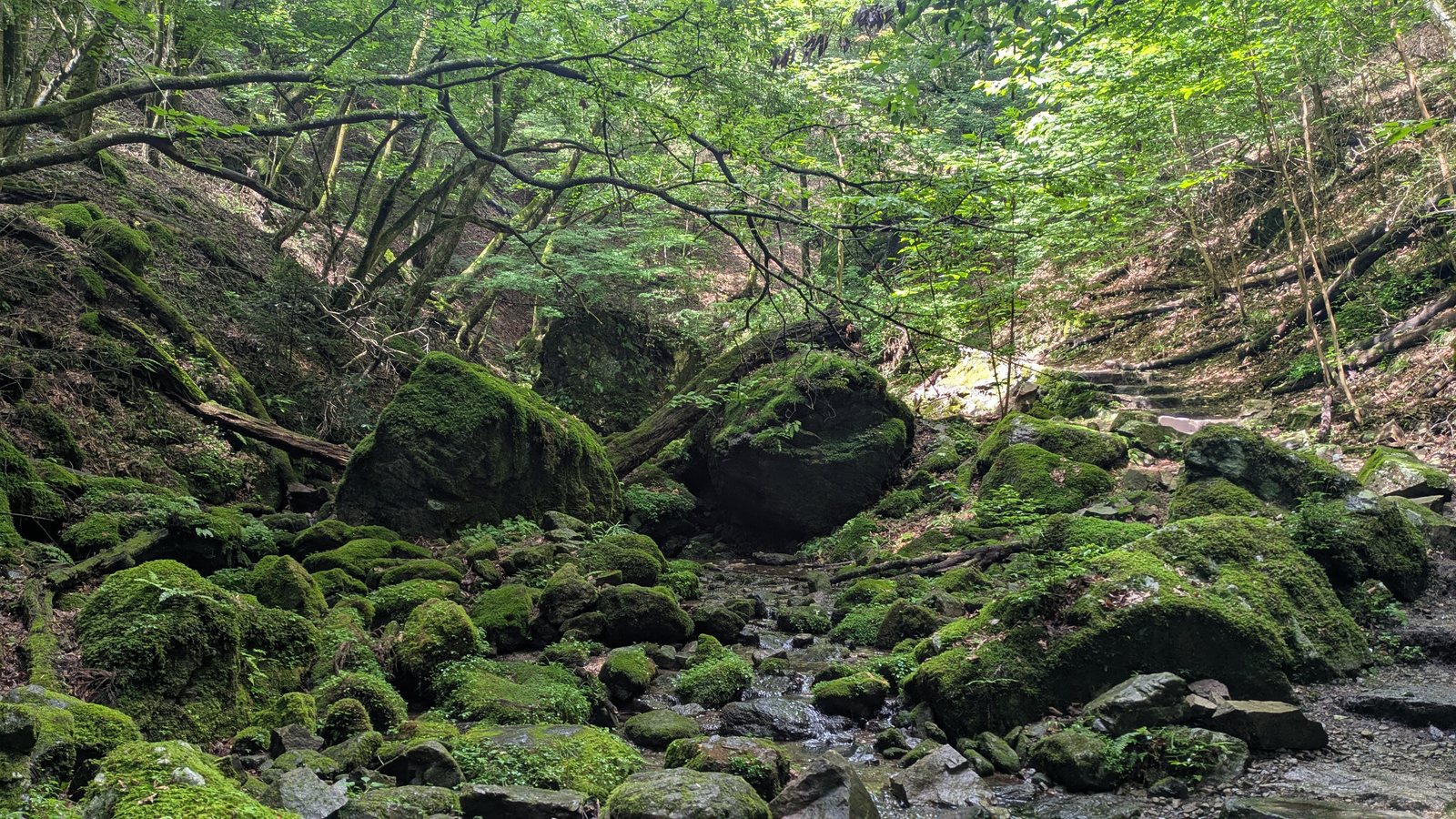
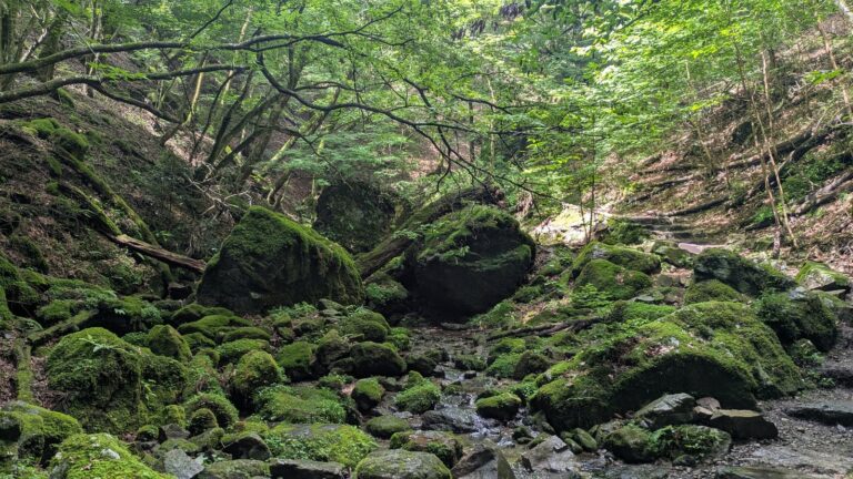
The name is misleading in English. Nothing here is arranged. It is a narrow valley floor where a stream runs between boulders that are entirely covered in moss, under a canopy that closes over the top of it. The Japanese board at the entrance calls it the Oirase of Tokyo, after a famous mossy gorge four hundred kilometres north. That comparison is closer than the English name.
It was built in 1935 as a walking path, using the stream and the exposed rock that were already there, and the whole area became national park land in 1950.
Here is the part that decides your day. The loop is not uniformly difficult. For most of its length it is a wide earth path with the stream running below it, easy enough that people walk it in trainers. The hard section is concentrated in one place: a steep staircase down to a waterfall called Nanayo Falls, and the climb back up the same staircase.
That waterfall is a spur. You go down to it, you come back up the way you came, and then you continue. Skip it, and the steepest ground on the loop never touches you.
Almost every English account describes the falls as a stage on the route, something you pass through on your way into the Rock Garden. On the ground it is a branch, not a stage. The hardest part of this loop is the part you can skip.
What this guide covers15 sections
- The essentials
- Getting to the start takes 25 minutes, and no sign tells you that
- The turning is halfway up the shrine steps
- Nagaodaira: the last place you have to decide anything
- Two boards, two very different amounts of English
- The fork: Nanayo Falls is a spur, not a stage
- The staircase, and why the day before matters
- Tengu Rock: the chain is real, and climbing it is optional too
- From here on, it is a wide path beside the stream
- What grows here grows almost nowhere else
- Ayahiro Falls, and the torii in front of it
- The way back is the easy half
- What to wear on your feet
- Questions people actually ask
- Related
The essentials
| Japanese name | ロックガーデン. The older Japanese name on the local board is 御岳岩石園 (Mitake Ganseki-en) |
| Loop distance | 1.5 km on the English interpretive board. The Japanese board gives about 1 km for the walkway itself. The two numbers describe different things |
| Measured, whole loop | 1 hour 34 minutes, Nagaodaira back to Nagaodaira, including the spur to Nanayo Falls and stops for photographs |
| Getting to the start | About 25 minutes on foot from the top cable car station |
| Highest point | Nagaodaira, the junction where the loop begins |
| Lowest point | Nanayo Falls, roughly 170 metres below the junction |
| Surface | Packed earth, stone steps, a long staircase with a handrail, flat stepping stones across the stream, wet rock near the falls |
| Toilets on the loop | Two. One at the rest area in the middle, one at the Okunoin junction near the end |
| Drinking water | None |
| Shade | Complete |
| Signage | Japanese throughout. English on the trail markers, on the national park board, on the interpretive panels |
Three of these deserve a second look.
The two distances are not a contradiction. The English interpretive panel at the junction gives 1.5 km for the trail that loops through the valley past both waterfalls. The Japanese board deeper in gives about 1 km for the constructed walkway between Tengu Rock and the top of Ayahiro Falls. The first is the walk. The second is the garden.
An hour and a half is the honest figure, not three hours. English sources often quote a three-hour round trip from the cable car station. Measured on a Thursday morning, unhurried, stopping to photograph twenty-five times: twenty-five minutes to the junction, one hour thirty-four minutes around the loop, twenty-five minutes back. Call it two and a half hours from cable car to cable car.
There are toilets, but no water. Two toilets on the loop is more than most mountain paths offer. There is no tap, no vending machine, nothing to drink from the moment you leave the village. The stream is right there for an hour. It is not drinking water.
Affiliate link. This site earns a commission if you book through it, at no extra cost to you. Photo from our own walk.
Getting to the start takes 25 minutes, and no sign tells you that
The Rock Garden does not begin at the cable car. It begins at a junction called Nagaodaira, about twenty-five minutes of walking further on, and the walk to it goes straight through the strangest thing about this mountain: a village that lives on top of it.
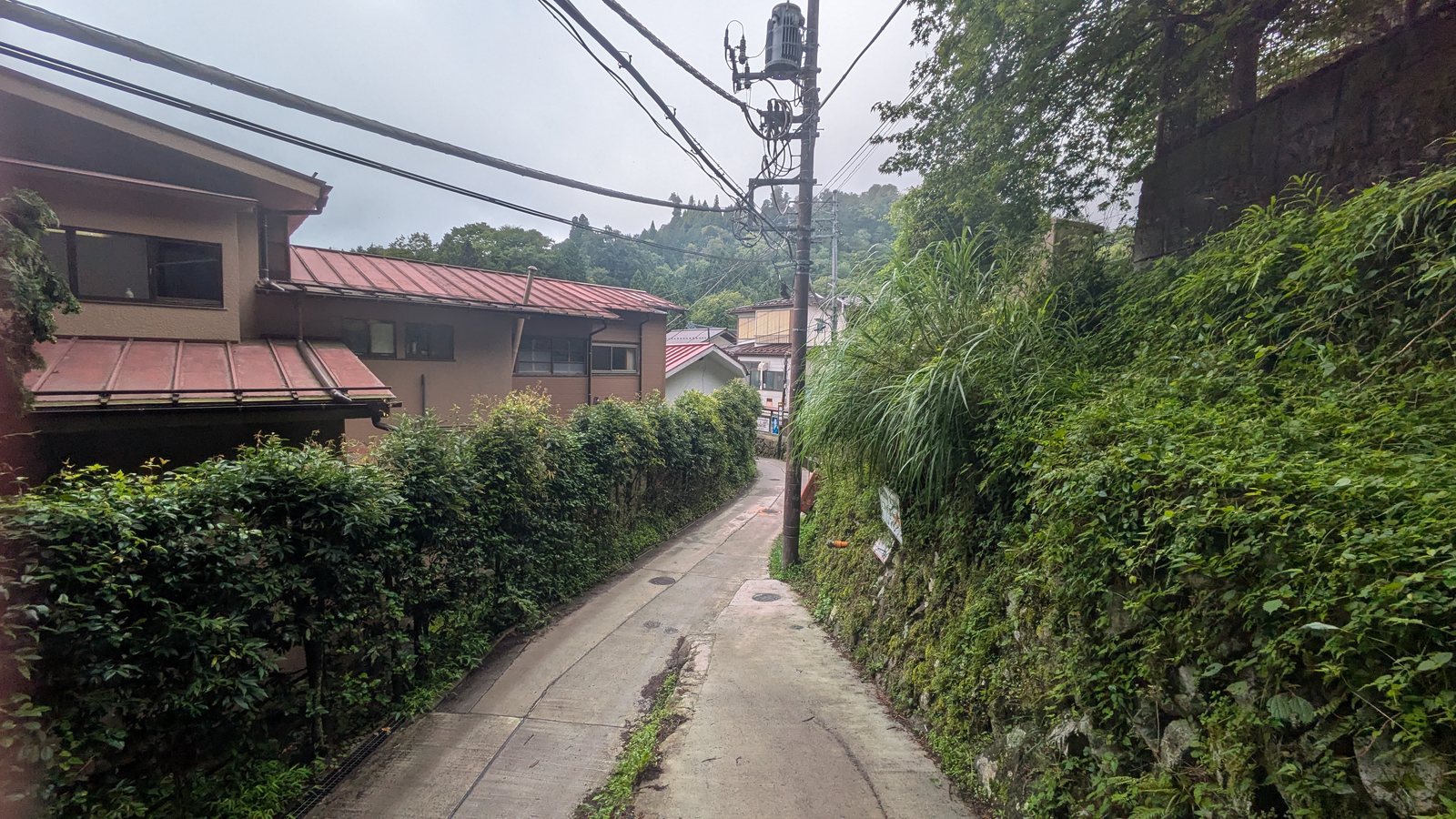
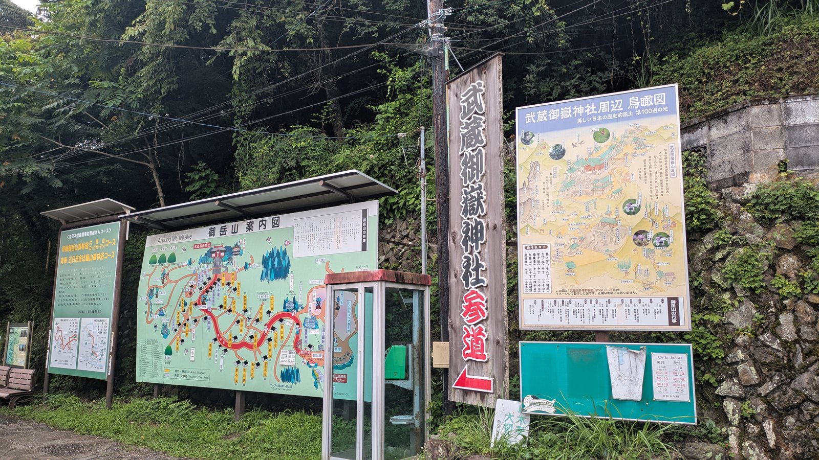
Step off the cable car and you are on the Omotesando, the main approach. It is a paved lane lined on both sides with lodgings, family houses, souvenir shops, restaurants, a clinic, a fire station. People live here. The map board at the station numbers more than fifty buildings.
Follow the lane. You pass the Mitake Visitor Center, then a vast cedar called the Jindai Keyaki, then the shops thin out, then the shrine torii appears ahead. Keep going.
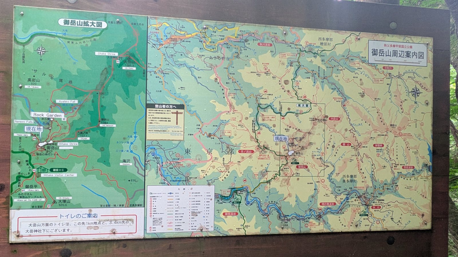
Here is the useful part. The station map board prints walking times for Mount Otake at two hours, for Okunoin at ninety minutes, for Mount Hinode at one hour, for Hatonosu Station at three hours. Every one of those is a destination beyond the Rock Garden. The time to Nagaodaira, the junction where the loop actually starts, is not printed anywhere on it.
So here is the measurement. Cable car station to the junction, walking at an unhurried pace, was about twenty-five minutes. The full recorded time was forty-nine minutes, but that included thirteen minutes spent on a flower detour at Fujimine and about ten minutes at the shrine itself.
Twenty-five minutes. Flat to gently rising. Paved most of the way.
The turning is halfway up the shrine steps
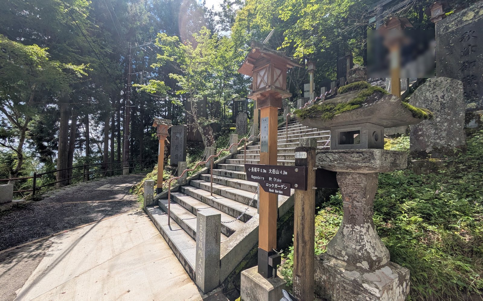
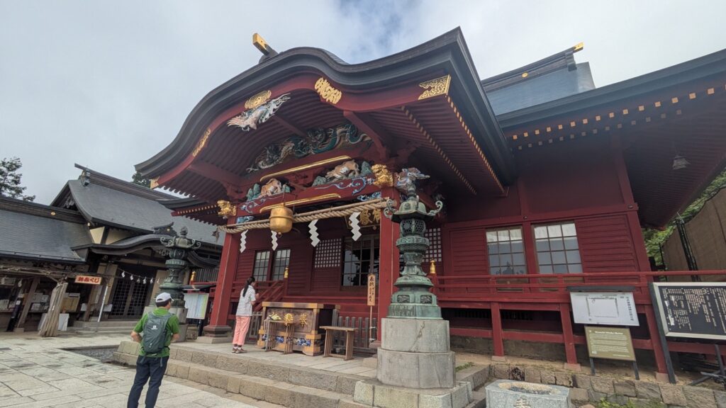
Musashi Mitake Shrine sits at 929 metres, at the top of a long flight of stone steps. The Rock Garden turning is on those steps, partway up.
You do not have to climb to the shrine building to reach the loop. You do have to climb about half the steps.
This is worth saying plainly, because the cable car creates the opposite impression. It lifts you from 407 metres at the bottom station to 831 metres at the top, which is more than four hundred metres of climbing done for you before you take a step. It is easy to arrive believing the hard work has been outsourced. The stone steps are the first correction to that belief, and they arrive before any trail does.
At the turning there is a wooden marker post, numbered 05-881 by the Tokyo Metropolitan Government. It reads:
← 長尾平 0.2km 大岳山 4.2km
Nagaodaira Mt. Otake
ロックガーデン
Rock Garden
Two hundred metres from here to the junction. Turn left, and the steps stop.
Whether you also climb the rest of the steps to the shrine is a separate decision, and it is one you make standing at this post rather than one you have to make in advance.
Nagaodaira: the last place you have to decide anything
The junction is a flat clearing with benches, picnic tables, a teahouse, and a toilet. It is the natural place to sit down before committing to anything.
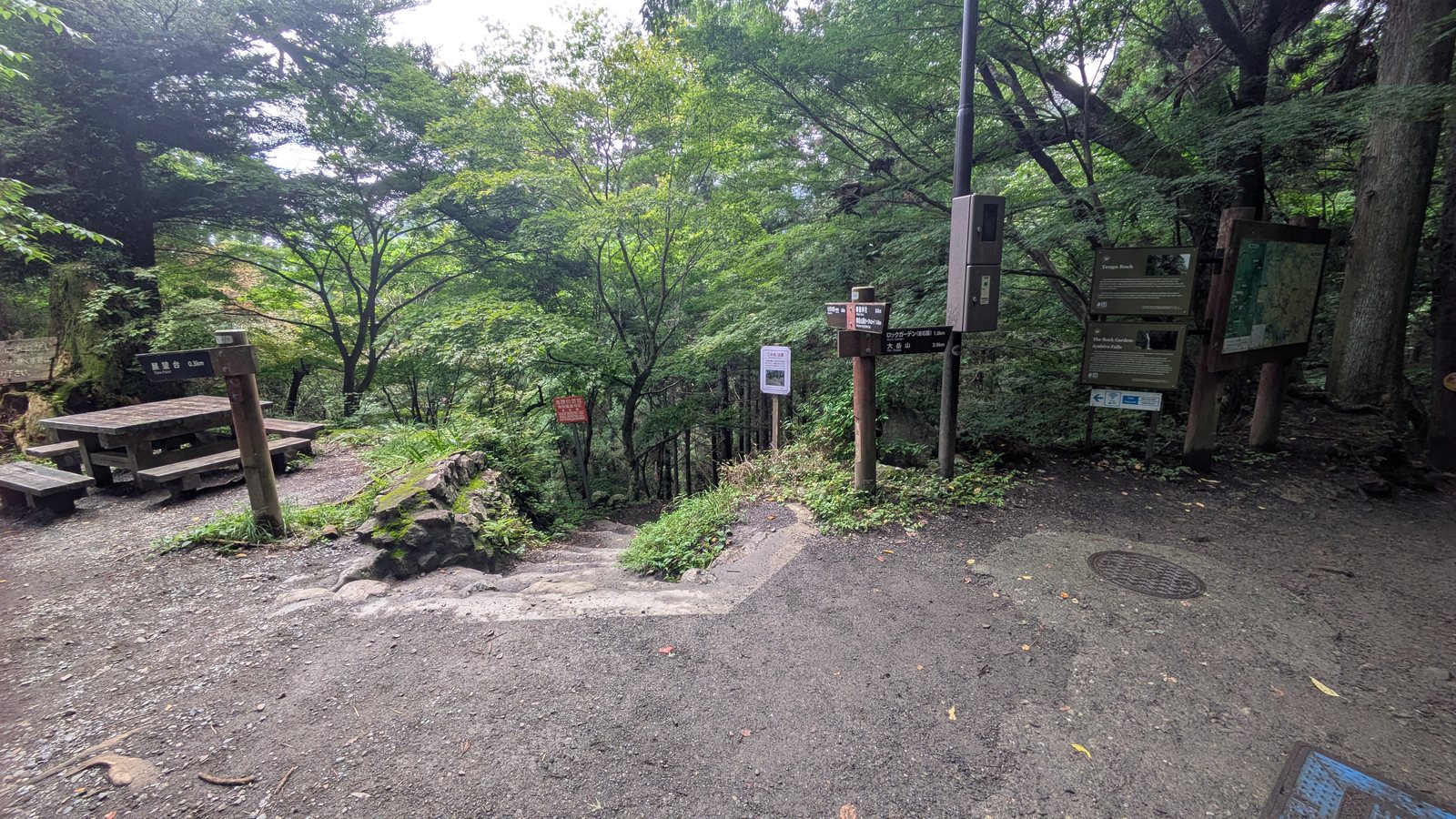
Three boards stand together here: the national park map, the English interpretive panel for Tengu Rock, and the English interpretive panel for the Rock Garden and Ayahiro Falls. Every piece of information you need to choose your route is in this one clearing.
Nothing before this point requires a decision. You ride the cable car, you walk through the village, you climb half a flight of steps, you arrive here. The choosing starts now.
Two boards, two very different amounts of English
The interpretive panels at the junction are good. They are brown metal, professionally written, with a QR code for audio guidance. The one for Tengu Rock explains that tree roots cover the rock in ridges resembling steps, that a chain is fixed for climbing it, that the surface is slippery when wet. The one for the Rock Garden explains that the torii in front of Ayahiro Falls marks the area as sacred, that priests and pilgrims practise waterfall austerities there, that the 1.5 kilometre trail is the most popular in the area.
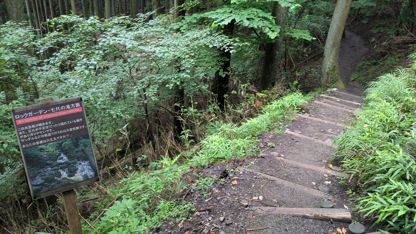
Then you start walking down, and after two minutes you reach a second board. This one is not part of that series. It is a local sign, and the difference in how much of it you can read depends entirely on which language you read.
The English is one line, in a red band:
Be careful of slipping down ahead.
Below it, in Japanese only, are four more:
A steep descent continues from here.
There are places where the footing is unstable or wet, and it is slippery.
Going in light footwear such as sandals is extremely dangerous.
Is your equipment adequate?
An English reader gets a general caution about slipping. A Japanese reader gets a warning that the descent is sustained, a specific note about sandals, and a direct question aimed at them.
That gap is the reason this article exists. Everything below is what the fourth line is asking about.
Affiliate link. This site earns a commission if you book through it, at no extra cost to you. Photo from our own walk.
The fork: Nanayo Falls is a spur, not a stage
Twenty-five minutes below the junction, the path reaches Tengu Rock. There is a map board here, and a branch.
Straight on takes you into the Rock Garden. Down to the left takes you to Nanayo Falls, and then back up here.
The spur cost seventeen minutes there and back, including time at the falls. Nine of those seventeen were the climb.
The English interpretive board mentions a metal staircase near Tengu Rock leading to Nanayo Falls. It does not say that you come back up it. Read quickly, it sounds as though it is a way through. Almost every English account online reads the same way: rest at the falls, then take the staircase towards the Rock Garden. On the ground, it is out and back.
This matters because that staircase is the steepest ground on the loop. Skip the falls and you skip the hardest part of the day.
So is it worth it?
That depends on what you came for, and this is the honest answer rather than a hedge.
If you came to see a waterfall, go. It is a waterfall, and it is the only proper one on this side of the loop.
If you came for the moss, the boulders, the trees, you can leave it out with a clear conscience. None of that is down there. The thing the name Rock Garden points at is straight on, not down.
What you will actually see
English sources describe Nanayo Falls as a fifty-metre cascade of seven tiers. That number needs unpacking, because it sets an expectation the site does not meet.
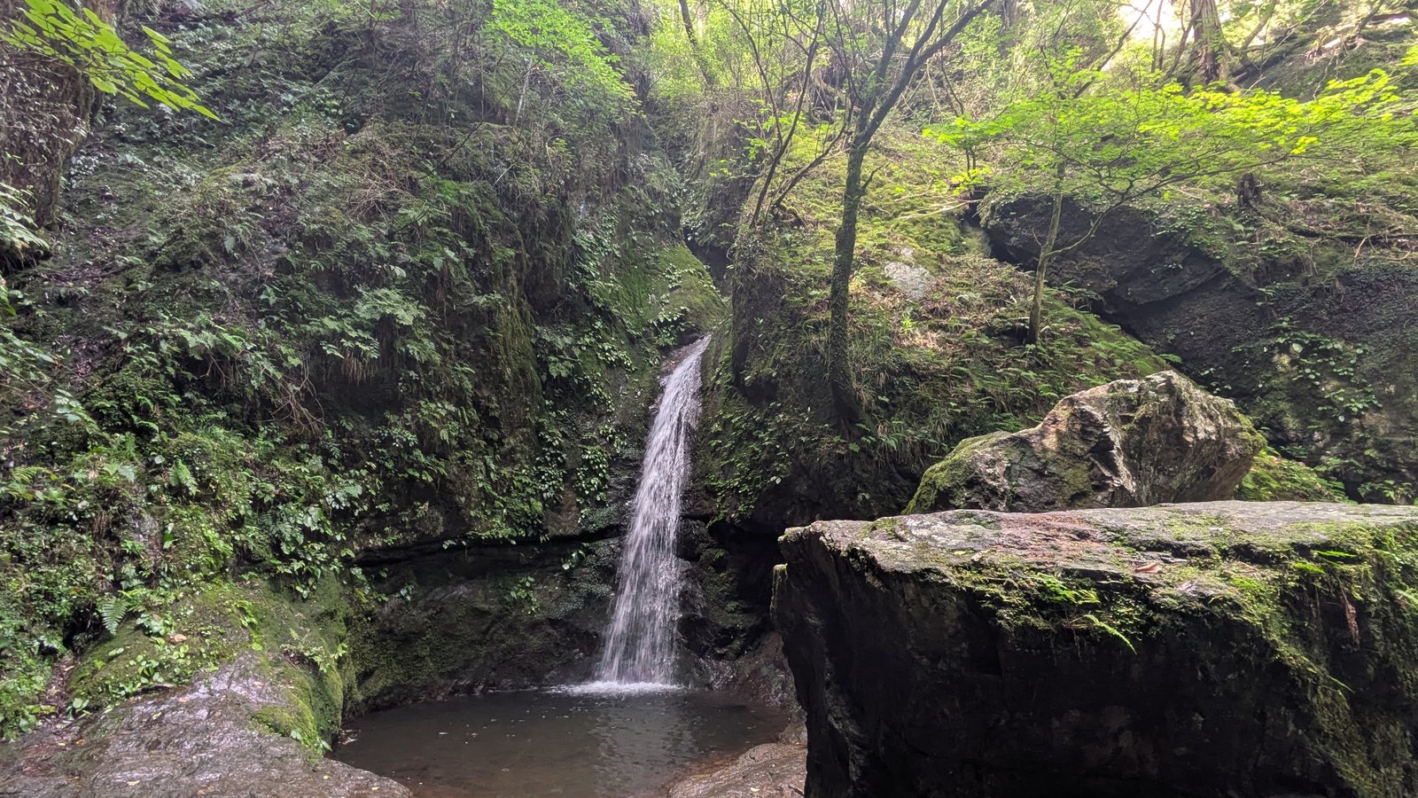
Fifty metres is the total. It is a chain of small falls dropping one after another down the mountainside, and fifty metres is all of them added together. The official guide published by the Ome tourism association counts eight tiers, not seven, and states plainly that the one visible from the trail is the fourth from the bottom.
So you walk down to see one tier of eight. It is a single narrow ribbon of water falling into a small pool, walled in by mossy rock.
How much water is in it is a second variable. It changes with the season and with how much rain has fallen in the days before. The photograph below was taken the day after rain.
None of this is a reason to stay away. It is the information you need to decide whether seventeen minutes and the steepest staircase on the mountain are worth it to you today.
The staircase, and why the day before matters
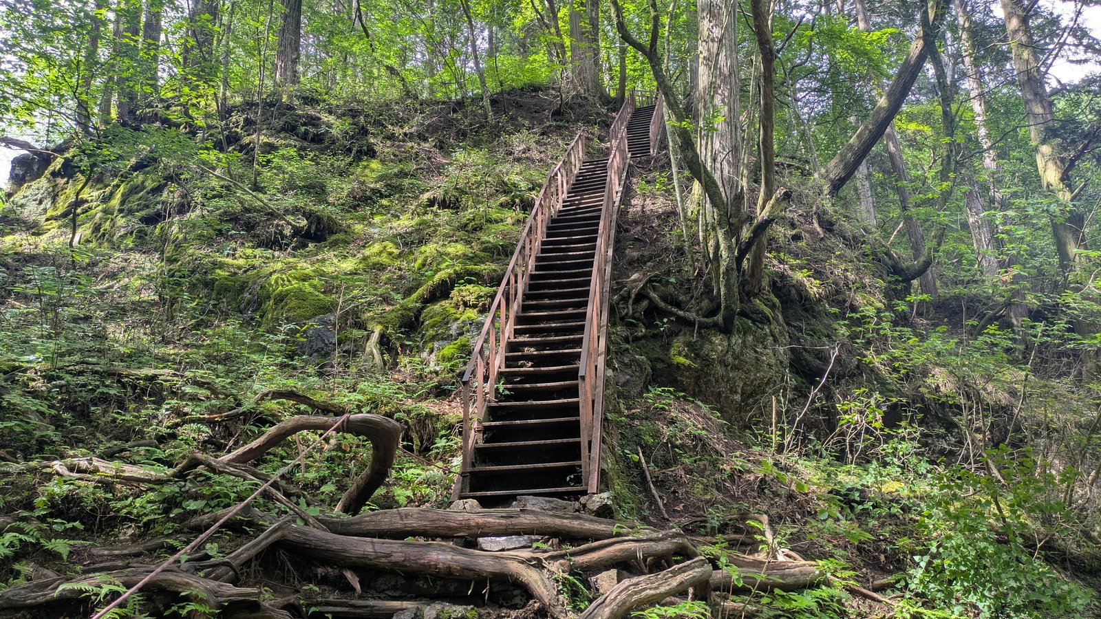
The staircase down to Nanayo Falls is a long timber flight with a handrail, cut into a slope of moss-covered rock and exposed roots. From the top you cannot see the bottom of it.
Going down took three minutes. Coming back up took nine.
The rock around the falls is a different surface from the staircase, and it is where the problem is. On 6 August 2026 the weather was clear, the path higher up was dry, and I still lost my footing on the rock beside the falls. It had rained the previous day.
This is the thing worth carrying away from this section. The English board says the surface is slippery when wet, which most people read as a statement about today. In a valley this narrow, under a closed canopy, beside running water, on stone that is entirely covered in moss, wet is not a condition that arrives with the rain and leaves with it. The floor of this valley does not dry out on the schedule the sky does.
Check the forecast for the day before, not just the day of.
Tengu Rock: the chain is real, and climbing it is optional too
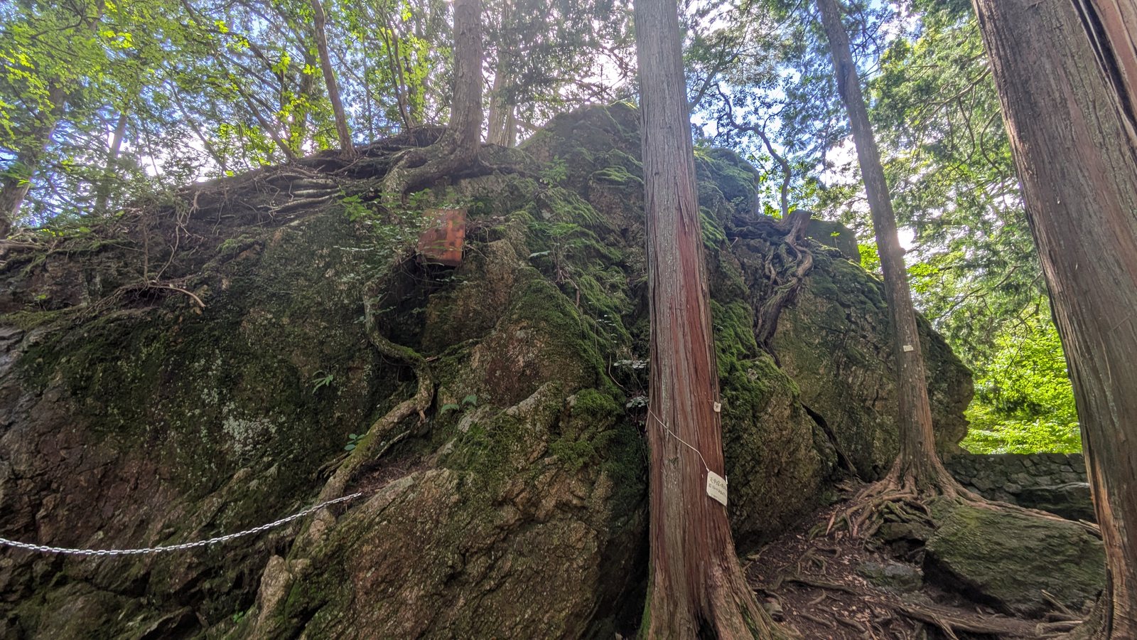
Back at the branch, Tengu Rock is a large outcrop rising beside the path, its surface bound in tree roots that lie across it in ridges resembling rough steps. A bronze tengu stands on top of it, visible from below. The English board says there is a chain for climbing.
The chain is real. It is fixed low on the rock and runs up out of sight.
I did not climb it. Two reasons, and both of them are the kind you can check against your own day.
It had rained the day before, and the same board that mentions the chain also says the surface is slippery when wet. And by that point I had already slipped once, on the rock beside the falls, twenty minutes earlier.
There is a difference between a route being possible and a route being sensible on the particular day you are standing there. The board tells you the chain exists. What it cannot tell you is what the rock is doing this week, or how your own footing has already been this morning.
The path continues past the base of the rock. Nothing about the loop requires you to go up.
From here on, it is a wide path beside the stream
Past Tengu Rock the character of the walk changes completely, and this is where the name starts to make sense.
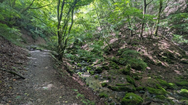
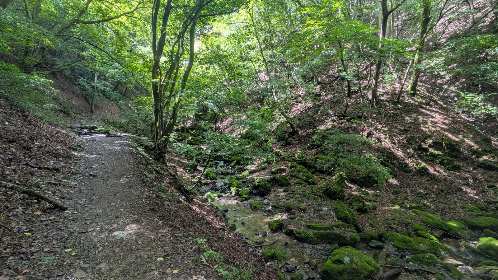
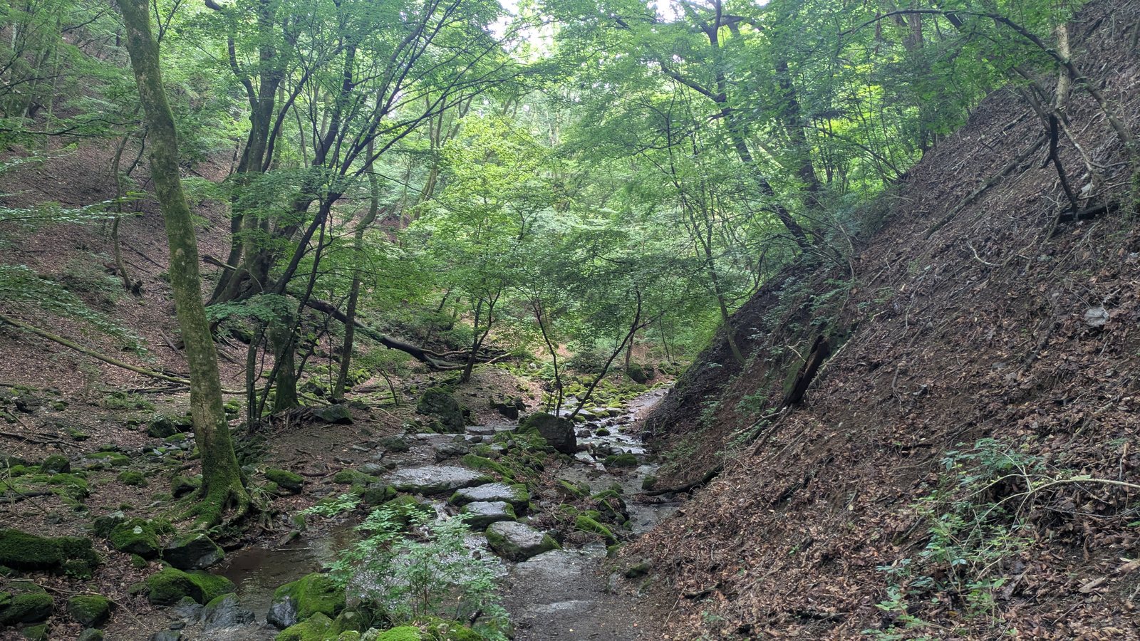
The trail runs along the valley floor as a wide, packed earth path. The stream is below it, to one side, separate. You are walking beside the water, not in it. On a mountain path this counts as comfortable.
Both banks are boulders under a continuous skin of moss, some of them the size of a small car, with ferns growing out of the cracks and broadleaf trees closing overhead. In August the light comes through green. This is the picture the Oirase comparison is reaching for.
You cross the stream several times on stepping stones. They are flat, broad, set close together, and they were wet when I crossed them. They are not the challenge here.
About halfway round there is a rest area: a timber shelter, picnic tables, and a toilet building. It is the obvious place to stop.
If you have read our Trail 6 article
Mount Takao Trail 6 is the other famous stream trail near Tokyo, and it is worth saying that these two are opposites, because the descriptions online make them sound the same.
| Takao Trail 6 | Mitake Rock Garden | |
|---|---|---|
| The stream | You walk in it for a stretch | You walk beside it throughout |
| Your boots | Get wet, reliably | Stay dry |
| The hard part | The staircase at the very end | The spur you can skip |
| Congestion | Groups in single file, hard to pass | Wide enough that it does not arise |
If you have done Trail 6 and are expecting the same experience, this is an easier walk.
What grows here grows almost nowhere else
The moss is the obvious thing to look at. On the wet rock faces there are also two flowering plants worth stopping for, for one specific reason: you probably cannot see them at home.
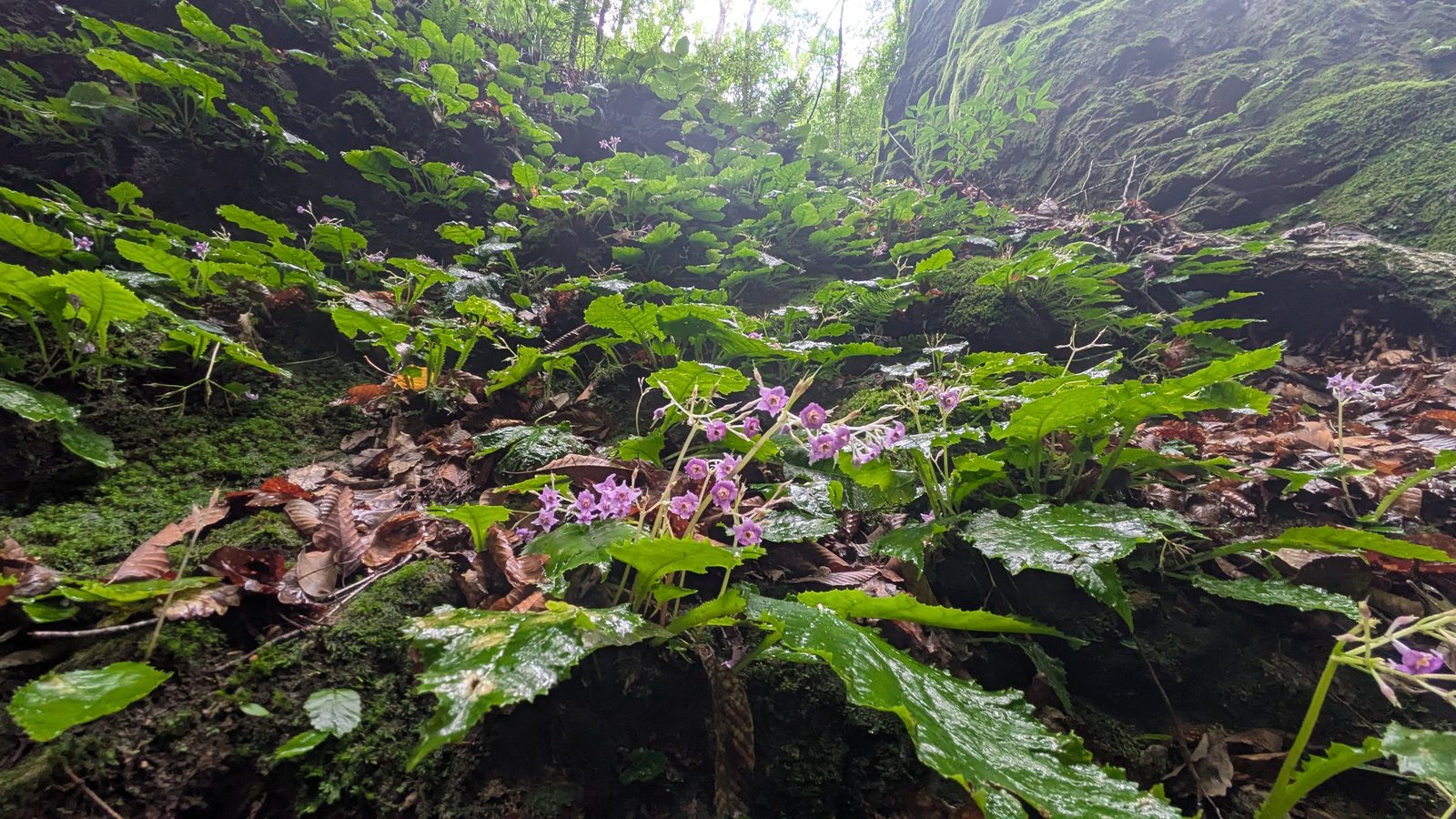
Iwatabako (Conandron ramondioides) grows straight out of wet rock, small purple star-shaped flowers above broad crinkled leaves. Conandron is a monotypic genus, meaning one genus containing exactly one species. It grows in the wild only in East Asia, in scattered populations across Japan, Taiwan, southern China, Vietnam, with large gaps between them. Botanical descriptions give its habitat as damp rock faces in forests beside streams, which is a fair description of this entire valley. In the photograph below, the rock behind the flowers is still wet, the day after rain.
Tamagawa hototogisu is a toad lily, genus Tricyrtis, with yellow flowers freckled in purple, growing out of the moss. The genus is East Asian. It grows wild nowhere else in the world.
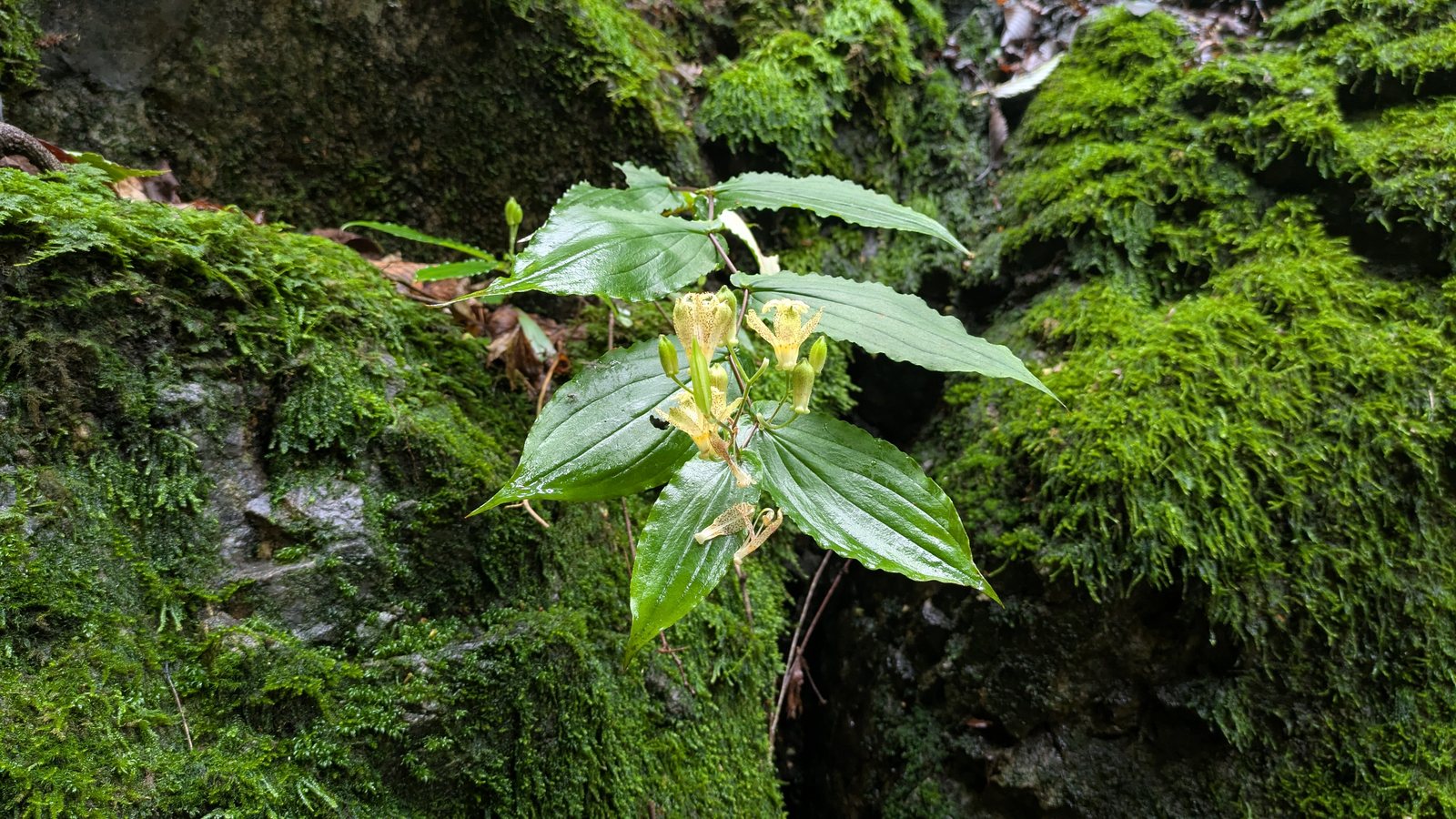
Both were flowering in early August, and both appear on the August list published by the cable car operator.
One more, on the same mountain
Rengeshoma (Anemonopsis macrophylla) is not in this valley, but it is worth knowing about while you are here. It is another single-species genus, endemic to Honshu, growing in the wild in only a handful of places. The largest colony in Japan sits about two minutes on foot from the top cable car station, roughly fifty thousand plants, flowering from late July into late August.
Set your expectations before you walk up there. Each flower is three to four centimetres across, pale lavender, hanging face down. English write-ups reach for the fifty thousand figure or call it the fairy of the forest. Neither prepares you for how small it is. It is a rarity rather than a spectacle. That is still a good reason to go, just not the reason the number suggests.
Ayahiro Falls, and the torii in front of it
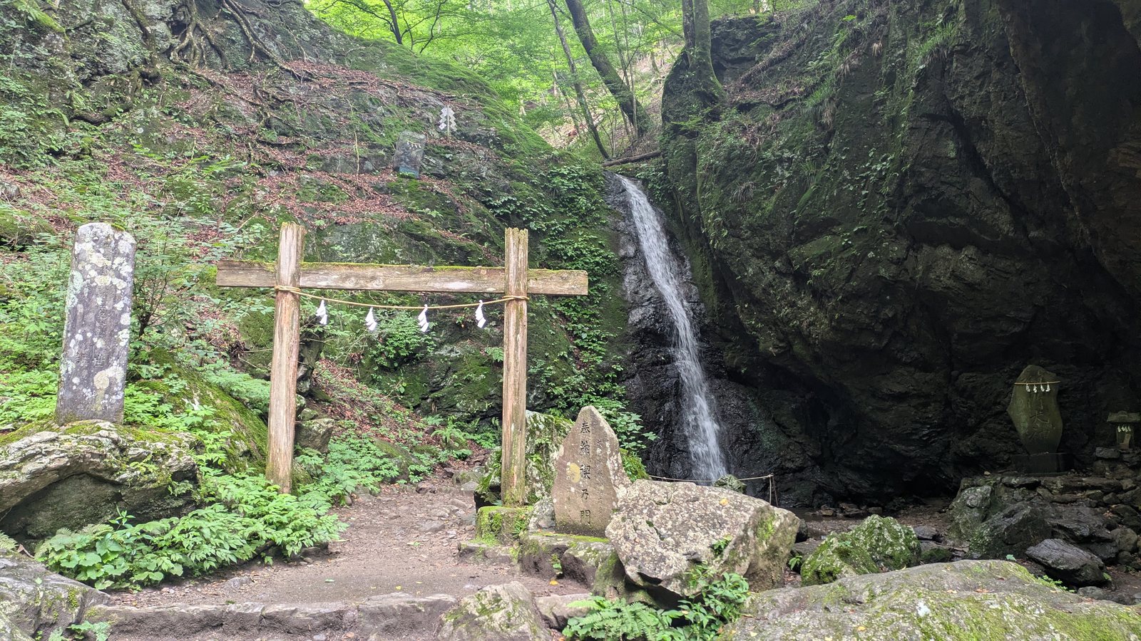
The far end of the loop is Ayahiro Falls. A wooden torii stands in front of it, with a shimenawa rope strung across, and a small stone shrine sits off to the right.
The torii is not decoration. The English board explains that it marks the area as sacred, that priests and pilgrims come here to practise takigyo, the ritual cleansing of body and mind under falling water, and that some of the lodgings in the village on the mountain offer guided takigyo sessions to their guests. It also notes that the practice involves specific prayers and rituals, so it is not something to attempt on your own.
The falls themselves are a single narrow drop into a rock-walled pool. Physically it is a modest waterfall. Culturally it is the point of the valley.
A few minutes above it is a shelter that marks the turnaround.
The way back is the easy half
From the shelter the trail climbs gently out of the valley, passes a toilet at the Okunoin junction, and runs back to Nagaodaira.
Thirty-three minutes, and about twenty-four metres of net climb. After the staircase earlier, it barely registers.
That is the shape of the loop, and it is worth holding in your head before you start: down, then a spur, then a long comfortable middle, then an easy return. The effort is front-loaded and concentrated in one optional place.
The same loop can be walked with a guide. One private Mitake day tour collects you from your hotel in Tokyo by van, walks the shrine and the Rock Garden with you, and stops for soba in the village. The cable car ticket is paid by each guest at the station.
Affiliate link · Pickup inside the 23 wards · About 10 hours · Free cancellation up to 24 hours before
What to wear on your feet
The Japanese warning board asks whether your equipment is adequate, and singles out sandals. That is the floor, not the recommendation.
Here is the practical version, split by what you actually plan to do.
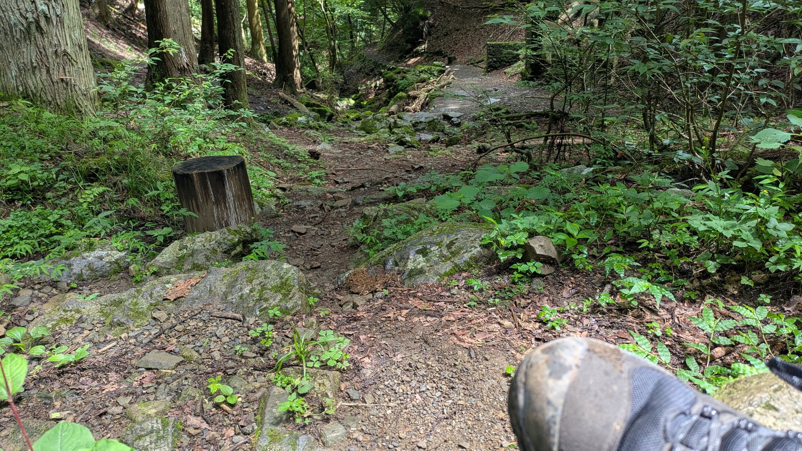
Doing the loop without the falls: trainers with a grip pattern are enough. The main path is wide packed earth. The stepping stones are flat and broad.
Doing the loop with the falls: wear something with a real sole. The staircase is long and steep, and the rock at the bottom of it is where footing is lost. This is the section the warning board is written for.
On any day after rain: treat the whole valley as wet regardless of the forecast. The moss holds water, the canopy blocks the sun, and the floor stays damp long after the sky has cleared.
For the record: I was in proper hiking boots, on a clear day, and still slipped once beside the falls.
Questions people actually ask
How long does the Rock Garden take? The loop itself took 1 hour 34 minutes from Nagaodaira back to Nagaodaira, including the spur to Nanayo Falls. Add about 25 minutes each way between the cable car station and Nagaodaira. Around two and a half hours from cable car to cable car.
Can I do it in trainers? For the main loop, yes, if they have a grip pattern. For the staircase down to Nanayo Falls, wear something with a proper sole. Sandals are specifically warned against on the Japanese sign at the top of the descent.
Can I skip the waterfall? Yes. Nanayo Falls is an out-and-back spur from Tengu Rock, not a section of the loop. Skipping it removes seventeen minutes and the steepest ground on the route.
What will I actually see at Nanayo Falls? One tier of a chain of eight. The fifty metres quoted online is the total drop of the whole chain. The official guide published by the Ome tourism association states that the tier visible from the trail is the fourth from the bottom. How much water is in it depends on the season and on recent rain.
Is it dangerous? No. It is a well-built walking path with handrails on the steep sections and interpretive boards in English. The risk on the day I walked it was slipping, and it was concentrated on wet rock near the falls.
What about after rain? The valley floor stays wet longer than the weather does. Check the forecast for the previous day as well. On a clear day after overnight rain, the rock beside the falls was still slippery.
Are there toilets? Two on the loop: one at the rest area in the middle, one at the Okunoin junction near the end. There is also one at Nagaodaira before you start.
Is there anywhere to get water? Not on the loop. Buy what you need in the village at the top of the cable car.
Can I bring a dog? Dogs are common on this mountain. The cable car sells a pet ticket, and the shrine has a water bowl for dogs at the purification font. The Rock Garden includes a long staircase and stepping stones, so judge it against your own dog.
Which direction should I walk the loop? I walked it descending from Nagaodaira first, reaching Nanayo Falls at the low point, then climbing gently back through the Rock Garden. I did not see a sign specifying a recommended direction, so this is what I did rather than what is advised.
Was it busy? On a Thursday morning in August it was quiet. There were no large groups, and passing was never an issue. That is a weekday observation only.
Is this the same as Mount Ontake? No. Mount Mitake (御岳山) is a 929-metre mountain inside Tokyo. Mount Ontake (御嶽山) is an active volcano on the border of Nagano and Gifu, several hundred kilometres away. Searches for one often return results about the other. Local signage here uses Mt. Mitake.
Affiliate link. This site earns a commission if you book through it, at no extra cost to you. Photo from our own walk.
Related
- Mount Takao Trail 6: You Walk in the Stream (64 Minutes) — the other famous stream trail near Tokyo, which turns out to be the opposite of this one
- Mount Takao Trail 1: Walk or Cable Car? — the same lesson about cable cars, stone steps, on a different mountain
- Mount Takao: Which Trail Should You Take? — the same question one mountain over
- How to Get to Mount Mitake: The Bus, the Cable Car, and the One-Way Ticket — how to reach the start of this loop, with both timetables
- Musashi Mitake Shrine: A Wolf Deity, Dogs at the Water Basin, and No Instructions Anywhere — the village and the shrine you pass through on the way to this loop
- Mount Mitake: The Hike You Decide After You Arrive — where this loop sits inside the whole day, and what the other choices cost in minutes