Some links on this site are affiliate links. If you book through one, Tokyo Trailhead earns a commission at no extra cost to you. It never decides what appears here.
The signboard just below the summit of Mount Takao points west and names two places: Kobotokeshiroyama, and Lake Sagami. It is an invitation, and the people who accept it almost all do the obvious thing. They walk on from the summit, along the ridge, and down to the lake.
Do it that way and you will have a good day out. You will also have arranged your day so that everything uncertain about it happens at the end.
This guide walks the same ridge in the opposite direction: start at Lake Sagami in the morning, climb to Kobotoke-Shiroyama, follow the ridge east over Icchodaira, arrive at the summit of Mount Takao in the afternoon, then come down the front of the mountain to the hot spring plus the train.
Same ridge. Same distance. A completely different day.
You get the quiet part while you are fresh, the famous part as the crowds thin, plus a finish at a station with a hot spring built into it. And the one thing you cannot control — what time you get back — stops being a problem, because the last hour of the walk is on the busiest, best-served side of the mountain.
It is a long day: roughly five and a half hours of walking if you do all of it. There are two ways to make it shorter, both described below, and neither of them feels as though you gave up.
What this guide covers11 sections
- The essentials
- Why walk it backwards
- The approach: one hour you are allowed to skip
- The one place you can go wrong
- Ninety minutes, and it does not let up
- Kobotoke-Shiroyama, 670.3 m
- The ridge east: watching the mountain fill up
- Coming down the front
- Making it shorter, plus doing it the other way
- Questions people actually ask
- The rest of the mountain
The essentials
| Route | Sagamiko Station → Sagamiko Park → Bentenbashi → Chigira → Kobotoke-Shiroyama (670.3 m) → Icchodaira → Mount Takao (599 m) → Trail 1 → Takaosanguchi Station |
| Walking time | About 5 hours 20 minutes total, before breaks |
| The climb | Chigira to Kobotoke-Shiroyama: about 90 minutes, steep the whole way |
| Getting there | JR Chuo Line to Sagamiko. Roughly one hour from Shinjuku |
| Getting back | Keio Line from Takaosanguchi, direct to Shinjuku |
| Part of | The Tokai Nature Trail, a national long-distance path |
| Toilets | Sagamiko Station, Sagamiko Park, Bentenjima, Chigira, Kobotoke-Shiroyama, Icchodaira, Mount Takao summit |
| Food on the way | Two teahouses on Kobotoke-Shiroyama, plus everything on Mount Takao |
| Signage | English on the mountain. None at the trailhead in the village |
The three ways to do it
You do not have to walk all of it. These are not compromises; they are how most people should probably do this route.
| Walking time | What you use | |
|---|---|---|
| Walk everything | about 5 h 20 | — |
| Bus to Chigira, skip the approach | about 4 h 10 | Kanachu bus route 湖28 |
| Bus up, cable car down | about 3 h 30 | Bus plus the Takao cable car |
The approach from the station to the trailhead is an hour of road, riverside path, plus village. It is pleasant. It is also the part you will be most glad to have skipped when you are forty minutes into the climb.
Affiliate link. This site earns a commission if you book through it, at no extra cost to you. Photo from our own walk.
Why walk it backwards
Three reasons, and the third one is the one nobody tells you.
1. The order of the day is better
Walk east, from the lake towards Mount Takao, and the day builds.
The first three hours are almost empty. The climb from Chigira is a working forest trail with nobody on it. Then you reach Kobotoke-Shiroyama, where there are teahouses, benches, other walkers. Then the ridge east, and the numbers grow. Then Mount Takao itself, arriving in the afternoon as the crowds start to drain back down the cable car. Then the temple, the shops, the hot spring, the train.
Walk the other way and you get the reverse: the busiest place at the busiest hour, then three hours of decompression ending at a quiet station.
Neither is wrong. But only one of them has the shape of a proper day out.
2. You can move your start. You cannot move your finish
This is the practical argument, and it matters more for a visitor than for a local.
If you miss a train in the morning, the day starts later. That is all that happens.
If you are running late at the end of the day, you are negotiating with a hotel check-in, a dinner reservation, a bus to the airport, or a flight. And you are doing it tired, in a country whose transport you do not know well.
So: put the uncertainty in the morning.
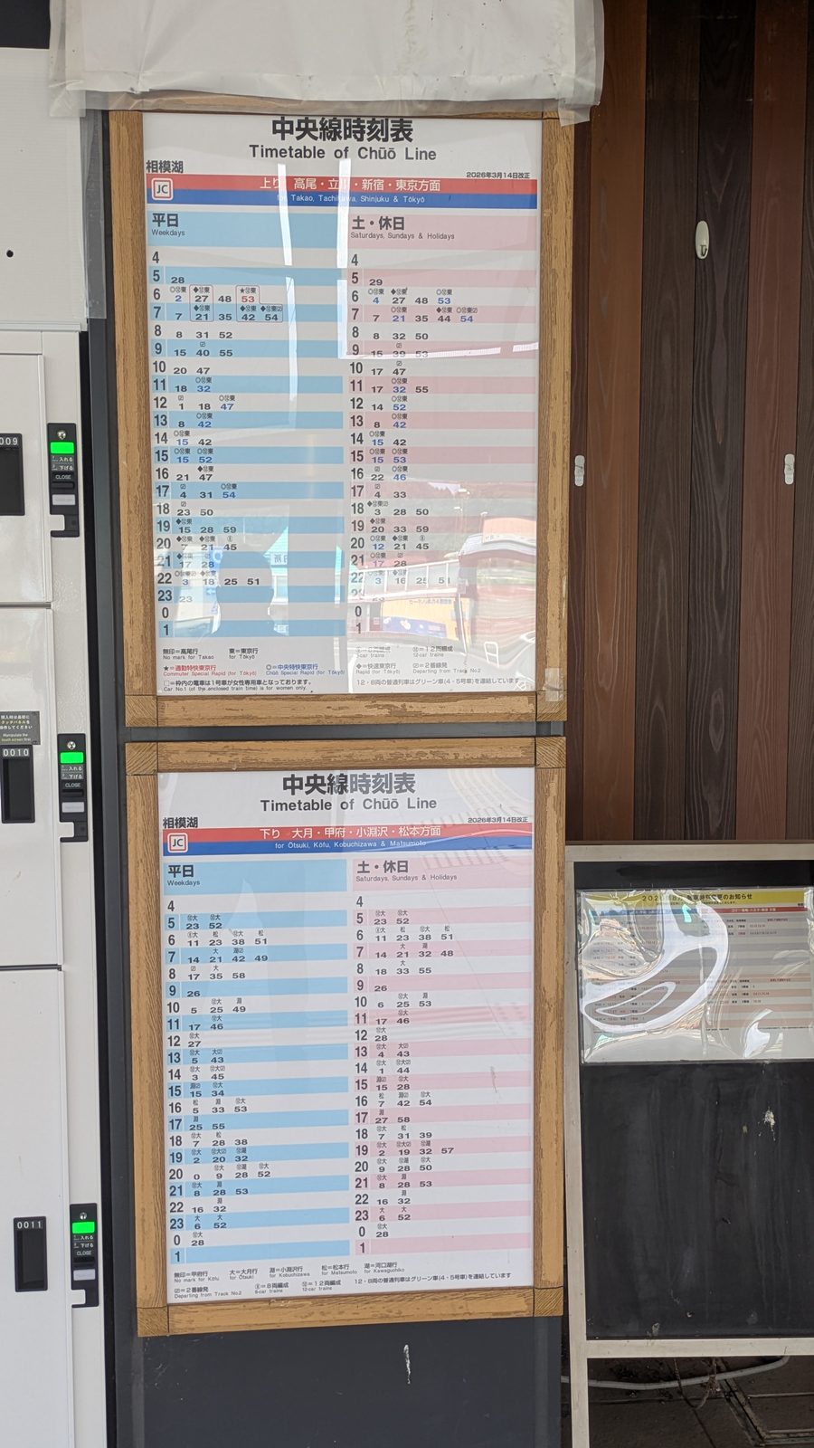
Finishing at Takaosanguchi means the Keio Line, straight through to Shinjuku, no change. Finishing at Sagamiko means the JR Chuo Line — about two trains an hour in the middle of the day, plus a change at Takao for most destinations. That is not a bad service. It is simply less slack, at the exact moment you have least appetite for a problem.
There is a weather argument stacked on top of this one. We walked this ridge on a clear Sunday in August. At about half past three it started to rain. Summer afternoons here do that. A day that finishes at two is a different day from one that finishes at five.
3. On a quiet trail, uphill is the forgiving direction
Getting lost is the single biggest cause of mountain accidents in Japan. In the National Police Agency figures for 2024 it accounts for 30.4 per cent of incidents — ahead of falls plus slips.
And it happens disproportionately on the way down, for a reason that is pure geometry.
Ridges divide as you descend, converge as you climb. Going up, a wrong turn usually still takes you towards the same summit; the mistake closes itself. Going down, taking the wrong spur means the error widens with every step, then the classic accident pattern follows: the ridge narrows, it gets steep, then instead of turning round the walker keeps descending into a valley.
Crowds hide this. On a busy path you can simply follow the person in front, which is why nobody notices the asymmetry on Trail 1. This ridge is quiet. With nobody to follow, the direction you walk in starts to matter.
None of which makes this a dangerous route. It is a signed national trail with waymarkers throughout. The point is narrower than that: going up, you have more margin.
The one place the rule does not apply
There is an exception, and it is worth stating plainly because it shapes the rest of this guide.
The only genuinely confusing point on this whole route is not on the mountain. It is in the village of Chigira, before you start climbing — where there is no ridge to converge on, no English sign of any kind.
That is why the next-but-one section is largely about a public toilet.
The approach: one hour you are allowed to skip
Sagamiko is a small station on the JR Chuo Line. It has a toilet, a drinking fountain, vending machines, a tourist map. Buy your water here.
From the station the road drops towards the lake — you go down before you go up — past a crossing, some steps, out at Sagamiko Park, which is a wide concrete apron on the water with a public toilet plus a view of the hills you are about to walk into.
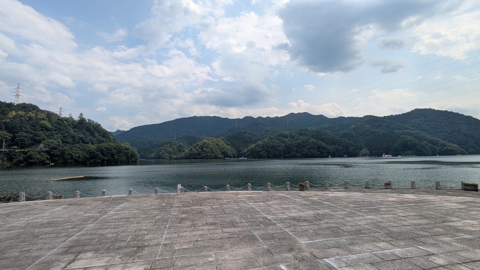
From there the route follows the road: over Sagamiko Ohashi, the arched road bridge, then left, past a school, through a car barrier, then down a flight of steps into the trees.
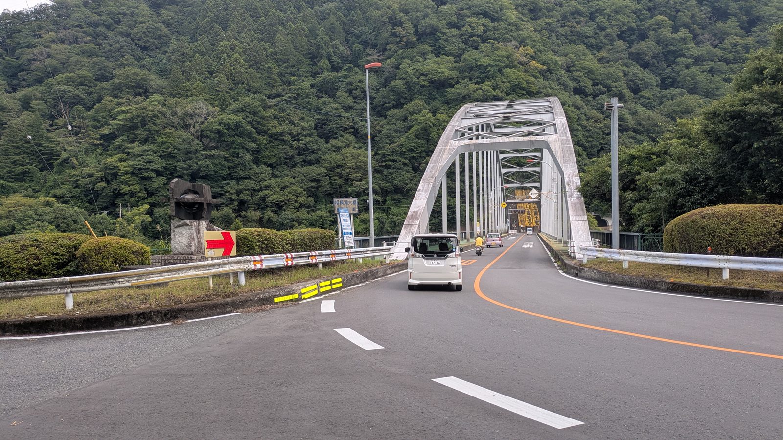
The road walking here is genuinely fine — there is a footway the whole way, which is not something you can assume in rural Japan. But it is roadside, in the open, and in summer it is hot.
Bentenbashi, plus the point where it becomes a proper walk
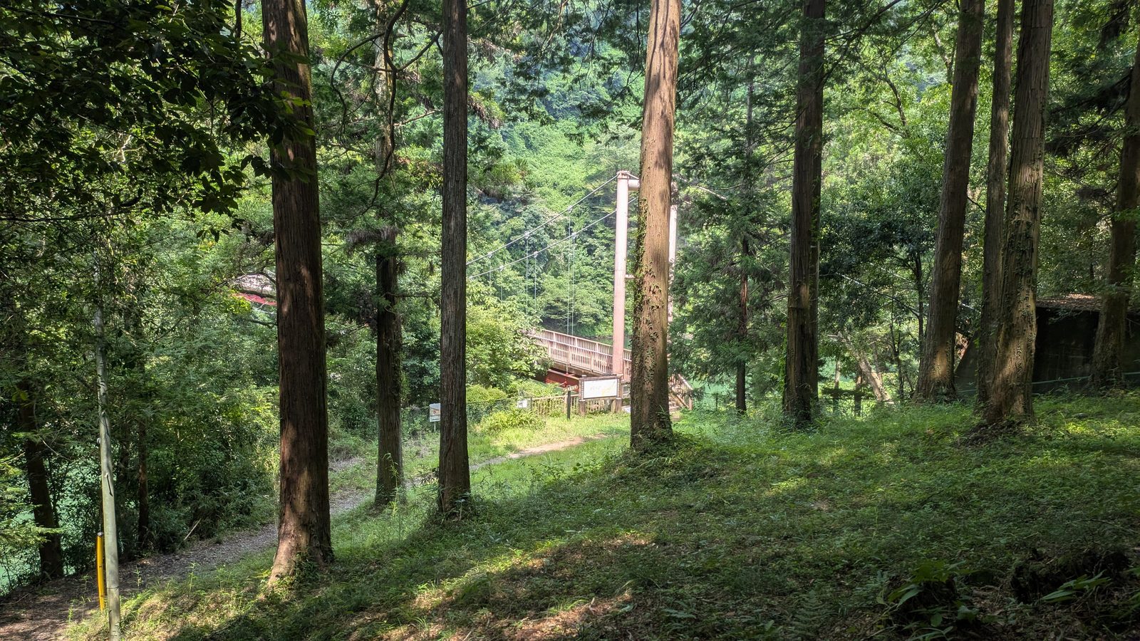
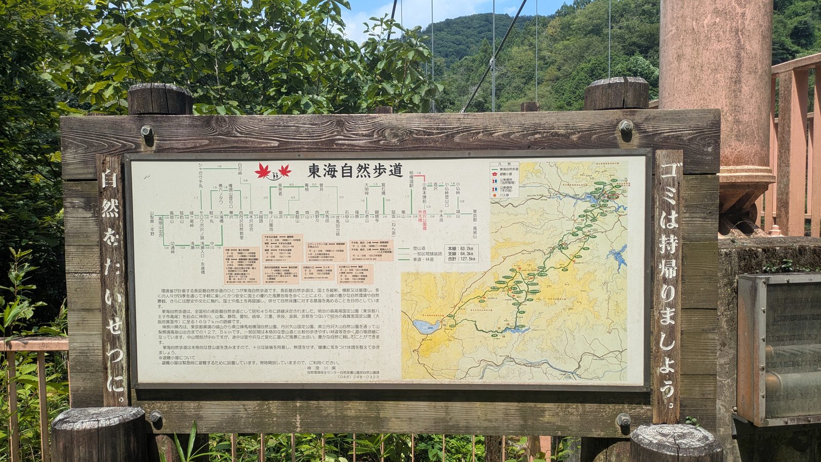
At the bottom of the steps is Bentenbashi, a red suspension footbridge over the river, beside it a large board showing the Tokai Nature Trail.
This is worth two minutes of your attention, because it reframes the whole day. The Tokai Nature Trail is a national long-distance path running for well over a thousand kilometres between Tokyo plus Osaka. You are not taking a shortcut between two stations. You are walking a section of one of the great long trails of Japan, and the waymarking you will follow all afternoon belongs to it.
Across the bridge the path turns into something much better than the road: a narrow shelf cut along the rock, with a wooden handrail, a small waterfall visible below, a stone jizo figure standing at a bend.
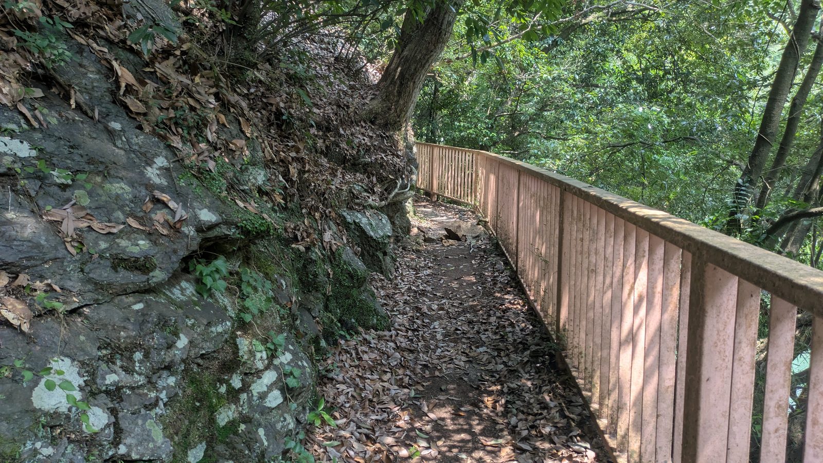
Twenty-five minutes of that and you come out beside a public toilet onto the road at Chigira.
Or: take the bus and start here
There is a bus stop at Chigira, on the Kanachu route 湖28, running between Sagamiko Station plus the village.
We photographed the board for the Chigira-to-station direction, which runs roughly hourly from early morning until about eight in the evening, with the same times at weekends as on Saturdays. We did not photograph the timetable for the direction you want, so check it at the station rather than trusting a number here — but the service level is the same road, the same route, about one an hour.
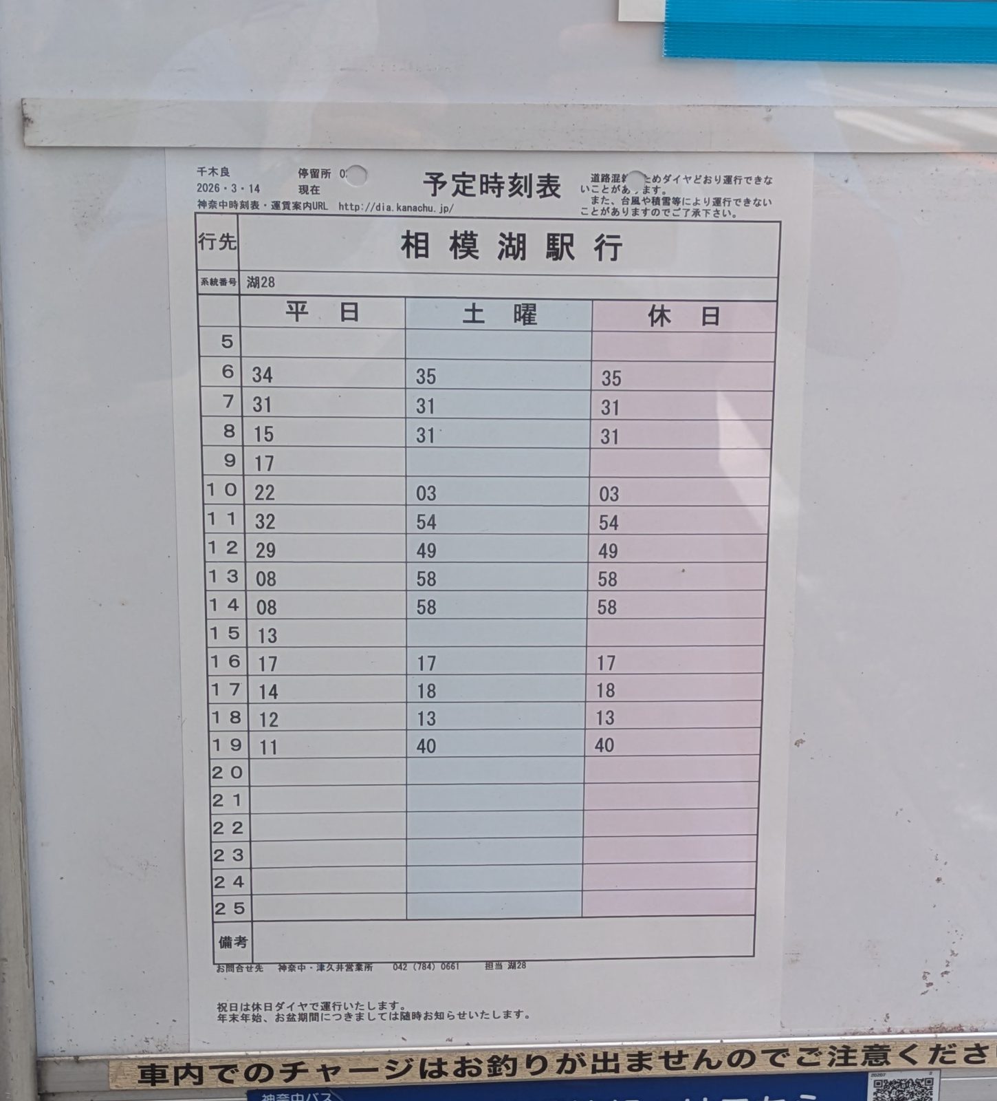
One warning that is easy to miss, expensive to learn: a notice on the bus stop says that topping up an IC card on board does not give change. Charge your Suica or Pasmo before you get on.
Taking the bus removes about seventy minutes of walking, none of the mountain. If you have any doubt at all about the climb, take it.
The one place you can go wrong
Everything else on this route is signed. This bit is not.
From the bus stop, cross the road at the crossing then walk up the lane opposite, into the village.
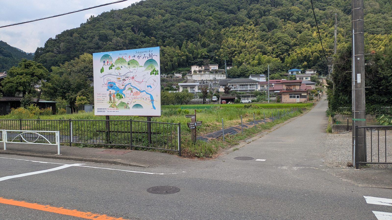
Follow it up. At the top the lane runs into a T-junction with a wooden signpost on the corner. Turn left.
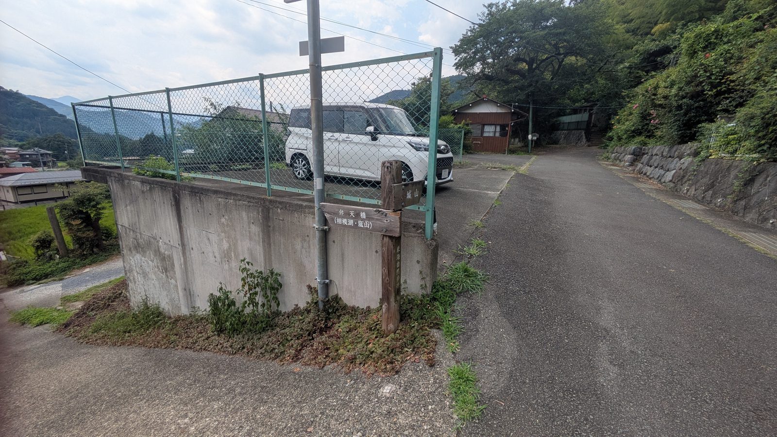
A little further along, on the right, is a small public toilet block with a green fence.
The trail starts immediately to the right of that toilet.
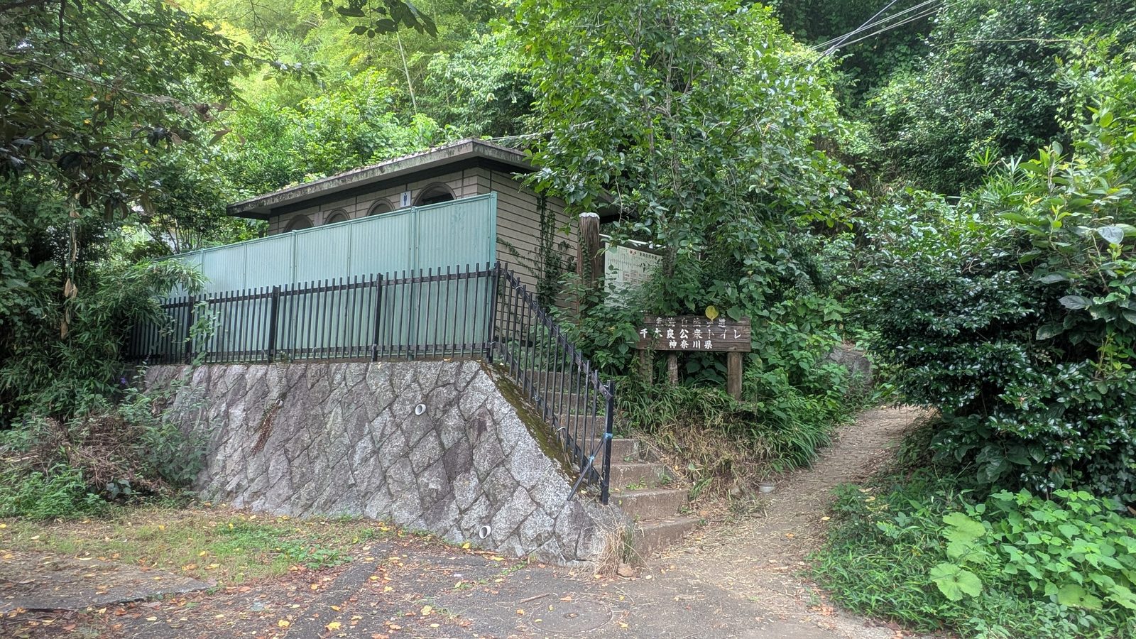
That is genuinely the best description available, which is the reason this photograph exists. There is no English signage at this point at all. When we walked it, somebody who reads Japanese fluently still had to stop plus look around to be sure this was the right gap.
It is not hidden, exactly. It is just unremarkable: a break in the vegetation next to a toilet, in a residential lane, with nothing announcing that a national long-distance trail goes up it.
Then the English starts
Fifteen minutes above the village, the waymarking appears — bilingual.
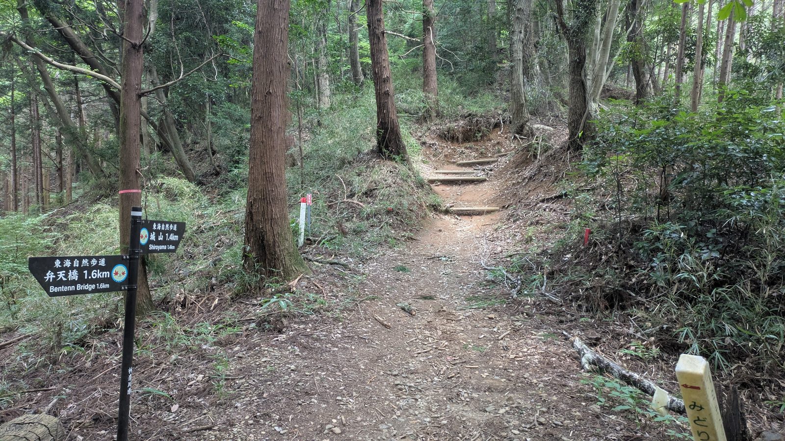
東海自然歩道 / 城山 1.4km / Shiroyama 1.4km in one direction, 弁天橋 1.6km / Bentenn Bridge 1.6km in the other. Romanised names, distances, consistent branding, all the way to the top.
Which produces the strangest thing about this route, the sentence worth remembering:
The English on this trail begins after you have already found the trail.
Once you are on it, the mountain looks after you. Getting on it is the part you are on your own for. Look for the toilet.
Ninety minutes, and it does not let up
This is the work of the day, and it is honest work.
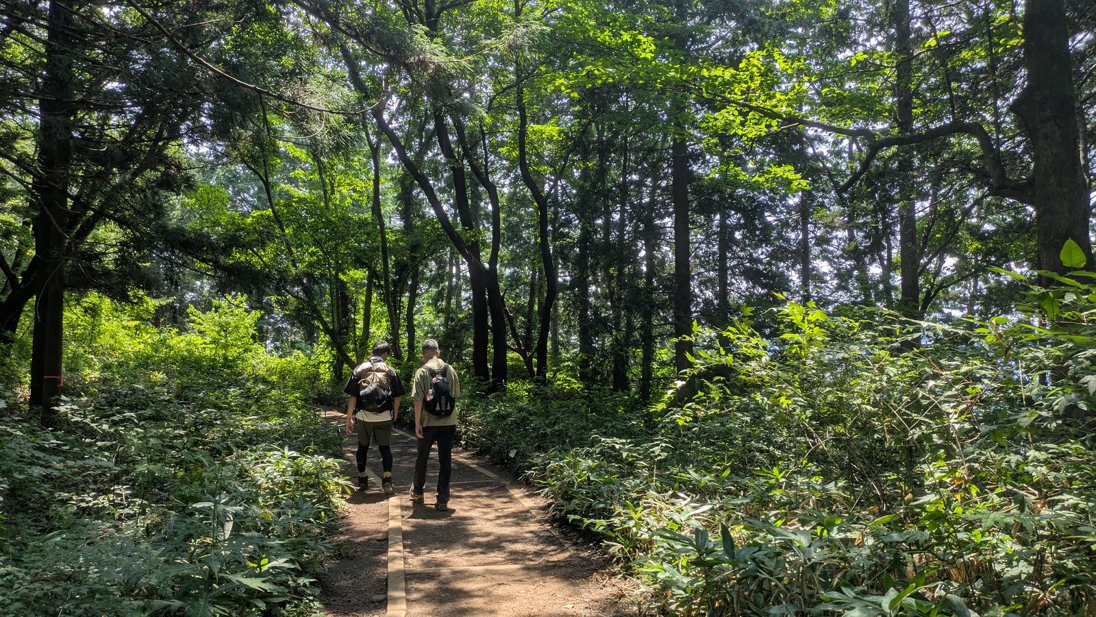
The trail goes up through bamboo, then cedar, on a mixture of earth, log steps, stone. It is well built, well maintained. It is also steep essentially the whole way, from the edge of the village to the summit plateau. Ninety minutes, going up.
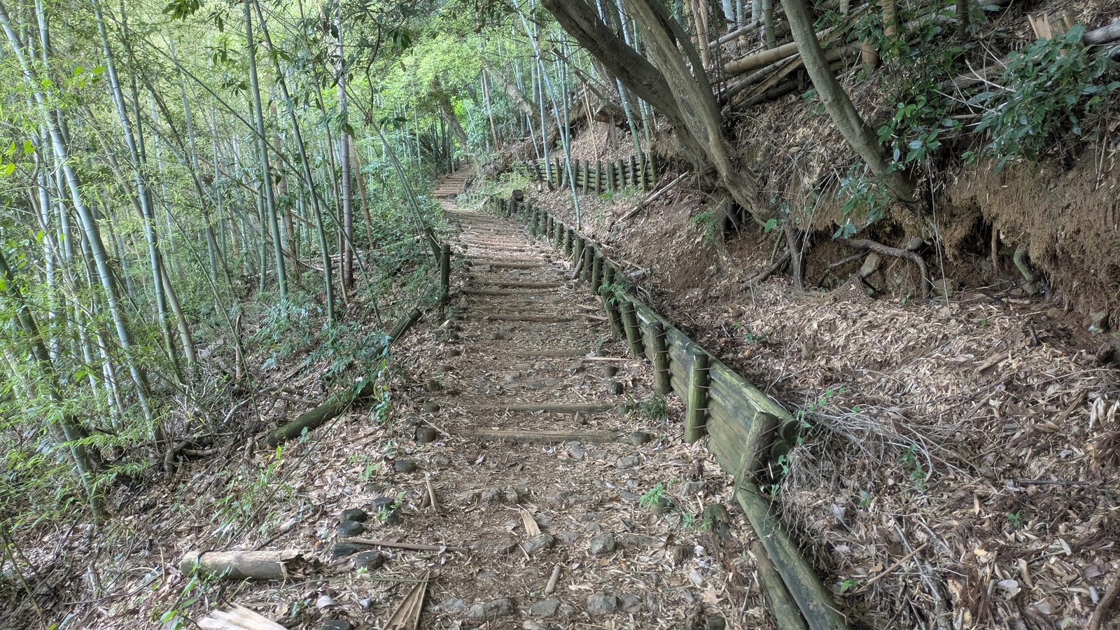
If you came up Mount Takao by Trail 6, you learned a particular shape of effort: an easy hour beside a stream, then eight hard minutes of staircase at the end. This climb is the opposite shape. There is no easy hour. There is no final push either, because it has all been the final push.
What there is instead is a series of clearings.
Every so often the trees open out, the ground levels, there are benches. They arrive often enough that you can plan around them. They are the reason this climb is manageable rather than grim.
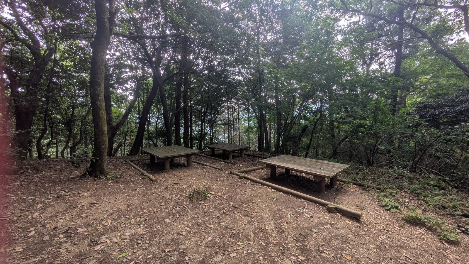
One honest note about them, which is the sort of thing a guide should say but usually does not: the clearings are not viewpoints. They open the canopy, not the horizon. You get level ground plus somewhere to sit. You do not get a reward view, and if you climb expecting one at each break you will find the whole thing more dispiriting than it needs to be.
So plan the climb the way the trail is actually built. Not in distance, not in gradient — in benches. Walk to the next clearing. Sit down. Then the next.
There is no water, nothing to buy, between the village plus the top. There is also, in ninety minutes of climbing on a Sunday in August, almost nobody. That is the trade, and for a lot of people it is a good one.
Kobotoke-Shiroyama, 670.3 m
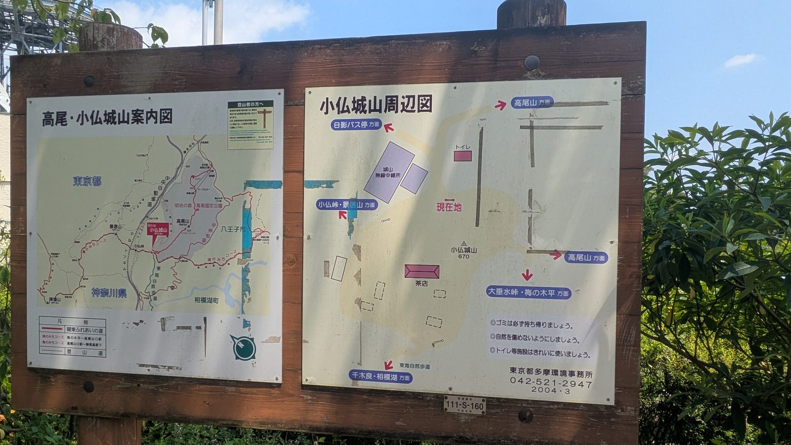
You come out of the trees onto a broad open top with benches, flags, two teahouses, a toilet, a view. After ninety minutes of forest it feels as though you have arrived somewhere.
The summit marker gives the name in both scripts plus the height to one decimal place: 小仏城山 / Mt.Kobotoke-Shiroyama / 670.3 m.
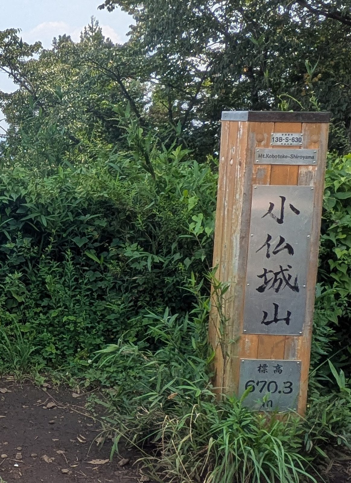
Note the number, because it matters in a moment. This is seventy-one metres higher than the summit of Mount Takao.
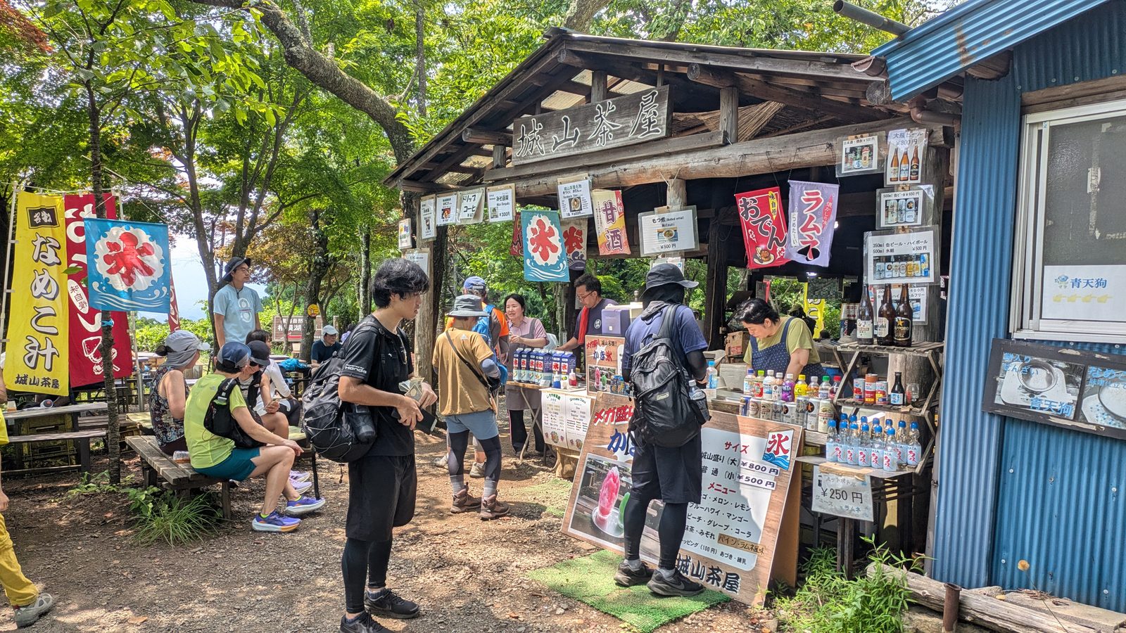
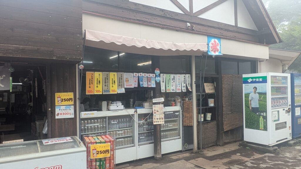
There are two teahouses, and on a summer weekend both are working. Benches plus long tables under the trees, flags for shaved ice, coffee, ramune, nameko soup. The shaved ice is the size of your head; it arrives with its own bottle of syrup.
The rule that breaks here
If you have read our route guide to Mount Takao, you were told something that sounds as though it were a law of nature: the higher you go on that mountain, the less your phone is worth. Card plus IC at the base station, cash only at the summit shops.
That is accurate for Mount Takao. It is also, as a rule about altitude, wrong — the place it breaks is seventy-one metres above the summit that produced it.
The window of the teahouse on Kobotoke-Shiroyama carries a payment sticker with more logos on it than most convenience stores:
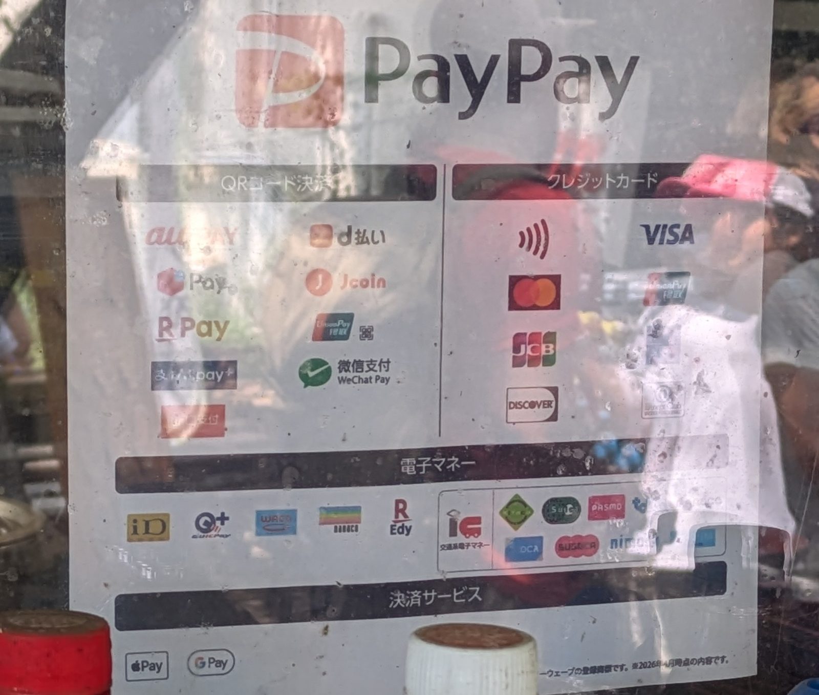
QR codes including PayPay, au PAY, d払い, Rakuten Pay, WeChat Pay, UnionPay. Credit cards including contactless, Visa, Mastercard, JCB, Discover, UnionPay. Electronic money including iD, QUICPay+, WAON, nanaco, Rakuten Edy plus the transport IC family — Suica, PASMO, the rest. Also Apple Pay, Google Pay.
A visitor can pay here with the phone they arrived in the country with, or a contactless card from home, without ever touching a yen note.
So the correct version of the rule is not about height at all:
Whether you need cash is decided by who runs the place, not by how high it is.
Carry cash anyway — the shops on Mount Takao itself really are cash, so is the temple office, so are the summit vending machines. But do not plan this ridge on the assumption that going higher means going backwards in time.
There is a toilet here. It is the last one until Icchodaira.
The ridge east: watching the mountain fill up
From Kobotoke-Shiroyama to the summit of Mount Takao is a little over an hour, the easiest walking of the day: a broad, rolling ridge with short climbs, short drops, well graded, heavily signed.
It is also where you watch the character of the day change.
Twenty minutes along is Icchodaira, the best-equipped place on the ridge — a shelter, benches, a toilet, a proper viewing deck with a railing plus a panorama board.
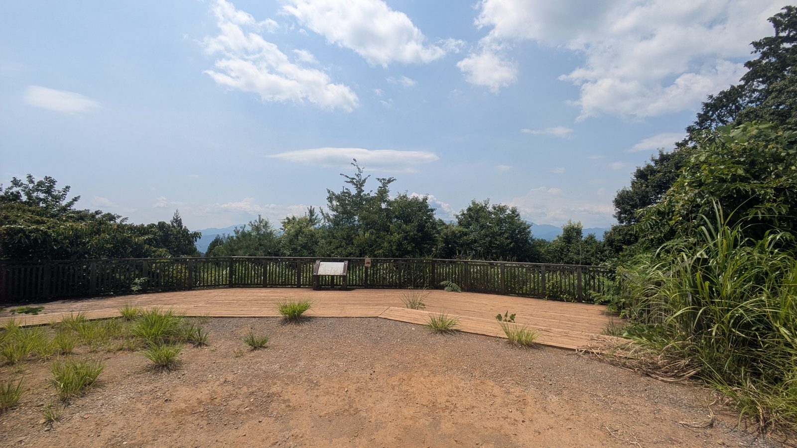
If you are going to have lunch anywhere, have it here rather than on Mount Takao. It has most of what the summit has, almost none of the people.
Past Icchodaira comes Momijidai, the signposts start listing Mount Takao in single kilometres, then you begin meeting walkers coming the other way in ones, then in threes, then continuously.
Then the trail climbs a last set of stone steps, the trees open, then you are on the summit plateau of Mount Takao with a hundred other people.
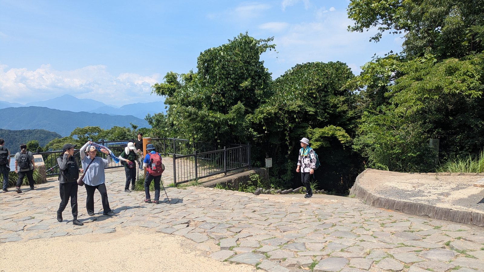
Arriving here from the west, in the afternoon, is a genuinely different experience from arriving from Takaosanguchi in the morning. You have earned it, everybody else has just got off the cable car, then the crowd is already starting to drain back down the hill.
Coming down the front
From the summit you are back on ground the rest of this site already covers, so you have the whole menu.
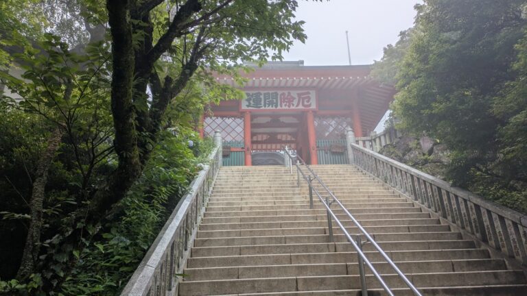
The straightforward finish is Trail 1, the paved main route, ninety minutes to the station. It takes you through Yakuo-in, the temple built into the mountain, which is worth the time even at the end of a long day — it has toilets plus vending machines the whole way down, which the ridge behind you did not.
The kind finish is the cable car or the chairlift from the halfway station. After five hours on your feet there is nothing to prove by walking the last descent, plus the steps below the temple are the hardest surface of the day on tired knees. Both services cost exactly the same, so the choice is about what you want to look at.
The correct finish is the hot spring built into Takaosanguchi Station, thirty seconds from the ticket gate. There are rules that can turn you away at the door. After a day this long you do not want to discover them at the door.
Then the Keio Line, direct to Shinjuku, without changing.
The guided day on this mountain does not walk this ridge. If a shorter day with an English-speaking guide suits you better, it is the small-group guided day on Mount Takao, which covers the temple and the summit and ends at a hot spring.
Affiliate link · Small group of up to 7 · About 8 hours · Free cancellation up to 24 hours before
Making it shorter, plus doing it the other way
Two ways to cut it down
Cut the approach. Take the 湖28 bus from Sagamiko Station to Chigira then start at the trailhead. This removes about seventy minutes of road plus riverside path, removes none of the mountain. Total walking drops to about four hours ten. If you are at all unsure about ninety minutes of continuous climbing, do this — the hour you save is the hour you would otherwise spend arriving at the climb already warm.
Cut the descent. Ride down from Mount Takao instead of walking Trail 1. Total walking drops to about three and a half hours, which puts this ridge within reach of a great many more people.
Do both and you have a substantial mountain day — a real 670-metre summit, a national long-distance trail, two teahouses, a hot spring — for about the walking effort of climbing Mount Takao then coming back down.
If you want to walk it the other way
Some people should. Walking east to west, Mount Takao to Lake Sagami, makes sense if:
- you are staying at Sagamiko, Otsuki or further west, so the finish is your way home anyway
- you can start very early, want the summit before the crowds rather than after them
- you actively want the day to end quietly
If that is you, three things to plan around.
Check the return timetable before you start walking, not at the end. Sagamiko has around two trains an hour through the middle of the day, with a change at Takao for most destinations. That is workable. It is simply less forgiving than the Keio Line if you are running late.
The descent to Chigira is the direction that needs more attention. See the reasoning above — plus remember that the last section, in the village, has no English signage in either direction.
There is a hot spring on the Sagamiko side, if you were going to miss the one at Takaosanguchi: Sagamiko Onsen Ururi, at the Sagamiko Resort, about eight minutes by bus from Sagamiko Station, ¥950 for an adult. Honestly, though: it is a bus ride away, the bus is about one an hour, so it is fiddly at the end of a long day. The onsen at Takaosanguchi is inside the station building. That difference is bigger than it sounds.
One case reverses that judgement completely. If the hot spring at Takaosanguchi is closed to you because you have a tattoo, then the bath at this end of the walk stops being a detour, because it is the nearest one with a written policy that admits anybody tattooed at all. That is written out in full here: Mount Takao with tattoos.
Questions people actually ask
How long does the Takao to Sagamiko traverse take?
About five hours twenty minutes of walking for the full route between the two stations, before breaks. Take the bus to Chigira and it is about four hours ten. Take the bus up then ride the cable car down and it is about three and a half.
Which direction should I walk it?
We recommend west to east — Sagamiko to Mount Takao. You get the quiet section while fresh, arrive at the famous summit as the crowds thin, then finish at a station with a hot spring plus a direct line to Shinjuku. Most importantly, it puts the uncertain part of your timing in the morning, when a delay costs you nothing.
How hard is the climb from Chigira?
About ninety minutes, steep essentially the whole way. There is no easy section, no flat recovery. There are, however, clearings with benches at regular intervals. Plan the climb in benches rather than in distance.
Is the trail easy to follow?
On the mountain, yes — it is part of the Tokai Nature Trail, with frequent signposts carrying romanised place names plus distances. The exception is the trailhead itself, in the village of Chigira, where there is no English signage at all. The trail starts immediately right of the public toilet.
Are there toilets on the route?
Yes, more than you would expect: Sagamiko Station, Sagamiko Park, Bentenjima, Chigira, Kobotoke-Shiroyama, Icchodaira, the Mount Takao summit. The long gap is the climb itself — about ninety minutes with nothing.
Can I buy food on the way?
Two teahouses on Kobotoke-Shiroyama, open on a summer weekend, selling shaved ice, coffee, soft drinks, hot food. Nothing at all between the village plus that summit, so fill your bottle at Sagamiko Station.
Do I need cash?
Less than you might think on the ridge, more than you think on Mount Takao. The teahouse on Kobotoke-Shiroyama takes contactless cards, QR payment, transport IC, Apple Pay, Google Pay. The shops on Mount Takao itself, the temple office, the summit vending machines are cash. Carry notes, but do not assume height means cash.
How do I get to Sagamiko Station?
JR Chuo Line, about an hour from Shinjuku. Coming back from Takaosanguchi you are on the Keio Line, direct to Shinjuku, no change.
Is there a bus if I do not want to walk the approach?
Yes — Kanachu route 湖28 between Sagamiko Station plus Chigira, roughly hourly. Charge your IC card before boarding: a notice at the stop warns that topping up on the bus does not give change.
Is this a good route in summer?
The forest sections are shaded, but the approach from the station is open roadside, plus afternoon thunderstorms are normal. We walked it on a clear Sunday in early August; it started raining at about half past three. Start early.
Is Kobotoke-Shiroyama higher than Mount Takao?
Yes. Kobotoke-Shiroyama is 670.3 m; Mount Takao is 599 m. The higher summit of the day is the quiet one.
Can I do this with children?
Older children who are used to walking, yes — with the bus to Chigira plus the cable car down. The ninety-minute climb is the limiting factor, it is relentless rather than technical. For a first mountain day with small children, stay on Mount Takao itself.
Affiliate link. This site earns a commission if you book through it, at no extra cost to you. Photo from our own walk.
The rest of the mountain
- Which trail should you take up Mount Takao? — all the routes compared, the guide this traverse extends.
- Trail 6: the stream is the path — the other quiet way up, the opposite shape of effort.
- The Inariyama Trail — the dry ridge route, if you want a shorter day.
- Trail 1: walk it or take the cable car? — how to come down the front.
- Yakuo-in: what to do at the temple — on your way down Trail 1.
- Cable car or chairlift? — the kind way to finish.
- The hot spring by the station — plus the rules that can turn you away.