Some links on this site are affiliate links. If you book through one, Tokyo Trailhead earns a commission at no extra cost to you. It never decides what appears here.
Three trails climb the front of Mount Takao. One is a paved temple approach with a cable car, a chairlift and stalls selling grilled dango. One follows a stream past a waterfall. The third climbs onto a ridge, on dirt, under trees — and almost nobody takes it.
That third one is the Inariyama Trail. If you came to Japan to walk in a forest rather than queue in one, it is the right choice, and our route guide already recommends it twice: easiest on foot, and quietest by a clear margin. Both still hold.
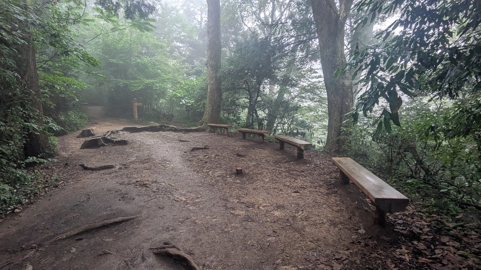
What no guide mentions — including, until now, ours — is that this trail has exactly one view, it sits halfway up, and it faces the wrong way.
There is a wooden deck with benches, and a board that names every hill and tower on the horizon. To see any of it you have to stop, turn round, and look back the way you came. Walk this trail at a steady pace, looking where you are going, and you will pass the best thing on it without ever knowing it was there.
The board that explains the view is in Japanese only.
This guide walks the trail in the order you meet it, tells you where the effort actually is, and makes sure you turn around.
What this guide covers11 sections
- The short version
- The Inariyama Trail at a glance
- Finding the start, and the climb that begins immediately
- The ridge: what you actually get for an hour
- The Inariyama Observatory: the view behind you
- Trail 5, and the last staircase
- What this trail does not have
- When to take this trail — and when not to
- Questions people actually ask
- One last thing
- Where to next
The short version
The climb is front-loaded. The trail leaves the road and goes almost straight up a long flight of log steps. That first stretch is the steepest thing on the route. Get up it and the trail settles into a ridge walk that stays gentle for most of an hour.
There is one view, and it is behind you. Halfway up, at the Inariyama Observatory, a deck looks back over Hachioji and the plain beyond it. You will not see it by looking ahead.
There is nothing else on this trail. No toilet. No tap. No vending machine. No shop. No temple. From the trailhead to the summit there is not a single building, and that is unusual on this mountain — Trail 1 has a temple, food and a cable car station on it.
Wet changes it. Dirt, exposed roots and timber steps are all slippery after rain, and this is the one condition that meaningfully raises the difficulty. Sun or shower is the variable that matters here, not season.
Allow 80 to 100 minutes to the summit, and remember there is nowhere to buy water once you start.
If what you actually want is the temple, the incense and the tengu statues, this is the wrong trail — that is Trail 1, and we cover the temple itself in the Yakuo-in guide.
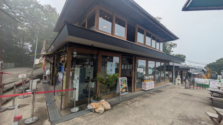
Affiliate link. This site earns a commission if you book through it, at no extra cost to you. Photo from our own walk.
The Inariyama Trail at a glance
| Where it starts | Left of the cable car base station at Kiyotaki — a flight of stone steps beside the green trail noticeboard |
|---|---|
| Distance | Marker posts count from 0.0 km at the trailhead up to 3.1 km. The signpost near the top gives 0.7 km to the summit |
| Time up | 80–100 minutes |
| Surface | Dirt, exposed tree roots, and a great many engineered steps — log, timber and concrete |
| Shoes | Grippy soles. Flat canvas shoes are the ones that catch people out; the route guide sets out the three levels of footwear for this mountain |
| Toilets | None — nothing between the trailhead and the summit |
| Water | None. No tap, no vending machine. Fill up at the base station before you start |
| Crowds | The quietest of the three front trails, by a clear margin |
| Shade | Continuous. The ridge is wooded the whole way — which is why this is the trail to pick in high summer |
| Views | One, at the Inariyama Observatory, roughly halfway. It faces back the way you came |
| Official English | Signposts read `Inariyama Observatory`, `Mt.Takao・Visitor Center` and `Takaosanguchi Sta.` |
| The temple | Not on this route. Trail 1 is the one that runs through Yakuo-in |
⚠️ Check it is open before you plan a day around it. This trail was closed for eight and a half months in 2025 — 19 February to 1 November — while hazardous trees were cleared and the path was rebuilt. That is why so much of the stonework and timber on it looks new. It was open when I walked it in July 2026, but closures on this mountain are measured in months, not days, and they do not reach the English-language internet. The Takao Visitor Center posts current conditions.
One number on the mountain does not add up, and it is worth knowing so it does not confuse you at a junction. The distance-marker posts run 0.0 km to 3.1 km from the bottom, and the arm signpost near the top says 0.7 km to the summit — consistent. But that same signpost also gives 3.1 km back to Takaosanguchi Station, which cannot be right if you are already 2.5 km up a 3.1 km path. Trust the marker posts for how far you have come, and the arm signs for how far is left to the summit.
Finding the start, and the climb that begins immediately
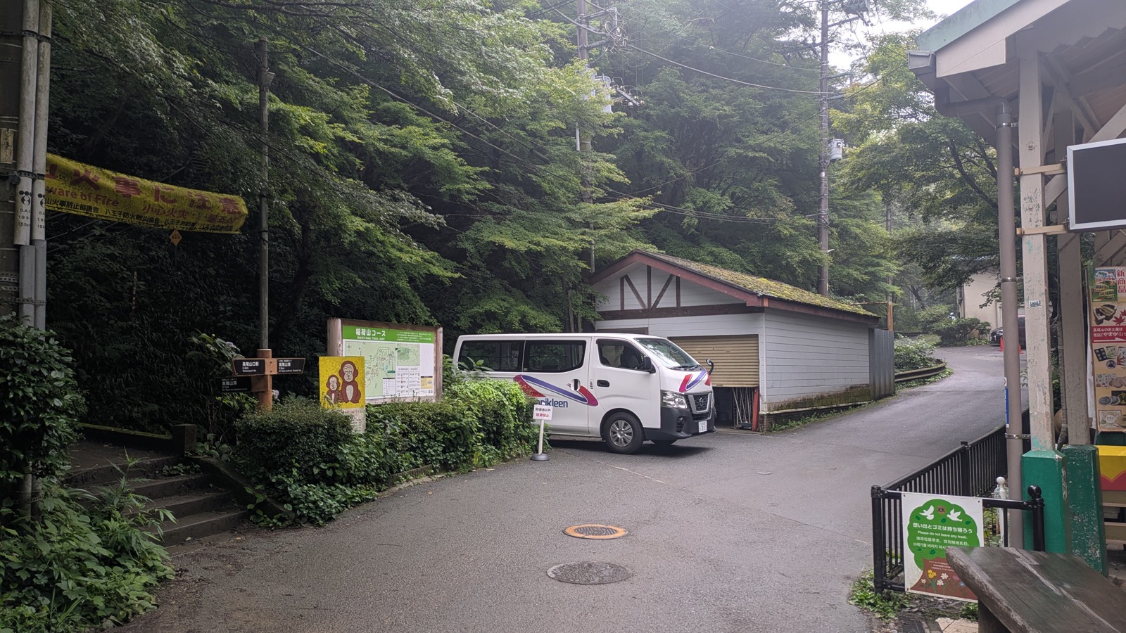
Everybody arriving at Takaosanguchi walks the same way: through the station, along the shops, up to the cable car base station at Kiyotaki. That is where the crowd stops and forms a queue.
You turn left. Beside a green noticeboard with a map of the trail on it, a flight of stone steps goes up into the trees. That is the Inariyama Trail, and the difference in noise between the queue and those steps is immediate.
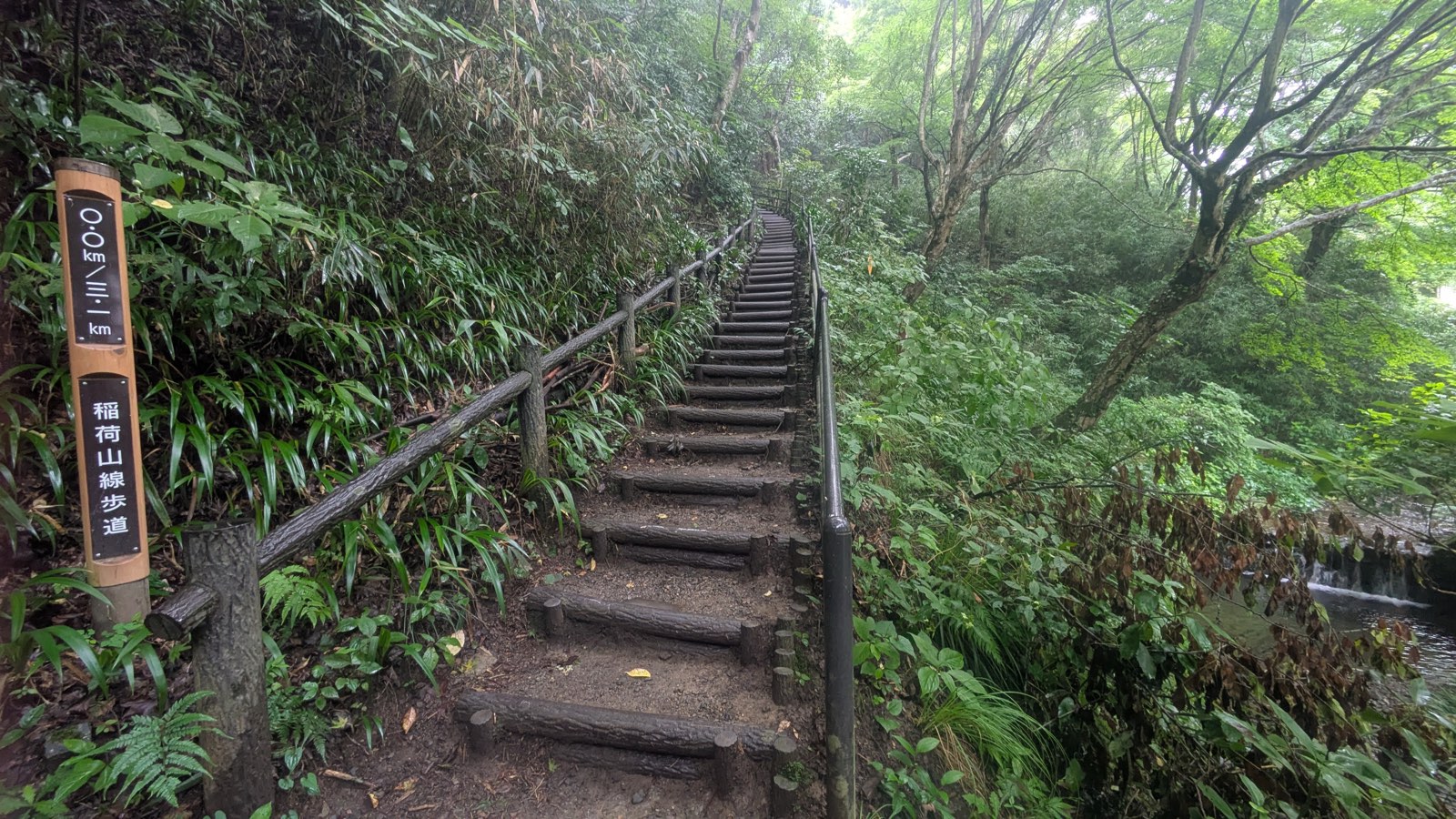
Then it climbs. Not gradually — the trail leaves the flat and goes up a long flight of log-and-earth steps with a handrail, and keeps going up them. The distance-marker post at the bottom reads 0.0 km, which is a slightly comic thing to be looking at while you get your breath back.
This is the steepest part of the whole route, and it arrives in the first ten minutes.
Why that is good news
On this mountain, where the hard part sits changes what you can do about it.
| Trail | Where the effort is | Can you change your mind? |
|---|---|---|
| Trail 1 | About 40 minutes in, past Kompira-dai | Yes — the cable car and chairlift are right there |
| Trail 6 | The last stretch before the top | No — you are committed by then |
| Inariyama | The first ten minutes | Yes — the station is still behind you |
The Inariyama Trail is the only one of the three that shows you its worst section while you can still walk back down to the cable car in five minutes and take the easy way up instead. If your legs, your shoes or the weather are not right, you find out at the point where it costs you almost nothing.
That is a better deal than it sounds. Most trails flatter you at the start and punish you at the end.
The ridge: what you actually get for an hour
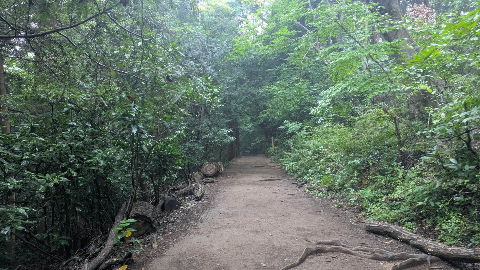
Once you are up, the trail turns into what you came for. It runs along the top of a ridge, on earth, under a continuous canopy, and it stays broadly gentle for most of an hour.
Three things define it.
Roots. The path is crossed by exposed tree roots in places — not an obstacle, but the reason footwear matters here in a way it does not on Trail 1.
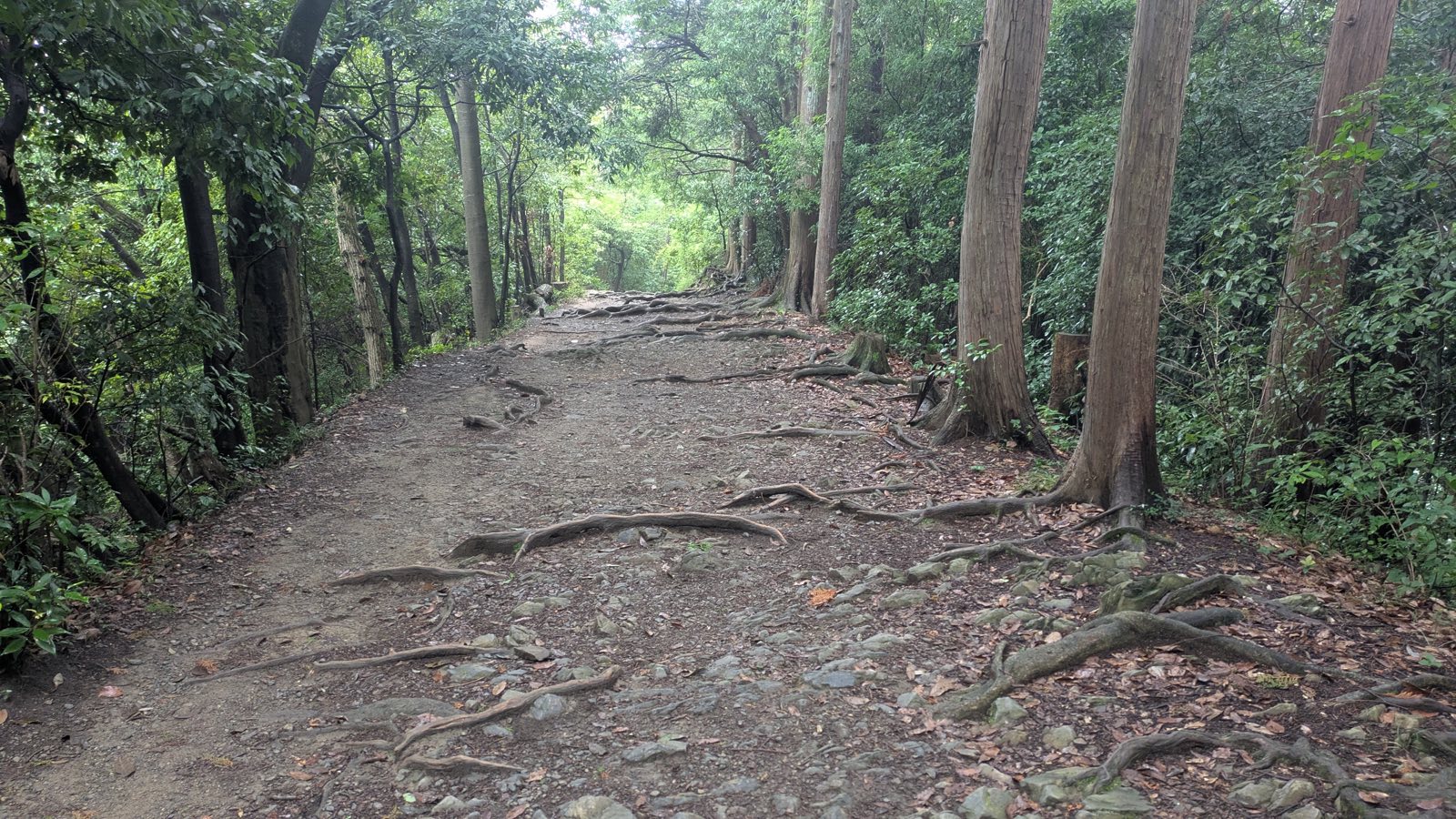
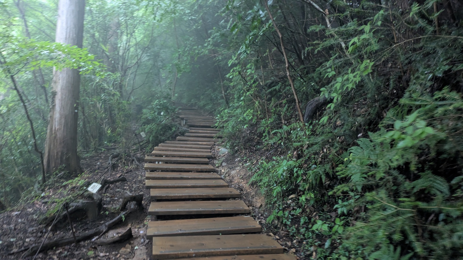
Steps — a great many of them, and most of them gentle. The rebuild in 2025 laid a lot of new timber into this trail. You will walk up stretches of pale, obviously recent wooden steps, and there are more of them than you would guess from any description of “a dirt ridge trail.”
What matters is that most are low. The risers are shallow and evenly spaced, which is why the trail does not read as a staircase even though a great deal of it technically is one. I did not come away thinking “that was a lot of steps.” I came away thinking it was the easiest of the three routes — and both of those things are true at once.
Width. The path is wide enough that people pass each other without anyone stepping off it. This is the direct opposite of Trail 6, where the trail narrows and a queue behind a slow walker has nowhere to go.
The one condition that changes this trail
Rain, or the day after it.
Wet earth, wet roots and wet timber are all slippery, and on this route you get all three. The timber is the worst of them: new wood with a smooth face sheds water badly, and a wet plank step on a descent is where you will actually feel it. It never becomes dangerous or technical — but it stops being the easy option, and it is the reason we keep saying grippy soles rather than “any comfortable shoes.”
If you are walking this trail in the rain or just after it, the sensible move is to go up the Inariyama and come down Trail 1 on tarmac, rather than descending wet timber. The route guide sets out the up-and-down pairings.
And no views, for the whole hour
The ridge is wooded from end to end. Along it you get green, quiet and shade, and no horizon at all.
That is worth saying plainly, because “ridge walk” promises something this is not. If you want to look at things, Trail 1 has the temple and the cable car terrace; the summit has the whole plain. On the Inariyama ridge, the reward is the walking itself.
With exactly one exception, coming up next.
The Inariyama Observatory: the view behind you
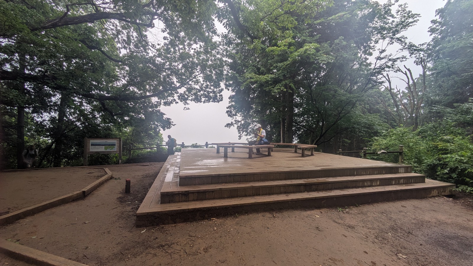
Roughly halfway up, the trees open on one side and the path arrives at a raised wooden deck with benches on it. The signs call it the Inariyama Observatory. It was rebuilt during the 2025 closure, and it is the only place on this trail with somewhere to sit down.
It is also the only view on the trail, and here is the thing this guide exists to tell you:
It faces back the way you came.
You are climbing a ridge with the summit ahead of you. The opening is behind your shoulder, looking back over the plain you walked in from. Walking up at a steady pace with your eyes on the path — which is what you do on a trail with roots in it — the geometry works against you. You reach the deck, register “benches,” and carry on. The view never enters your field of vision.
Stop. Turn round. Sit down for a minute. That is the whole instruction, and nothing on the mountain gives it to you.
What you are looking at
There is a board at the edge of the deck titled ここからの眺め — “the view from here.” It carries a photograph of the same panorama on a clear day, with every feature labelled, and a map of the Kantō plain with a “you are here” marker.
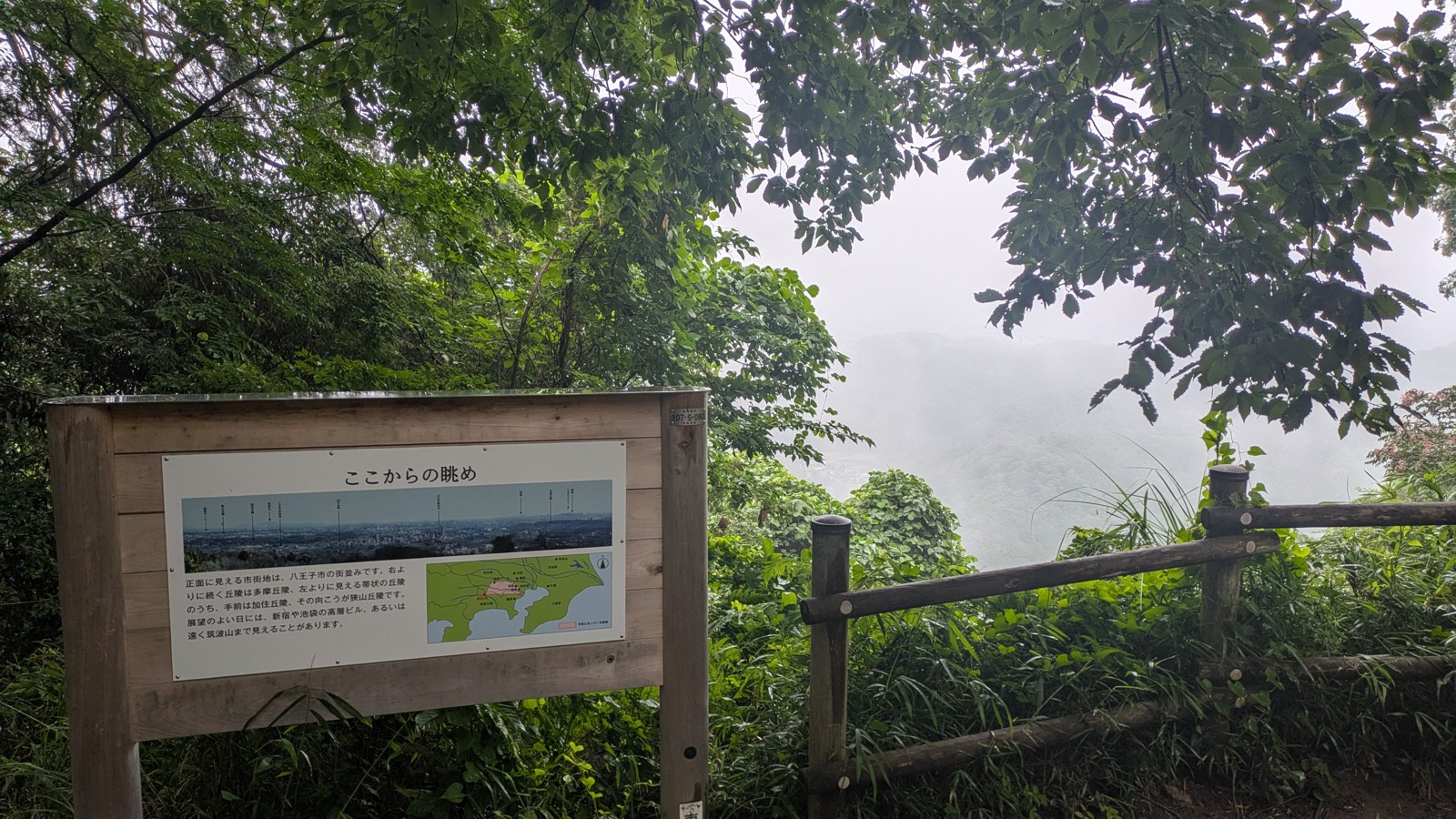
It is in Japanese only.
So here is what it says:
- Straight ahead — the built-up area is the city of Hachioji.
- To the right — the run of hills continuing away is the Tama Hills.
- To the left — a band of hills, one behind the other: the nearer one is the Kasumi Hills, and beyond it the Sayama Hills.
- On a clear day — the high-rise towers of Shinjuku and Ikebukuro, and sometimes as far as Mount Tsukuba, about 100 km away in Ibaraki.
- The labelled panorama also marks the Seibu Dome and Tokyo Skytree.
That is a remarkable amount of Japan to be able to name from a bench on a suburban mountain, and the board hands it to you for free — as long as you read Japanese, notice the board, and are facing the right way.
And on the day I was there, it was white
The photograph on the board shows the towers of Tokyo in clean winter air. What I got was fog, to the point where the opening in the trees was simply a rectangle of nothing.
That is not bad luck, and it is not rare. It is a July morning on Mount Takao. We say the same thing in the route guide about Mount Fuji from the summit: this mountain’s views are a bonus, not a fixture, and the clear air belongs to winter.
So take the view as a possibility rather than a plan. But turn round either way — because on a white day, turning round costs you nothing, and on a clear one it is the best five minutes of the climb.
Trail 5, and the last staircase
Above the observatory the ridge carries on much as before, and then the trail arrives at a flat, open clearing where another path crosses it. This is Trail 5, the short loop that runs right around the summit, and the junction is your signal that you are nearly there.
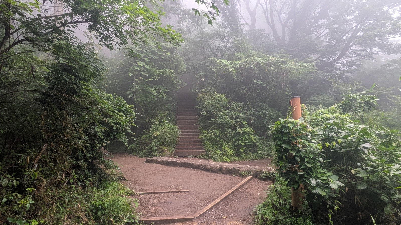
From here there is one more thing between you and the summit, and it is a staircase: a wide flight of engineered steps going up, and up, and on my morning straight into cloud.
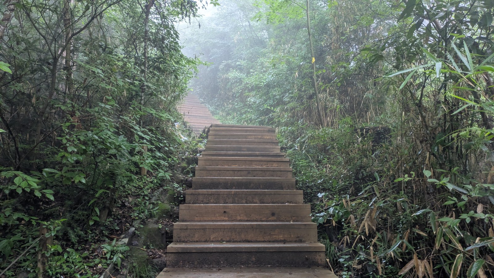
This is the second real effort of the route, and after the gentle hour behind you it will feel like it. It is also short. The arm signpost below gives 0.7 km to the summit and the Visitor Center from the junction area, and most of that is these steps.
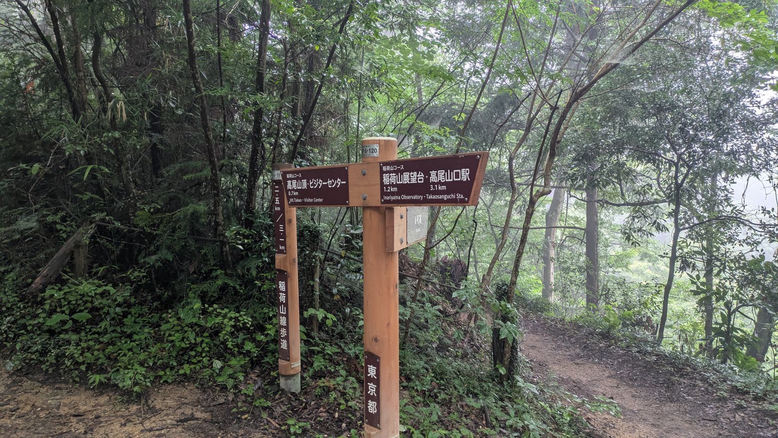
Then the trees end and you are on the summit, with the toilets, the shops, the Visitor Center and — weather permitting — the whole Kantō plain on one side and Mount Fuji on the other. All of that, including which viewpoint faces where and what is actually open, is covered in the route guide.
One last thing worth knowing before you plan the day: the Inariyama Trail does not go past Yakuo-in. If you climb this way you will reach the summit without seeing the temple at all. Plenty of people want exactly that. If you do not, the standard fix is to come down Trail 1, which walks you straight through the grounds — and the Yakuo-in guide tells you what to do when you get there.
If you would rather not carry the planning yourself, one small-group guided day on Mount Takao covers the temple, the summit and a hot spring with an English-speaking guide. It is not sold as an Inariyama walk, so check the route on the listing before you book.
Affiliate link · Small group of up to 7 · About 8 hours · Free cancellation up to 24 hours before
What this trail does not have
Most route descriptions tell you what is on a trail. On this one, the absences are the practical information.
No toilets. There is nothing between the trailhead and the summit. The last one is at the cable car base station, right beside where you turn off; the next is at the top. On Trail 1 you pass toilets at the cable car station and at the temple, so if you are walking with children or anyone who needs a predictable stop, that route is the safer choice.
No water. No tap, no vending machine, nowhere to buy a bottle. Fill up at the base station before you start — there is a tap there, and vending machines. Japanese tap water is drinkable, which is worth knowing if you come from somewhere it is not; the route guide covers where the drinkable water on this mountain actually is, and where it only looks like it.
No shops, no food, no benches except one. The single place to sit on this trail is the observatory deck. There is no tea house, no dango stall, no soba. If eating on the mountain is part of why you came, that is Trail 1, and it is one of the genuine pleasures of the tarmac route.
No temple. Covered above, but worth repeating because it surprises people who assumed all routes converge: you can climb Mount Takao and never see Yakuo-in. This is the route that does that.
No phone signal worth relying on. Treat navigation as something you sort out before you start rather than mid-climb.
The upside of all this is the thing you came for. A trail with no facilities on it is a trail with no reason for anyone to gather on it.
When to take this trail — and when not to
Take it in high summer. The ridge is shaded end to end, which on this mountain is a real advantage rather than a pleasant detail. Trail 1 is tarmac in the sun for long stretches. If you are walking Takao in late July or August — and see the heat warning in the route guide before you commit to that at all — the shade of this ridge is the best microclimate on the front of the mountain.
Take it on a weekend or a holiday, if you are going to be here on a busy day anyway. Crowding is the main thing that ruins Mount Takao, and this trail is the least affected by it. Same mountain, same Sunday, noticeably fewer people.
Take it if you want the walk to feel like a walk. This is the route where you are on earth, under trees, with the sound of your own footsteps — rather than on a road with a queue.
Think twice in the rain, or the day after it. Wet timber steps are genuinely slippery, and there are a lot of timber steps. If you go anyway, climb this trail and descend Trail 1 on tarmac rather than coming back down wet wood.
Think twice if you need certainty about facilities. No toilet for 80 to 100 minutes is fine for most adults and a problem for some groups.
Do not plan around the view. Plan around the walk, and treat the panorama from the observatory as something that may or may not be there on the day. That is the honest way to enjoy this mountain in any season but winter.
And check the trail is open at all. Eight and a half months in 2025. The Takao Visitor Center is thirty seconds of your time.
Questions people actually ask
Is the Inariyama Trail hard?
It is the easiest of the three front trails on foot, but the effort is unevenly distributed: a steep flight of log steps in the first ten minutes, a gentle hour along the ridge, then a final staircase before the summit. Allow 80–100 minutes up.
Are there toilets on the Inariyama Trail?
No. There is nothing between the trailhead and the summit. The last toilets are at the cable car base station where you turn off, and the next are at the top.
Is there anywhere to get water on the Inariyama Trail?
No — no tap, no vending machine, no shop. Fill a bottle at the cable car base station before you start.
What shoes do I need for the Inariyama Trail?
Something with a grippy sole. The path has exposed roots and a lot of timber steps, and both are slippery when wet — wet timber especially. Flat-soled canvas shoes are the ones that catch people out. Hiking boots are not necessary.
Where does the Inariyama Trail start?
Left of the cable car base station at Kiyotaki. Walk up from Takaosanguchi Station as if you were going to the cable car, then look left for a green noticeboard with a trail map on it — the stone steps beside it are the start.
Does the Inariyama Trail have any views?
One, at the Inariyama Observatory about halfway up. It faces back the way you came, so you have to stop and turn around to see it. The rest of the trail is wooded with no horizon.
Does the Inariyama Trail go past Yakuo-in temple?
No. This route reaches the summit without passing the temple at all. If you want to see it, come down Trail 1 — see the Yakuo-in guide.
Which is better, the Inariyama Trail or Trail 6?
They take about the same time. Inariyama is a dry ridge, wider, quieter, and the effort comes first; Trail 6 follows a stream past a waterfall, is cooler, narrower, and the effort comes last. Trail 6 also gets one-way restrictions at the busiest times of year. The route guide compares all three.
Can I go down the Inariyama Trail?
Yes, and it is a good descent — wide enough that passing is never a problem, unlike Trail 6. In the wet, though, come down Trail 1 instead.
One last thing
The trail asks for ten hard minutes, gives you an hour of quiet forest, then asks for one more flight of steps. Nothing about it is difficult, and nothing about it is spectacular.
But halfway up there is a bench with a view of Hachioji, the Tama Hills, and — on the right day — the towers of Shinjuku and a mountain a hundred kilometres away in Ibaraki. A board tells you all of their names, in a language you probably do not read, at a spot most people walk straight past because it is behind them.
Stop there. Turn around. Whether or not there is anything to see, you will be one of the few people on that trail who knew to look.
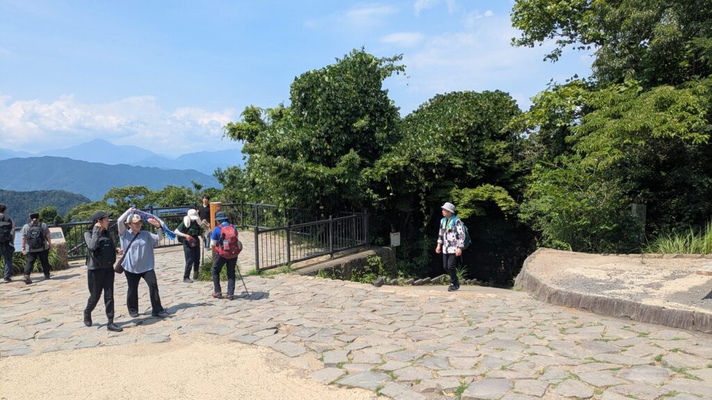
Affiliate link. This site earns a commission if you book through it, at no extra cost to you. Photo from our own walk.
Where to next
- Choosing between all the routes → Mount Takao: Which Trail Should You Take?
- The paved main route, and whether to take the cable car → Mount Takao Trail 1: Should You Walk Up or Take the Cable Car?
- The temple this trail avoids → Yakuo-in Temple, Mount Takao: What to Do as You Walk Through
- If you would rather ride → Cable Car or Chairlift? They Cost the Same
- The hot spring at the bottom → Keio Takaosan Onsen: The Rules That Can Turn You Away
- The narrow, wet counterpart to this trail → Mount Takao Trail 6: The Stream Is the Path
- The ridge west of the summit → Mount Takao and Lake Sagami: the traverse
- Why this is the trail to walk in autumn → Mount Takao in Autumn: There Is No Wrong Week