Some links on this site are affiliate links. If you book through one, Tokyo Trailhead earns a commission at no extra cost to you. It never decides what appears here.
Every English description of Trail 6 says the same thing. It follows a stream. It is cool in summer. There is a waterfall.
All of that is true, and none of it prepares you for the part that actually matters.
For roughly the first two thirds, Trail 6 does follow the stream. The water is beside you, below you, audible but separate. You cross it twice, on plank bridges, without getting wet.
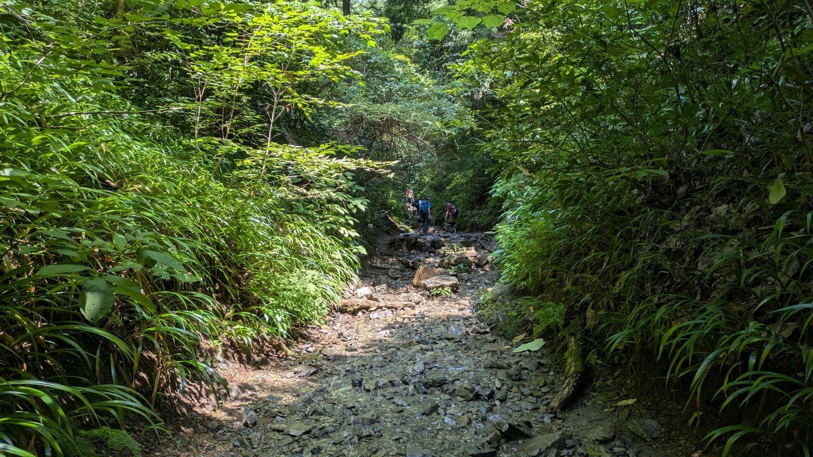
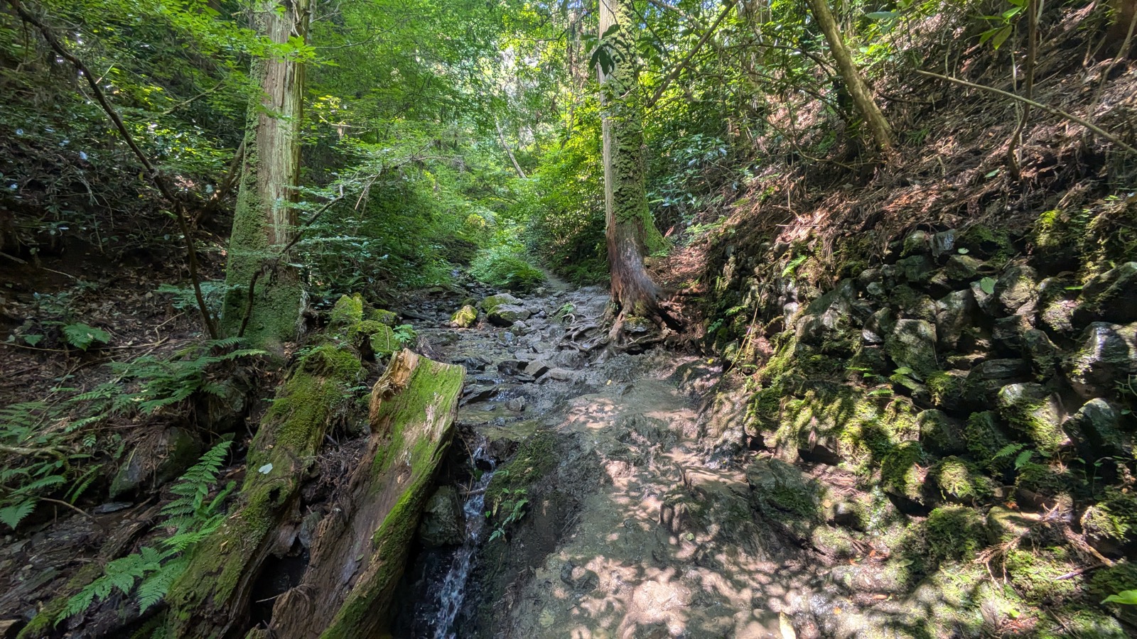
Then the path runs out of bank to use, and the trail simply moves into the water. Not onto a tidy line of stepping stones — the guidebook picture most people arrive with — but onto the wet, uneven rock of the streambed itself. For a stretch, the stream is not something the trail follows. The stream is the path.
This is the single fact that decides what shoes you should wear, why your legs feel heavier than the gradient explains, why you cannot get past the group in front of you, and why the staircase at the end hits as hard as it does. It is also, oddly, the reason the trail is worth doing.
Nothing here is dangerous. On a dry August Sunday it took sixty-four minutes to the summit, against the ninety minutes printed on the official sign. But it is a trail with a specific character, and arriving without knowing that character is what turns a good walk into an anxious one.
What this guide covers10 sections
- The essentials
- Finding the start
- The first two thirds: alongside the water
- The junction where you can still change your mind
- Where the stream becomes the path
- The bottleneck is not the direction you expect
- The staircase, and the number nobody gives you
- Arriving
- Questions people actually ask
- If you are still deciding
The essentials
| Japanese name | 6号路 (Rokugo-ro). Also signed as the Biwataki Trail |
| Distance | 3.3 km |
| Official time | 90 minutes |
| Measured, going up | 64 minutes, with stops for photographs |
| Climb | Takaosanguchi Station is 190 m. The summit is 599 m. Call it just over 400 metres |
| Surface | Packed earth, exposed tree roots, loose rock, wet streambed, then a long wooden staircase |
| Toilets on the trail | None |
| Vending machines | None |
| Drinking water | None |
| Shade | Almost complete |
| Signage | Japanese with English throughout |
Two numbers deserve a second look.
Ninety minutes is generous. The official figure is set for a comfortable pace. Going up, unhurried, stopping to take twenty photographs, took sixty-four minutes. If you are reading ninety minutes and quietly worrying about whether you are fit enough, you probably are.
There is nothing on this trail. No toilet, no vending machine, no tap, from the trailhead to the summit — and that includes the temple grounds at Biwa Falls, which look like they should have something. You will spend an hour walking beside running water you cannot drink. Buy what you need at Takaosanguchi Station.
One-way restrictions: probably not your problem
You may have read that Trail 6 is uphill-only. It is, but only twice a year: during Golden Week (8:00 to 14:00) and through the autumn foliage season (all day), on the section between Biwa Falls and the junction with Trail 5. Current trail conditions are published by the Takao Visitor Center.
Outside those windows there is no restriction — and, worth knowing, no sign at the trailhead saying so either. In August there was nothing posted. If you have read about the rule online, there is no notice on the mountain that will tell you whether it is in force today. Check the dates before you come, then stop thinking about it.
Either way, it does not affect you if you are walking up.
Affiliate link. This site earns a commission if you book through it, at no extra cost to you. Photo from our own walk.
Finding the start
Come out of Takaosanguchi Station, walk up past the shops, and keep going until the paved approach opens into the square at the foot of the cable car. This is Kiyotaki. The cable car cars are on your right; a flight of stone steps on your left is the start of the Inariyama Trail.
Trail 6 is neither of those. Carry straight on, past the cable car building, and the tarmac narrows into a lane climbing gently between trees.
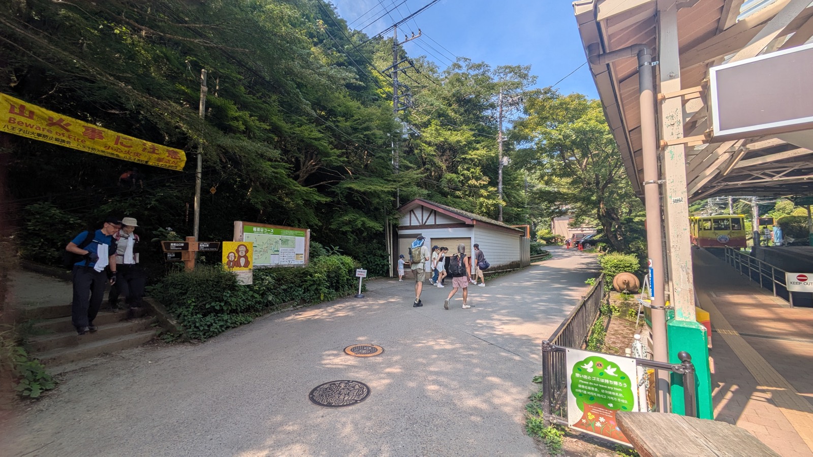
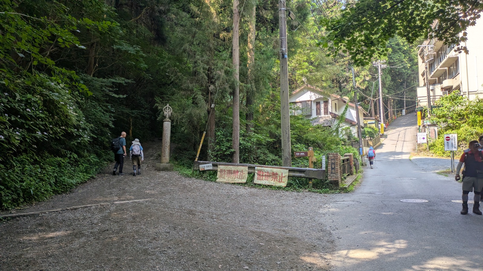
Three or four minutes later the lane forks, and this is the point where people go wrong.
The right-hand branch is a paved road that climbs steeply. It leads to a hospital. It looks like a trail because it is going uphill into the trees, and on a busy morning you will see people walking up it.
The left-hand branch is the trail. It is flat, gravelled, and marked by a stone pillar. Two red signs on the guardrail read No parking — not, as you might reasonably assume, anything about the trail.
The reliable landmark is the small brick-parapeted bridge on the right of the fork: Myoon-bashi, Myoon Bridge. If you can see it, you are in the right place. Take the flat gravel to its left.
There is a signpost here too, brown with white lettering: 6号路・琵琶滝 / 6th Trail, Biwataki Water Fall. English, on the sign, at the fork. From this point the waymarking is genuinely good.
The first two thirds: alongside the water
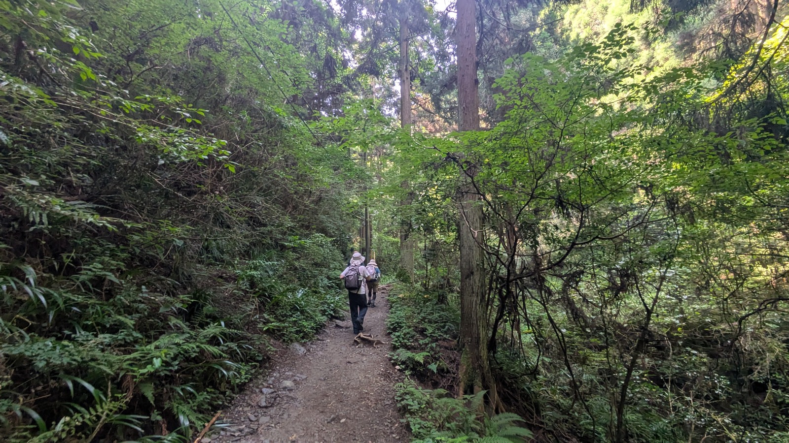
For a good half hour, Trail 6 is the easiest serious-looking trail on the mountain.
The path is packed earth, wide enough for two, and it barely climbs. It runs through cedar and broadleaf under near-total shade, with the stream dropping away to your right. In August, walking in from a station platform that was already uncomfortable, the temperature change is immediate and obvious.
Ten minutes in, the trail reaches Biwa Falls.
Biwa Falls is somewhere you pass, not somewhere you stop
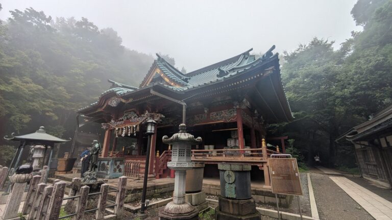
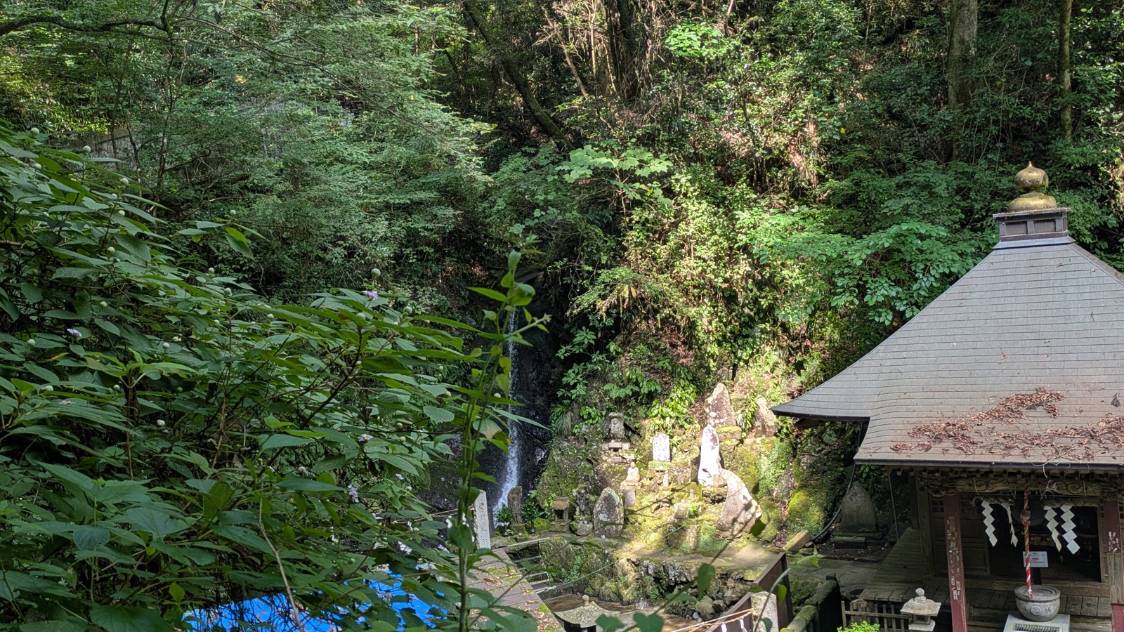
The falls are a working religious site — a place where practitioners stand under the water — with a temple hall, a gate, and, on the morning we walked through, people in white robes on the terrace. It is not a viewpoint built for visitors, and there is no path down to the water.
What you get instead is better than it sounds. The trail climbs slightly above the compound, and from the path you can look down on the whole thing at once: the hall, the terrace, the white thread of the falls in the trees behind. It takes about fifteen seconds to walk past. Look right.
Do not plan around it. There are no toilets here, no water, no vending machine, and nowhere to sit. It is a thing you see on the way, not a destination.
Two bridges, and you stay dry
Past the falls the trail begins, gently, to behave more like a mountain path. Tree roots come through the surface in ridges that work as rough steps. The rock underfoot is damp in places even in dry weather — this is a valley that does not get much sun.
You cross the stream twice on this section, and both crossings are plank bridges. You walk across. Your feet stay dry. If your idea of Trail 6 is hopping between stones over running water, this is where that idea comes from, and it is completely painless.
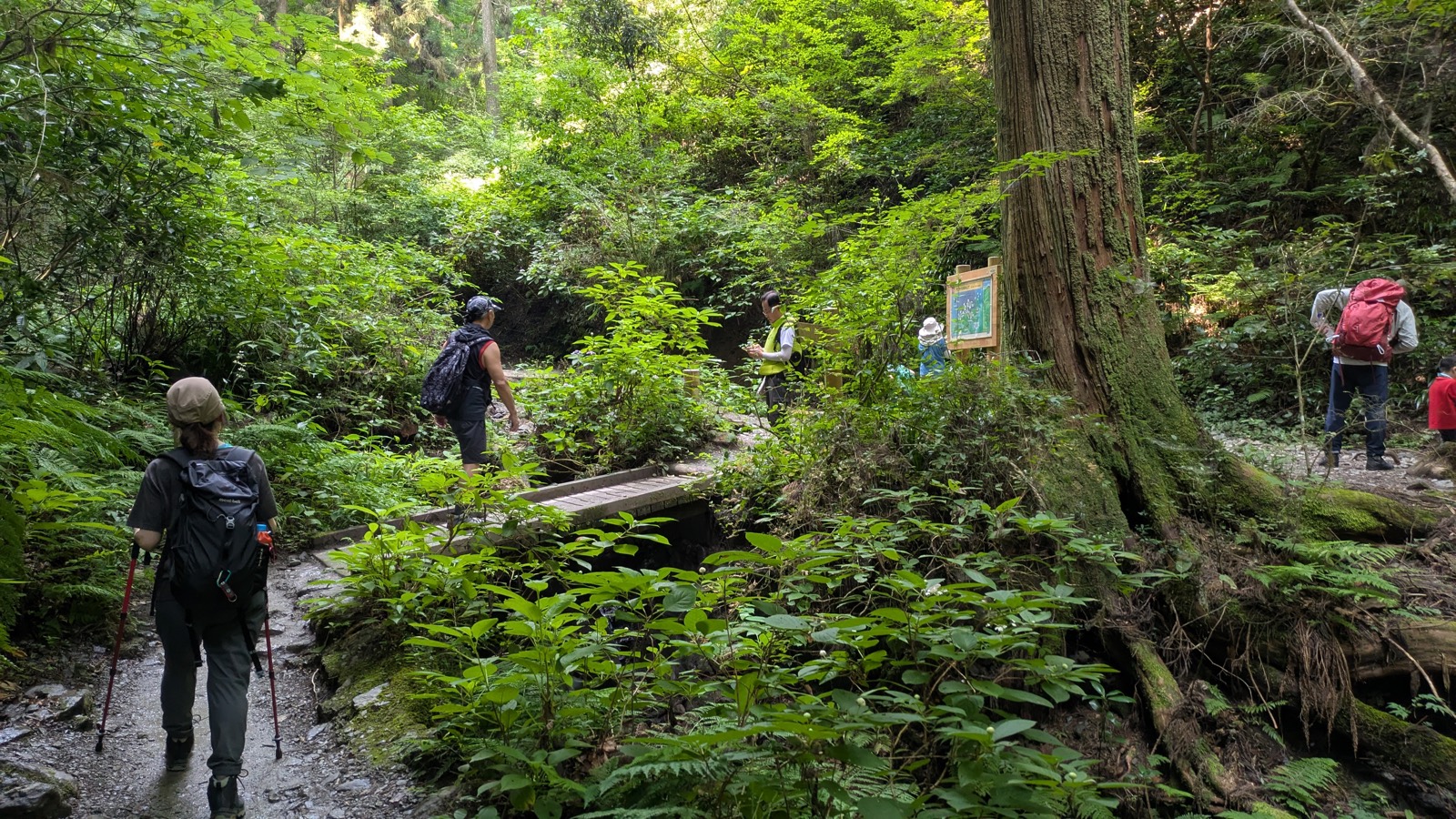
Then, about forty minutes in, the trail arrives at a junction — and everything changes.
The junction where you can still change your mind
Roughly forty-two minutes in, the trail reaches a small clearing. A fallen trunk lies across the slope. There is a wooden footbridge on the left, and a signpost with three arms.
Read the signpost. It is in English, and it is doing more work than it looks.
| Direction | Sign |
|---|---|
| Straight on, up the stream | 6号路・髙尾山頂 — 6th Trail, Top of Mt.Takao |
| Left, across the footbridge | 稲荷山コース — Inariyama Trail |
| Back the way you came | 髙尾山口駅 — Takaosanguchi Sta. |
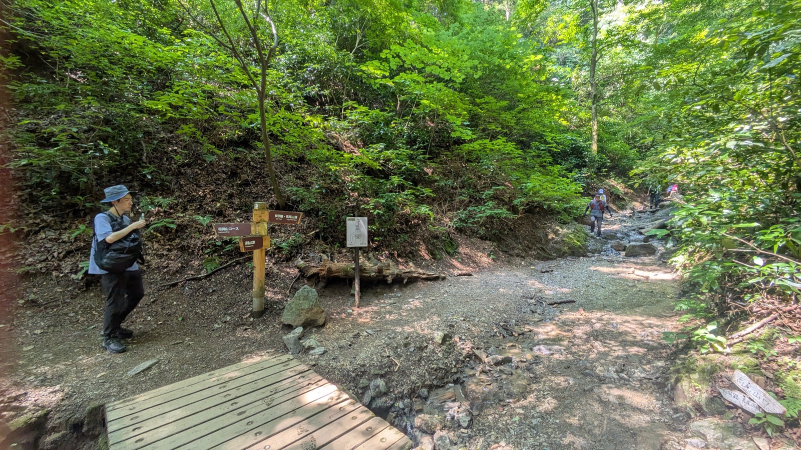
That left-hand arm is the useful one, and almost nobody takes it.
Cross the footbridge and you climb away from the water to join the Inariyama Trail, the broad dry ridge route, and follow that to the same summit. You do not go back down. You do not lose the day. You simply finish on a different trail — a wider, drier, sunnier one, described in full in our Inariyama Trail guide.
Here is why this junction is worth knowing about even if you never use it.
Everything after this point is the stream section. If it has rained, if the water is high, if you are in trainers and would rather not soak them, if the group ahead of you has been blocking the path for ten minutes — this is the last place where any of that is easy to fix. Beyond here, the alternative to continuing is walking back down.
On a dry Sunday morning, people did take the bridge. Only a few. The overwhelming majority walked straight on into the stream — which tells you something useful about how hard the next section actually is.
So: note the bridge, then walk past it. It is not there because the trail ahead is dangerous. It is there so that continuing is a decision you made, rather than one you drifted into.
Where the stream becomes the path
Past the junction the banks close in, the vegetation leans over from both sides, and the trail stops being a trail beside water. It becomes the streambed.
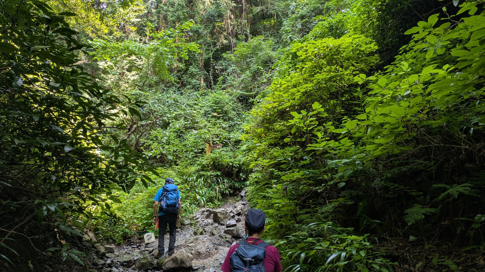
There is no dry line running alongside. The rock is loose in places, worn smooth in others, and wet more or less throughout. There is water moving under your boots.
There are very few stepping stones. This is the part that surprises people, because almost every description of this section uses the phrase stepping stones, which sets an expectation of a dry crossing on placed rock. In practice you are choosing your own footing on a wet, irregular streambed for several minutes.
What that means for your feet
Let us be precise about it, because a flat warning that you will get wet is the kind of thing that makes people change trail unnecessarily.
| Conditions | Soles of your shoes | Inside your shoes |
|---|---|---|
| Dry weather, normal water level, hiking boots | Wet — reliably | Dry |
| Higher water, trainers | Wet | Wet, unless you pick your line across the rocks |
On a dry August Sunday, in boots, the soles got wet and nothing got through. That is the normal outcome, and it is a non-event.
So the question is not whether your shoes get wet. They will. The question is whether the water gets inside them, and that is decided by three things: how much water is running that day, what you are wearing, and whether you bother to pick your line rather than walking straight up the middle.
What to wear. Anything with a closed toe and a sole that grips wet rock. Proper boots make this section a non-issue. Trainers are survivable in dry conditions if you place your feet deliberately. Sandals, and any smooth-soled shoe, are a bad idea here — the same conclusion we reached about grip in the route-choosing guide, arrived at from the opposite direction. There, the concern was slipping. Here, it is soaking. It is the same pair of shoes that solves both.
Why it tires you more than the gradient suggests
The stream section is not steep. Measured, it is a small part of the climb. And yet people arrive at the end of it noticeably more tired than the height gained can account for.
The reason is that you cannot stop paying attention. Every step is placed rather than taken. You are reading the rock, choosing lines, watching the person ahead of you do the same. That is a low-grade, continuous cognitive load, and it goes on for the whole section.
You will not notice it while you are in the stream. You will notice it about ten minutes later, on the staircase.
The bottleneck is not the direction you expect
Trail 6 is narrow. For long stretches it is a single-file path with a bank on one side and a drop to the water on the other, and the obvious conclusion is that passing oncoming walkers must be a constant nuisance.
It is not. That is worth saying plainly, because it is the opposite of what the width of the path suggests.
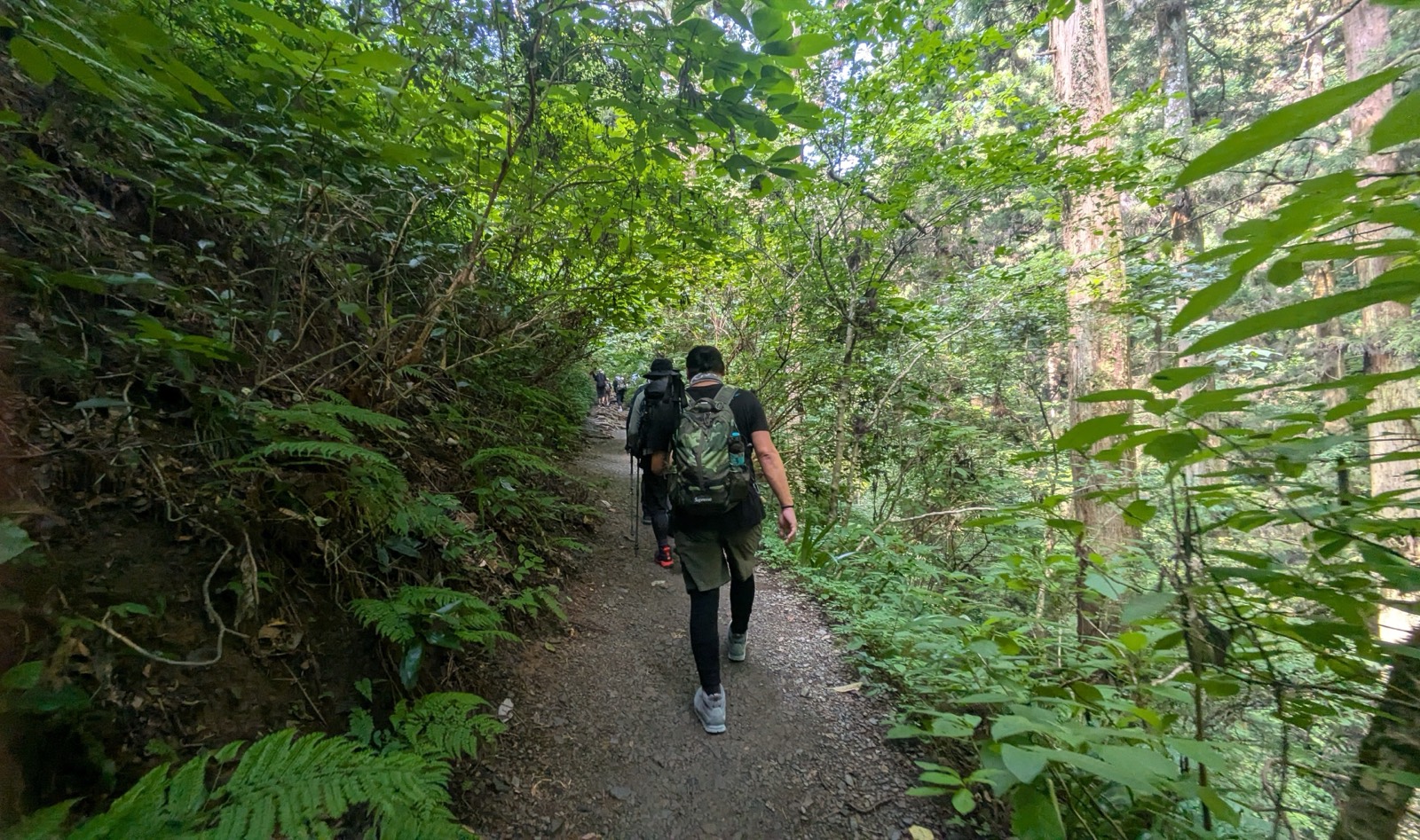
On a Sunday morning in August, over sixty-four minutes of climbing:
- About ten encounters with people coming down. Not one of them was a problem.
- About five occasions overtaking a slower walker. Straightforward.
- Groups, repeatedly. This was the only genuine frustration of the day.
Why oncoming traffic works and overtaking does not
When two people are walking towards each other, both can see the situation developing. Both slow down. One finds the wider spot; the other waits. It is settled without a word, and on a narrow path it happens naturally, because neither party can pretend not to have noticed.
Overtaking removes that. The people ahead are facing away. They cannot see you, and on this trail they usually cannot hear you either — the stream is loud enough to cover footsteps. So a group walking at its own pace has no idea a queue has formed behind it, and the path has nowhere for you to get past.
This is exactly what the stream section produces: everyone looking down, everyone moving slowly, everyone in single file. It is a perfect machine for making a queue nobody at the front knows about.
The part that applies to you
Most visitors to Mount Takao walk in groups. If you are one of them, you are as likely to be the front of that queue as the back of it.
Look behind you every few minutes. That is the whole etiquette. If somebody has been sitting behind your group waiting, they will be obvious, and the next wide spot — a bridge, a flatter shelf of rock, a bend where the bank opens out — takes about three seconds to stand aside on.
There is no sign anywhere on this mountain asking you to do this. It is simply what everybody who walks here regularly does, and it is the single thing most likely to make you popular on a narrow trail.
The mirror image is also true. If you are stuck behind a group, they are almost certainly not ignoring you. They do not know. A cheerful greeting works, and sumimasen — excuse me — is understood by everyone on the mountain.
The staircase, and the number nobody gives you
The stream section ends abruptly. The watercourse narrows, the rock gets steeper, and then you are lifted out of it onto the bottom step of a wooden staircase.
Look up. You will not see the top of it.
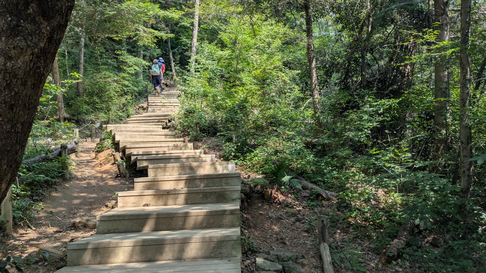
That is the honest description of this staircase, and it is the reason it has a reputation out of proportion to its size. The steps run up through the trees, bend, and keep going. From almost anywhere on it, what you can see is more staircase. The feeling it produces is not this is steep but this does not end.
And you arrive at it in the worst possible condition — not physically wrecked, but forty-five minutes into concentrating on where your feet go. The stream did not tire your legs. It tired your attention. The staircase is where you find that out.
So here is the number that English descriptions of Trail 6 never give you.
From the end of the stream section to the top of the staircase: eight minutes.
Measured, by timestamp, on 2 August 2026, at an ordinary pace with photograph stops. Eight minutes. That is the whole of the hard part of Trail 6.
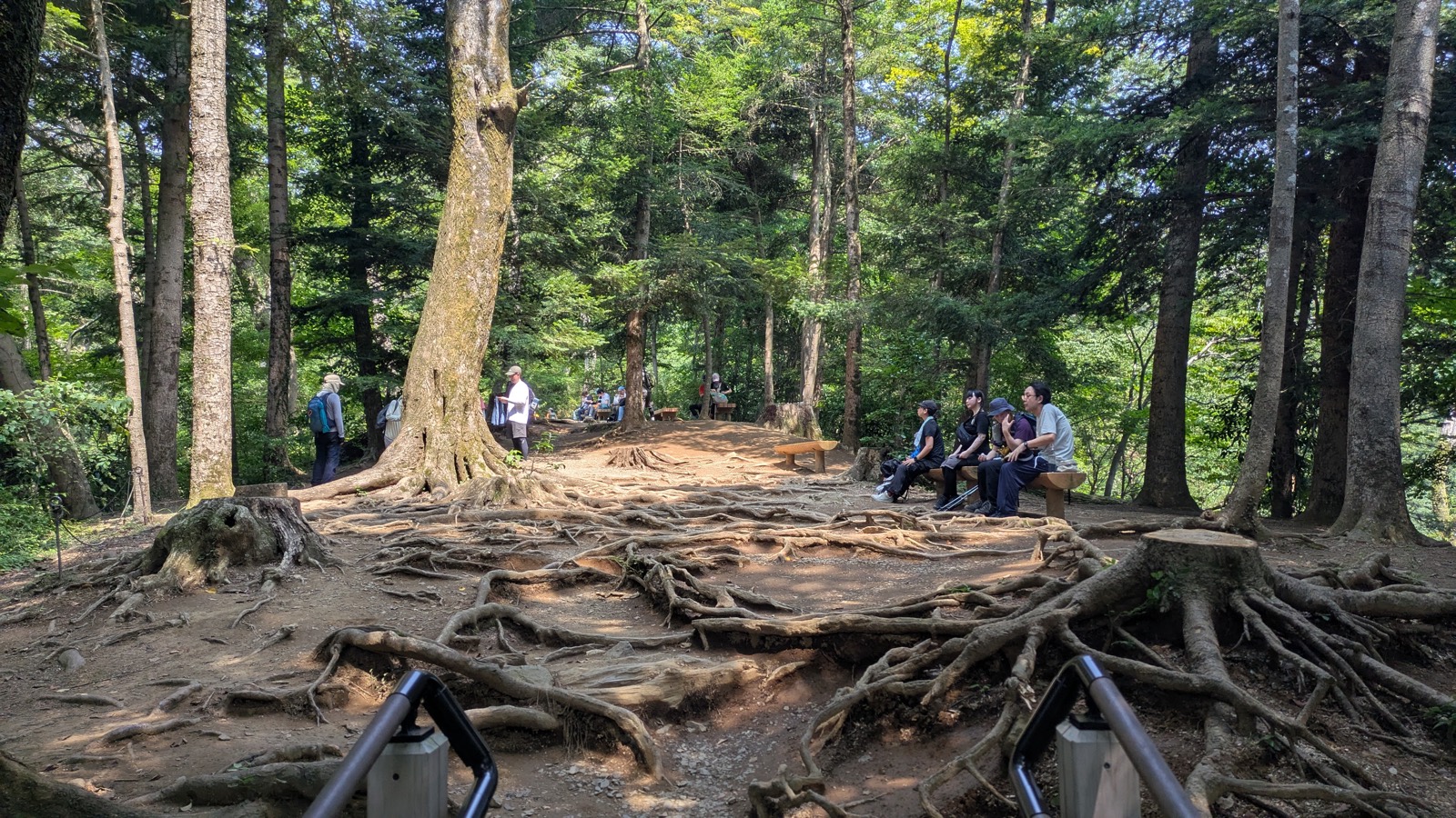
Knowing that changes the experience of it more than any advice about pacing or breathing could. You are not looking up at an unknown quantity. You are looking up at eight minutes.
Above the staircase the trail levels into a broad, root-laced clearing with benches, and the work is done. What remains is a gentle walk to the top.
None of this has to be worked out alone. One small-group guided day on Mount Takao walks to the summit with an English-speaking guide. It is not sold as a Trail 6 walk, so the stream section may not be on it.
Affiliate link · Small group of up to 7 · About 8 hours · Free cancellation up to 24 hours before
Arriving
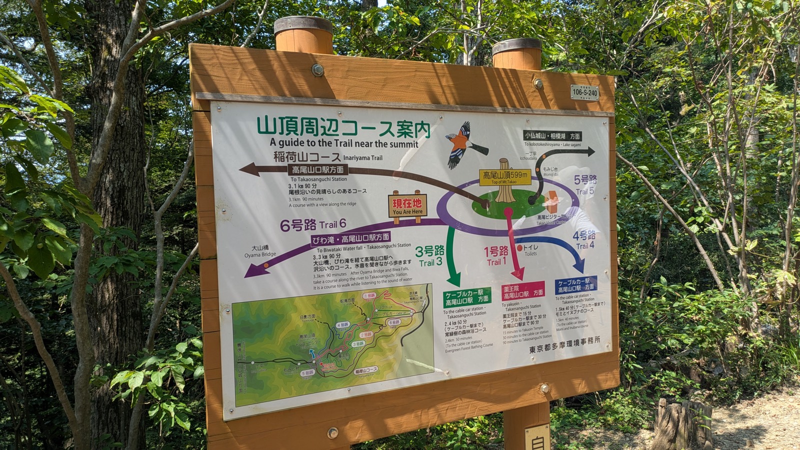
Trail 6 does not deliver you to the summit marker. It joins the network of paths circling just below the top, and the first thing you meet is a large bilingual board — A guide to the Trail near the summit — with a You Are Here arrow on it.
It is worth two minutes. This is the board that tells you every way down, with distances and times, in English:
| Route | Distance and time |
|---|---|
| Trail 6 (back down the way you came) | 3.3 km, 90 min |
| Inariyama Trail | 3.1 km, 90 min |
| Trail 3 | 2.4 km, 50 min to the cable car station |
| Trail 4 | 1.5 km, 40 min to the cable car station |
| Trail 1 | 15 min to Yakuo-in, 30 min to the cable car, 90 min to the station |
It also points the other way, to Icchoudaira, Momiji-dai, Kobotokeshiroyama, Lake Sagami — the ridge traverse west, which is a different day out and a different guide.
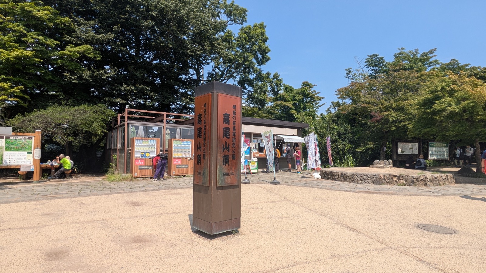
From the board it is a few minutes on the level to the summit itself: an open plateau at 599 m, with a stone marker, shops, benches, and, on a Sunday, a lot of people.
About the view
Two things, said plainly, so that you are not disappointed by something nobody is responsible for.
The eastern view over the Kanto plain towards central Tokyo is there, and on a clear day it is genuinely long. In summer it is hazy. You will see the plain and a suggestion of towers on it.
The western viewpoint is where people go for Mount Fuji — and in summer, you will not see it. Fuji is a cold-air, clear-sky object; the reliable season is roughly November to February. On a bright August Sunday the western horizon was a beautiful, complete wall of blue-grey ridgelines with no Fuji anywhere in it.
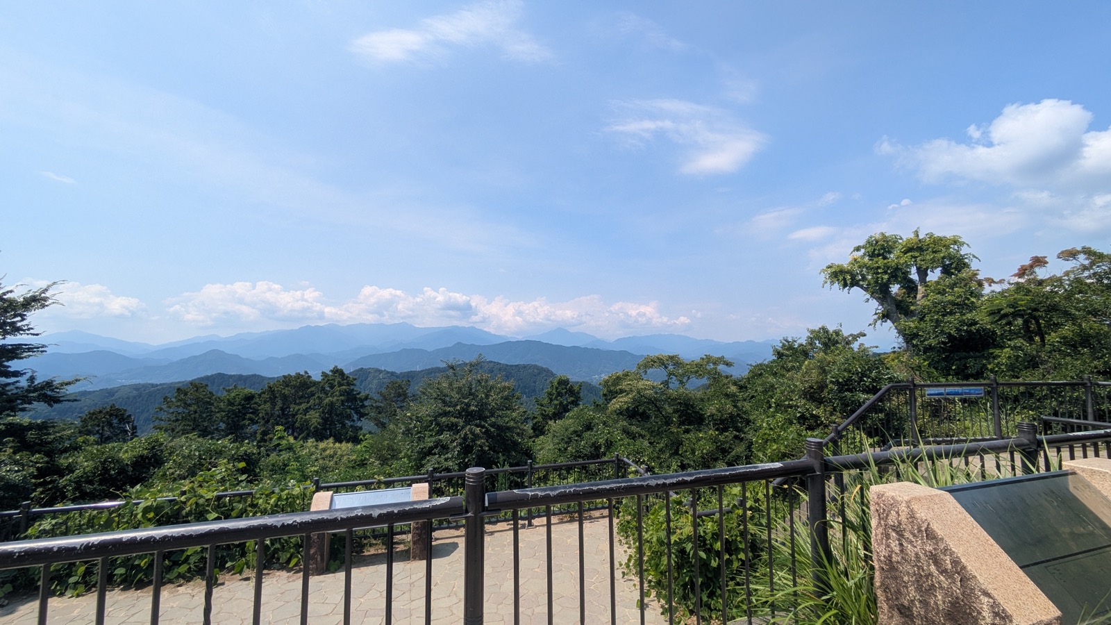
It is still the best place on the mountain to stand. Just do not travel for the mountain that is not out.
Questions people actually ask
Will my shoes get wet on Trail 6?
The soles, yes — reliably. There is a section where the trail runs up the streambed itself with water moving over the rock. Whether water gets inside your shoes depends on the water level that day, what you are wearing, and whether you pick your footing. In dry conditions, in boots, it does not.
Can I do Trail 6 in trainers?
In dry weather, with care, yes — place your feet deliberately in the stream section rather than walking up the middle. After rain, or if you would rather not risk soaked feet, take the Inariyama Trail instead. There is a marked junction about forty minutes in where you can switch.
How long does Trail 6 actually take?
The official sign says 90 minutes. Going up at an unhurried pace with photograph stops, it took 64 minutes from the trailhead to the summit. Allow ninety if you are stopping properly at Biwa Falls, walking with children, or going up on a crowded weekend.
Is Trail 6 hard?
No, with one qualification. There is no exposure, no scrambling, no navigation to do. The gradient is gentle for most of the way. The hard part is a wooden staircase at the end, and it takes eight minutes. What catches people out is not fitness — it is arriving at that staircase after concentrating on wet rock for the previous stretch.
Are there toilets on Trail 6?
No. There is no toilet, no vending machine, no drinking water between the trailhead and the summit, including at Biwa Falls. The last facilities are at Takaosanguchi Station and the cable car base; the next are at the summit.
Can I come down Trail 6?
You can when it is not restricted, but it is not the best choice. The staircase and the streambed are both harder going down than up, and the rock is slick. Use the Inariyama Trail or Trail 1 to descend — see the route-choosing guide.
Is Trail 6 one-way?
Only during Golden Week (8:00 to 14:00) and the autumn foliage season (all day), on the section from Biwa Falls to the Trail 5 junction, and only uphill — which is the direction you are going anyway. Outside those periods there is no restriction, and no sign at the trailhead telling you either way. Check the dates before you travel.
Is Trail 6 suitable for children?
Older children who are steady on their feet will enjoy it — the streambed is the best part of the mountain for them. It is not suitable for pushchairs, and there is no toilet for an hour. For small children, Trail 1 with the cable car is the easier day: see Trail 1 and the cable car guide.
Can I see Biwa Falls up close?
Not really. It is an active religious site for waterfall training, not a viewpoint, and there is no path down to the water. You see it from the trail above, which shows you the hall, the terrace and the falls together — then you carry on.
Is Trail 6 crowded?
On a weekend morning, yes, but the crowding takes an unexpected form. Passing people coming down is easy. Getting past a group going the same way is not, because the path is single file and the stream is loud enough that they cannot hear you. If you are in a group, glance behind you every few minutes.
Which is better, Trail 6 or the Inariyama Trail?
They take about the same time. Trail 6 is cool, shaded, beside water, narrow, and saves its effort for the end. Inariyama is a dry open ridge, wide enough to pass on, with the climbing done early and a view along the way. In hot weather, Trail 6. After rain, Inariyama. Full comparison in the route-choosing guide.
Affiliate link. This site earns a commission if you book through it, at no extra cost to you. Photo from our own walk.
If you are still deciding
- Which trail should you take up Mount Takao? — all the routes compared, including why Trail 6 is not the one to come down.
- The Inariyama Trail — the dry ridge alternative, and the trail you join if you take the footbridge described above.
- Trail 1: walk it or take the cable car? — the paved route, the temple, and the one everybody defaults to.
- Cable car or chairlift? — identical fares, different experiences, real boarding restrictions.
- Yakuo-in: what to do at the temple — Trail 6 misses the temple entirely. This is how to see it on the way down.
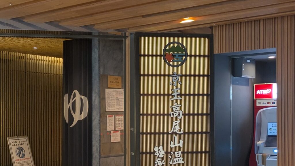
- The hot spring by the station — and the rules that can turn you away at the door.
- Mount Takao and Lake Sagami: the traverse — the opposite shape of effort, on the ridge west of the summit.
- Mount Mitake Rock Garden — the other famous stream trail near Tokyo, which turns out to be the opposite of this one.