Some links on this site are affiliate links. If you book through one, Tokyo Trailhead earns a commission at no extra cost to you. It never decides what appears here.
The Ten-en ridge is free to walk. The way onto it is not.
Coming from Kita-Kamakura, the entrance to the trail sits at the back of Kencho-ji, above the temple, at the top of a long flight of stone steps. To stand on it you walk in through the main gate, past the ticket window, and across the whole precinct. The window wants 500 yen, in cash, and it wants that from you even though you have arrived in boots and are only passing through.
This page is one day of measurement. Sunday 13 September 2026, the morning after rain. Somon gate at 09:22, the top of the steps above Hansobo at 09:44, Ohirayama at 10:27, Ten-en at 10:37, the Zuisenji end of the trail at 11:16, Kamakura Station at 12:00. Every timing below comes from the clock inside a camera and from a GPS track recorded on the day, not from another page.
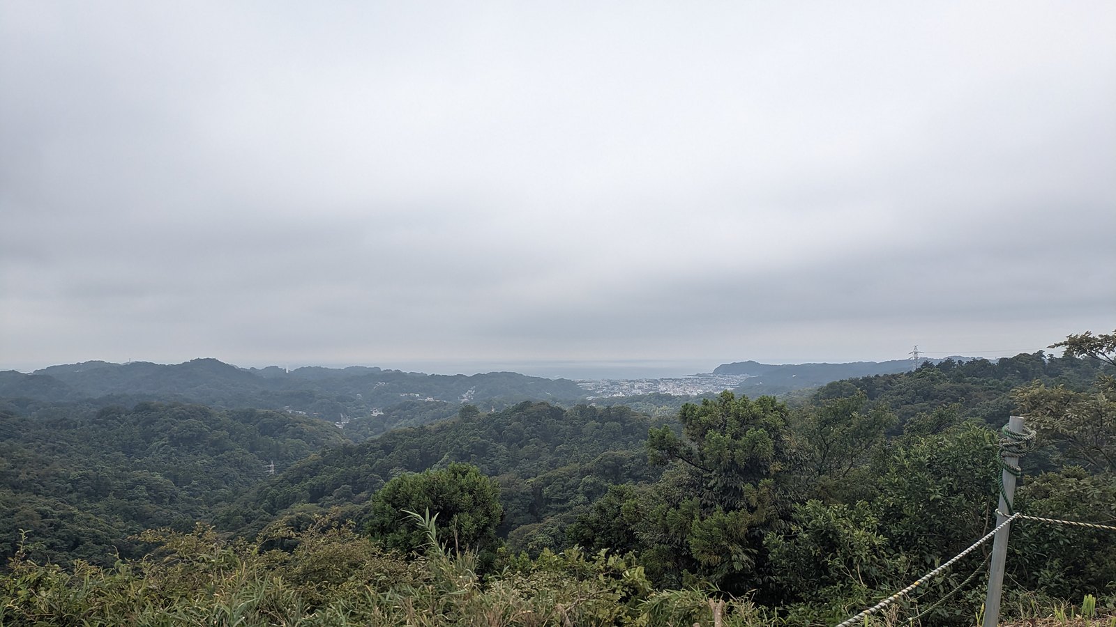
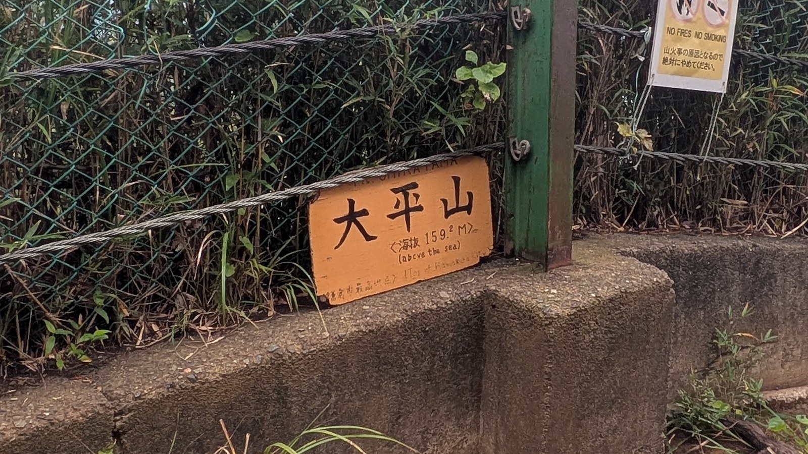
The highest ground on the whole walk is 159.2 metres (522 feet). The sign up there says so, and it also says that this is the highest point in the city of Kamakura. From that ridge you can see the sea.
What this guide covers12 sections
- Ten-en trail, in figures
- The price is in English. The sentence that makes it yours is not
- What the 500 yen buys is 22 minutes
- Can the 500 yen be avoided
- Why published times for this trail disagree, and which one to believe
- What the ridge is actually made of
- The caves are a detour, and they are graves
- The ground does not dry out here
- Where the trail puts you down
- The gate closes at 16:30, and that governs the whole day
- Questions people actually ask
- What to decide before you reach the window
Ten-en trail, in figures
| Official English name on the boards | Ten-en Hiking Course |
| Entrance from Kita-Kamakura | Through Kencho-ji and up past Hansobo, 33 minutes from the station |
| Cost to start from that end | 500 yen, cash only |
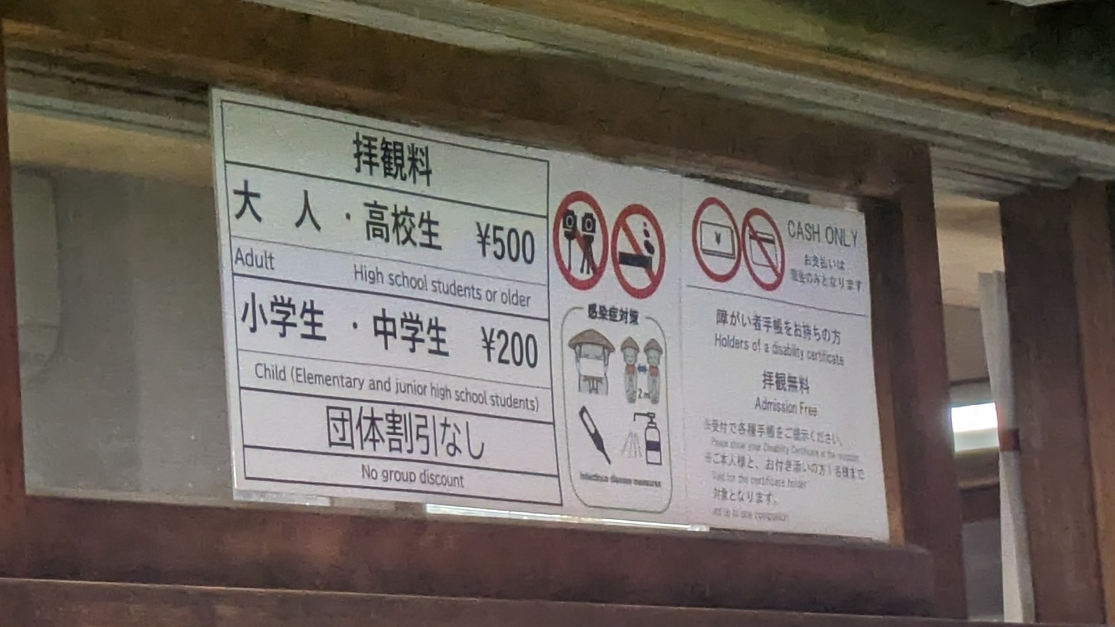
| What the fee board says | Adults and high school students 500 yen, elementary and junior high school students 200 yen, no group discount |
| Temple hours | 08:30 to 16:30 |
| Trail only, above Hansobo to the Zuisenji end | 3.74 km, 92 minutes |
| Kencho-ji main gate to the Zuisenji end | 4.70 km, 1 hour 54 minutes |
| Station to station, Kita-Kamakura to Kamakura | 8.35 km, 2 hours 49 minutes |
| Climbing | About 319 metres in total |
| High point | 159.2 metres at the sign on Ohirayama |
| Exit | Zuisenji side, then Kamakura-gu, then a bus to Kamakura Station for 240 yen |
| Water | The station, then seven vending machines before Kencho-ji, then nothing until the houses at the far end |
| Toilets | The station, then inside Kencho-ji once you have paid, then one public toilet at Ten-en |
| Surface | Earth, tree roots, wet rock slabs, and cuttings driven through rock |
| Weather on the day | Cloud, after overnight rain |
Two notes on those numbers. The climbing figure comes from the terrain model that the GPS application reads rather than from a barometer, so it is approximate. The 159.2 metres is the exception, because it is painted on the sign at the summit.
The 92 minutes is the walking on dirt. It does not include the 22 minutes inside the temple, and it does not include the 44 minutes of streets and shrines at the far end. Section 6 takes those apart, because the difference explains why published times for this trail disagree so widely.
The price is in English. The sentence that makes it yours is not
Four things stand at the Kita-Kamakura end of this trail, and putting them side by side is the whole point of this section.
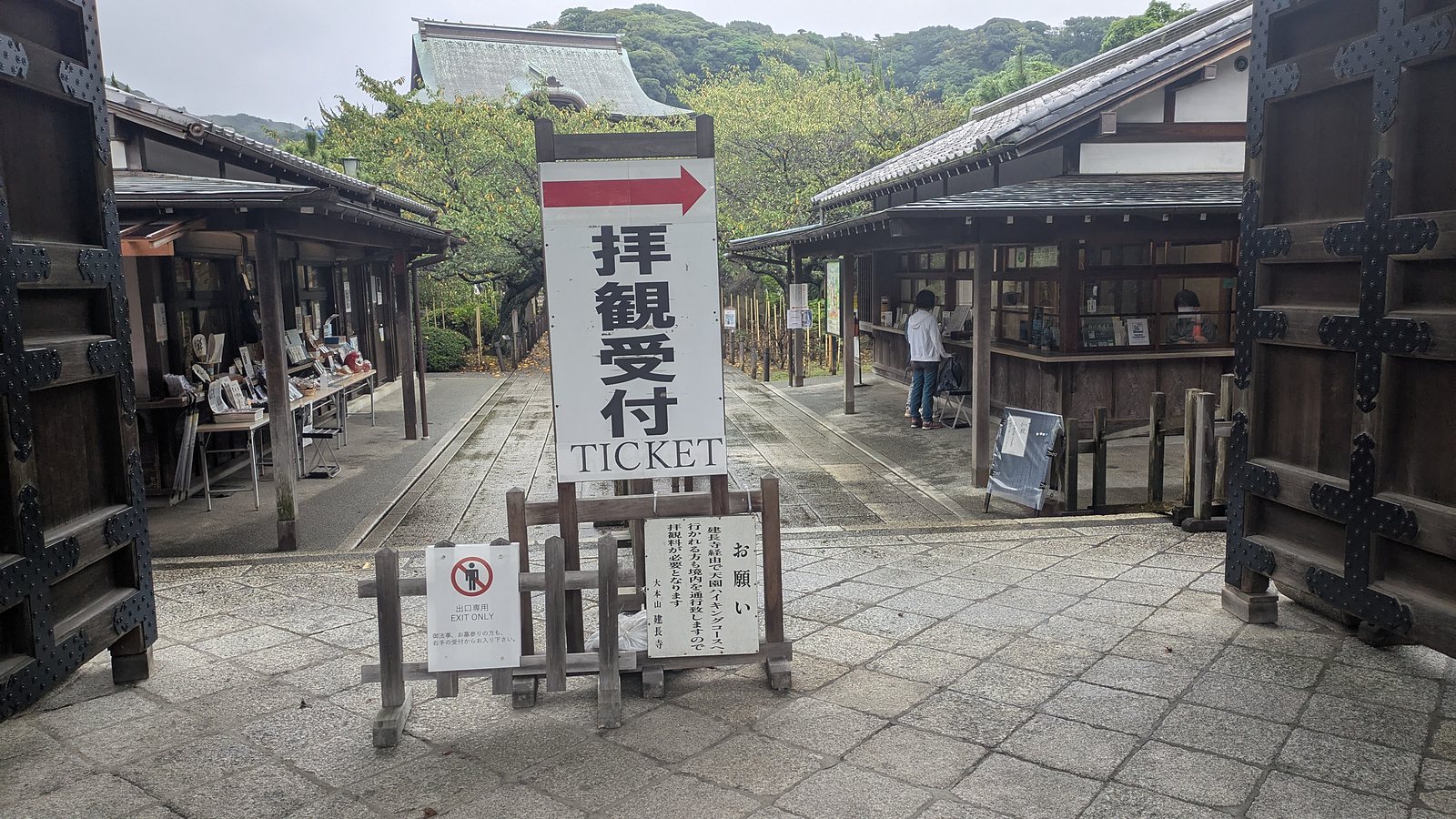
The first is the ticket window. Beside it stands a vertical board, and that board says that people heading for the Ten-en hiking course by way of Kencho-ji are crossing the precinct, and so the admission fee applies to them. The board is in Japanese. There is no English on it at all. In the same photograph, two other signs are in English: TICKET, and EXIT ONLY.
The second is the fee board, one step further on. That one is bilingual. Adults and high school students 500 yen, elementary and junior high school students 200 yen, no group discount, and a pictogram reading CASH ONLY. So the amount is readable in English, right there at the gate.
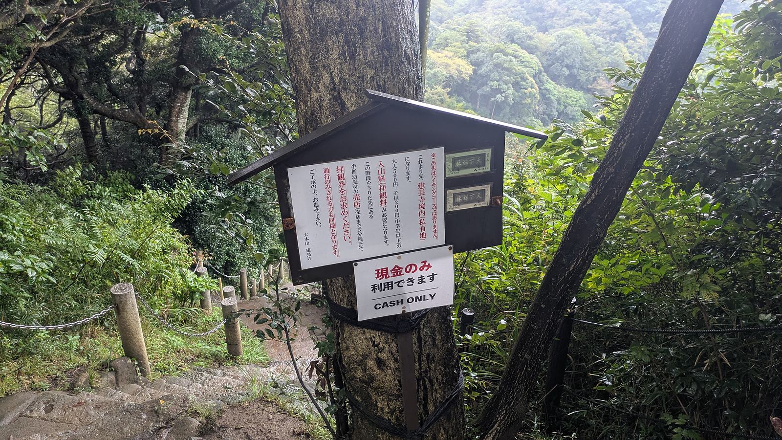
The third stands 22 minutes later, at the top of the stone steps above Hansobo, facing the other way. It tells people arriving down off the ridge that beyond this point is not the hiking course, that the ground ahead is the precinct of Kencho-ji and is private land, that the fee is 500 yen for adults and 200 yen for children, and that people who are only passing through are included. Below it hangs a second sheet, and that sheet carries the only English on the board: CASH ONLY, two words.
The fourth is the ticket itself. Pink, with a drawing of the plaque over the Sanmon gate, the name of the temple, and the words for adult and 500 yen. All of it in Japanese.
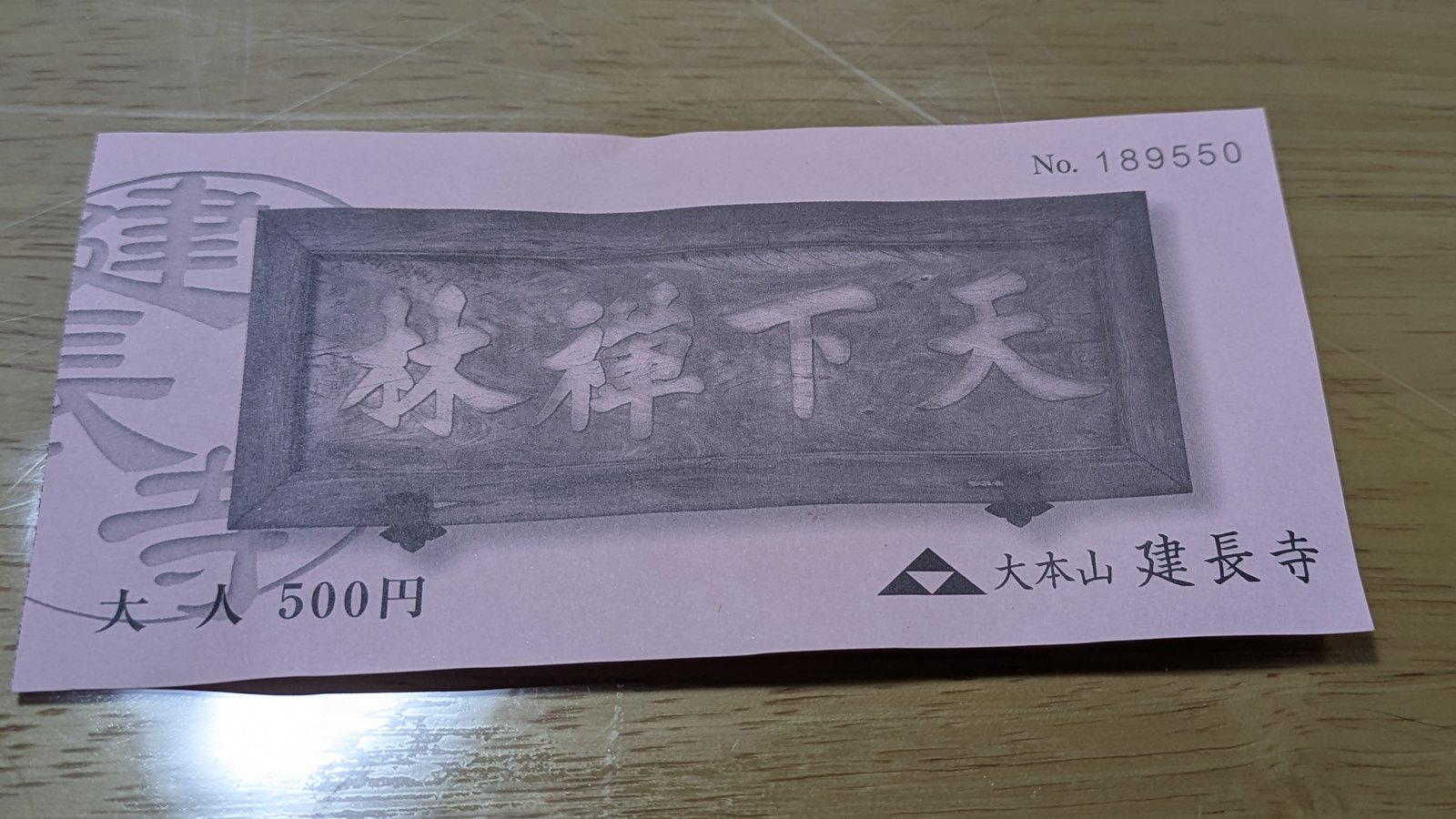
Set those four down together and the pattern is narrow and specific. The amount is published in English in more than one place. The official English site of the Kamakura City Tourism Association states it twice, once on the page for this very trail and once on the page for the temple, along with the opening hours of 08:30 to 16:30 (Ten-en Hiking Course, Kencho-ji Temple). The fee board at the gate says it in English too.
What no English source says, anywhere, is the part that decides whether the amount applies to you. Both of the boards that spell out the rule for people walking through, rather than visiting, are in Japanese. The official English map for the city prints a small note where Hansobo is drawn, saying that admission is charged at the entrance of Kencho-ji, and then prints no figure, while giving 400 yen for Hase-dera and 300 yen for Kotoku-in on the same sheet.
None of this is a complaint. Kencho-ji is a working monastery that happens to own the ground the trail starts on, 500 yen is an ordinary temple admission in this town, and the temple has stated the rule clearly twice. It has simply stated it to the people who can read Japanese.
What the 500 yen buys is 22 minutes
Here is the figure that reframes the whole question. From the Somon gate at 09:22 to the top of the steps above Hansobo at 09:44 took 22 minutes. That is 1.01 km of walking and about 94 metres of climbing, at a pace that included stopping to photograph things.
So the 500 yen is not the price of a path. The path is free and starts above all of this. The 500 yen is admission to the temple that you have to cross in order to reach the path, and crossing it takes the better part of half an hour.
What stands inside those 22 minutes is not a corridor. It is a full temple visit, whether or not you came for one.
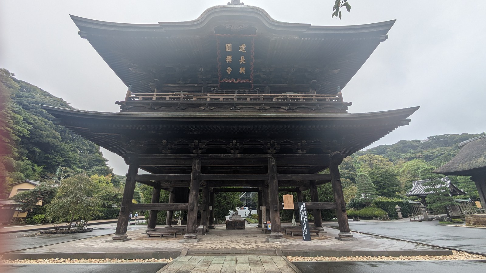
The Sanmon gate comes first, an enormous two-storey wooden gate and an Important Cultural Property of Japan. The temple says that passing under it frees the mind from earthly attachment.
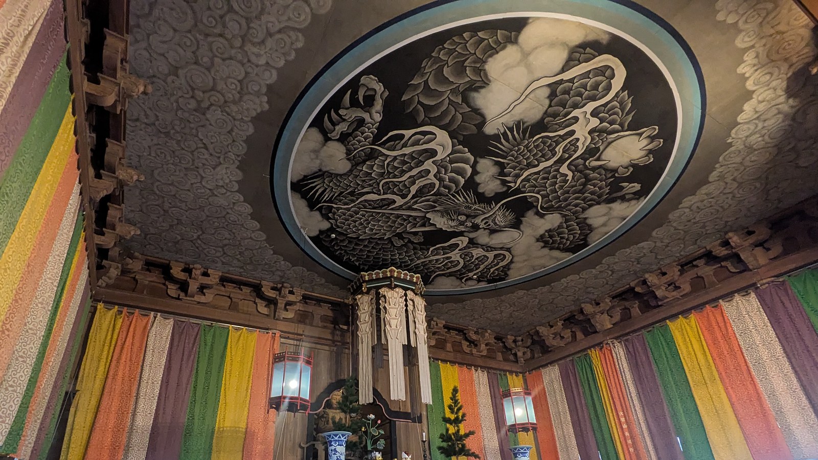
Then the Hatto, the lecture hall, with a cloud dragon painted across the ceiling and five-coloured banners hanging under it. You walk in and look up.
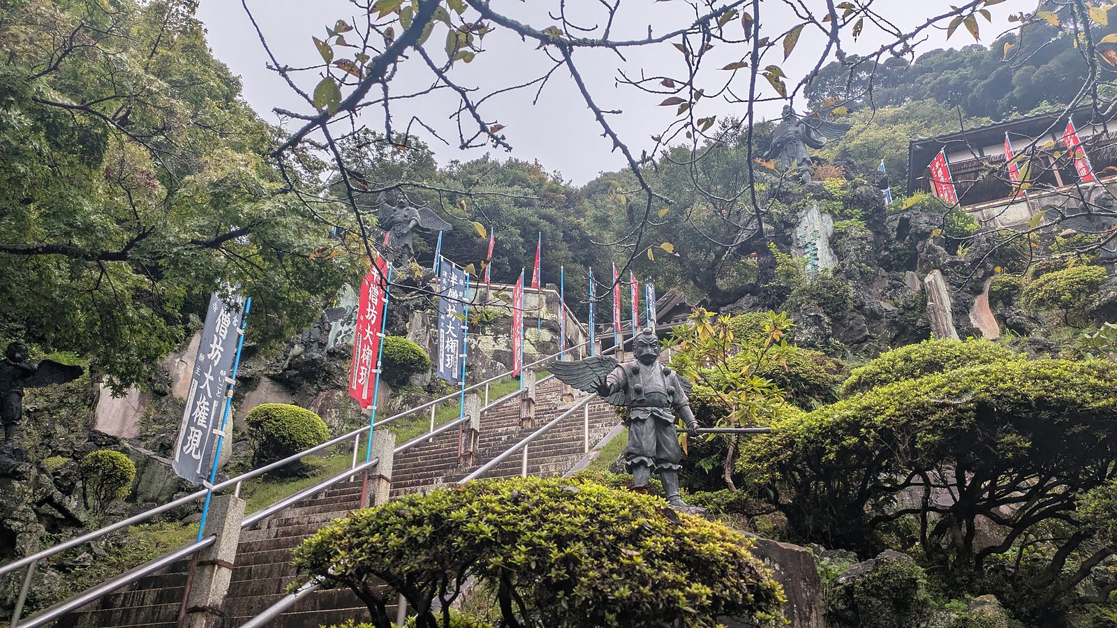
Then the approach to Hansobo, a torii and a paved path, and then the steps. The official English page for this trail counts roughly 240 of them up to the shrine, and about 150 more from there to the Shojoken lookout. Along the way, scattered on the slope among the banners, stand statues of tengu, the long-nosed and crow-billed guardians of the mountain.
Then the top, and the view opens. Hills folding away, and on a clear day Mount Fuji and Sagami Bay. The morning of the walk was cloud, and the hills were enough.
One honest note. Part of the precinct was under repair on the day, white sheeting and scaffolding around one building. That is the ordinary condition of a working temple, and it is a reason to check nothing more than your expectations.
There is no verdict in this section, because the verdict is yours. Some readers will look at that list and feel that 500 yen for the Sanmon, a painted dragon, a shrine full of tengu and a lookout is an ordinary price and a good morning. Others came to walk a ridge and will resent every yen of it. The only genuinely bad outcome is arriving at the window without knowing which of those two people you are.
Can the 500 yen be avoided
From Kita-Kamakura, no. The temple has addressed that question directly on both of its boards, and the one on the ridge names people who are only passing through.
From the other end, the situation on the day was different. The trail came out on the Zuisenji side at 11:16 beside the retaining wall of a house, and there was no gate, no window and no notice of any kind. A signpost up on the ridge also points to a further entrance at Imaizumidai 4-chome, about 0.2 km away. The suggested hiking route on the official English map for the city enters the ridge from the Zuisenji end, and it gives no reason for doing so.
That is the answer. The reasoning, the cost of each end, and the same question asked of the other Kamakura trail are set out in the hub article, because the choice of end is the thing that decides the price of a day here: Kamakura hiking trails, and the end you start from.
Why published times for this trail disagree, and which one to believe
English sources give this trail wildly different durations, and a reader planning an afternoon around it has no way to tell which one to trust.
| Source | What it says |
|---|---|
| japan-guide.com | About 60 to 90 minutes, Kencho-ji to Zuisenji |
| The official English site of the Kamakura City Tourism Association | Approximately 5 km, estimated walking time 2.5 hours |
| nippon.com | Roughly 4 km, about three hours |
Here is what a single GPS track and a camera clock recorded on 13 September 2026.
| Segment | Time | Distance |
|---|---|---|
| Kita-Kamakura Station to the Somon gate | 09:11 to 09:22, 11 min | 0.83 km |
| Inside Kencho-ji, gate to the top above Hansobo | 09:22 to 09:44, 22 min | 1.01 km |
| Above Hansobo to Ohirayama | 09:44 to 10:27, 43 min | 1.68 km |
| Ohirayama to Ten-en | 10:27 to 10:37, 10 min | 0.43 km |
| Ten-en to the Zuisenji end | 10:37 to 11:16, 39 min | 1.58 km |
| The Zuisenji end to Kamakura-gu | 11:16 to 11:28, 12 min | 0.69 km |
| Kamakura-gu to Kamakura Station on foot | 11:28 to 12:00, 32 min | 1.92 km |
| Dirt only | 92 min | 3.74 km |
| Somon gate to the Zuisenji end | 1 h 54 min | 4.70 km |
| Station to station | 2 h 49 min | 8.35 km |
Now put the two tables against each other, and the disagreement stops being a disagreement.
The 60 to 90 minutes is the dirt. Measured at 92 minutes, that figure is honest and slightly optimistic. It assumes you are already standing above Hansobo when the clock starts.
The 2.5 hours is the same segment the official page describes, which is the temple and the ridge together. Measured at 1 hour 54 minutes, that figure has ordinary sightseeing built into it, which is reasonable for a page that sends you into a temple on the way.
The three hours is a slow version of the same thing, or a walk that continues to a station on foot. Station to station, this day took 2 hours 49 minutes.
So none of them is wrong. They count different segments. Decide which segment applies to you, then add the 22 minutes inside Kencho-ji if you are coming from Kita-Kamakura, because every published time that starts at the trailhead has quietly left those out.
What the ridge is actually made of
Above Hansobo the stone ends and the ground turns to earth and tree roots, and it stays that way, with variations, for 92 minutes.
The variations are the interesting part. There are stretches of bare rock slab tilted down the line of the path, polished and dark when wet. There are places where the trail has been driven straight through rock, leaving vertical walls at shoulder height, which is a shape the hills around this town are full of. There are narrow sections hemmed in by bamboo grass, and flat brown stretches holding standing water after rain.
Ohirayama, at 10:27, is the high point and the reason a lot of people come. The sign on the summit is orange, gives the height as 159.2 metres above the sea in Japanese and English, and states that this is the highest point in Kamakura.
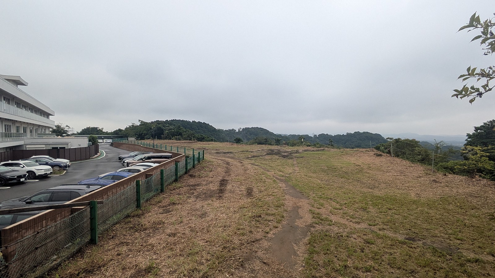
Three minutes later the path opens onto a car park and a mown grass field, because the summit of the highest ground in Kamakura sits against the edge of a golf course. The official English page for the trail mentions the same thing in passing, when it describes the one toilet on the ridge as being next to the Kamakura Country Club.
This is worth saying plainly rather than cropping out. The Ten-en ridge is a strip of forest running along the top of a city, with houses below it on one side and fairways on the other. That is not a flaw to be forgiven. It is the actual character of hiking here, and it is why a 159 metre ridge can hold a sea view, a golf club, medieval tombs and a bus stop within one hour of walking.
Ten-en itself, at 10:37, is a small clearing with an information board. The board carries the map, the direction of Kamakura to one side and Yokohama to the other, and the spelling that settles a question further down this page: Ten-en.
The caves are a detour, and they are graves
At 10:00 the ridge reaches a junction where a branch drops away towards Kakuonji. Walk straight on and you will pass one of the strangest sights in Kamakura without ever knowing it was there, because it is not on the ridge line. It is about 100 metres down that branch.
The detour cost about five minutes there and back. The GPS track for this day shows it as a short spur leaving the route at 10:01 and rejoining it at 10:06, and the 92 minutes of trail walking quoted on this page includes it.
What is down there is the Hyakuhachi Yagura.
Yagura are artificial caves cut horizontally into soft rock and used as tombs and memorial chambers, roughly from the middle of the thirteenth century to the middle of the fifteenth. Kamakura is closed in by hills on three sides and the sea on the fourth, flat ground was scarce, and so the dead went into the hillsides rather than onto the valley floor. Those buried are mostly of the warrior class, although the names of priests and craftsmen have been found as well. Estimates of how many survive around the city run from about 1,500 to more than 5,000.
This particular group has been a designated historic site of Kanagawa Prefecture since 1961. It is cared for by Kakuonji, the temple at the bottom of the branch trail, and it holds something on the order of 180 caves, large and small. The name points at the 108 earthly desires of Buddhist teaching rather than at a headcount.
The first thing that registers is the number of them. The rock face carries openings on two levels, squared off, dark, with tree roots running over the top of them.
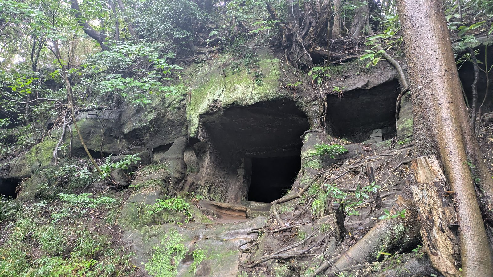
The second thing is what one of the chambers holds. A seated stone figure at the centre, stone stupas ranged along both sides, and a low platform in front of it with offerings set out on it. Somebody still comes here.
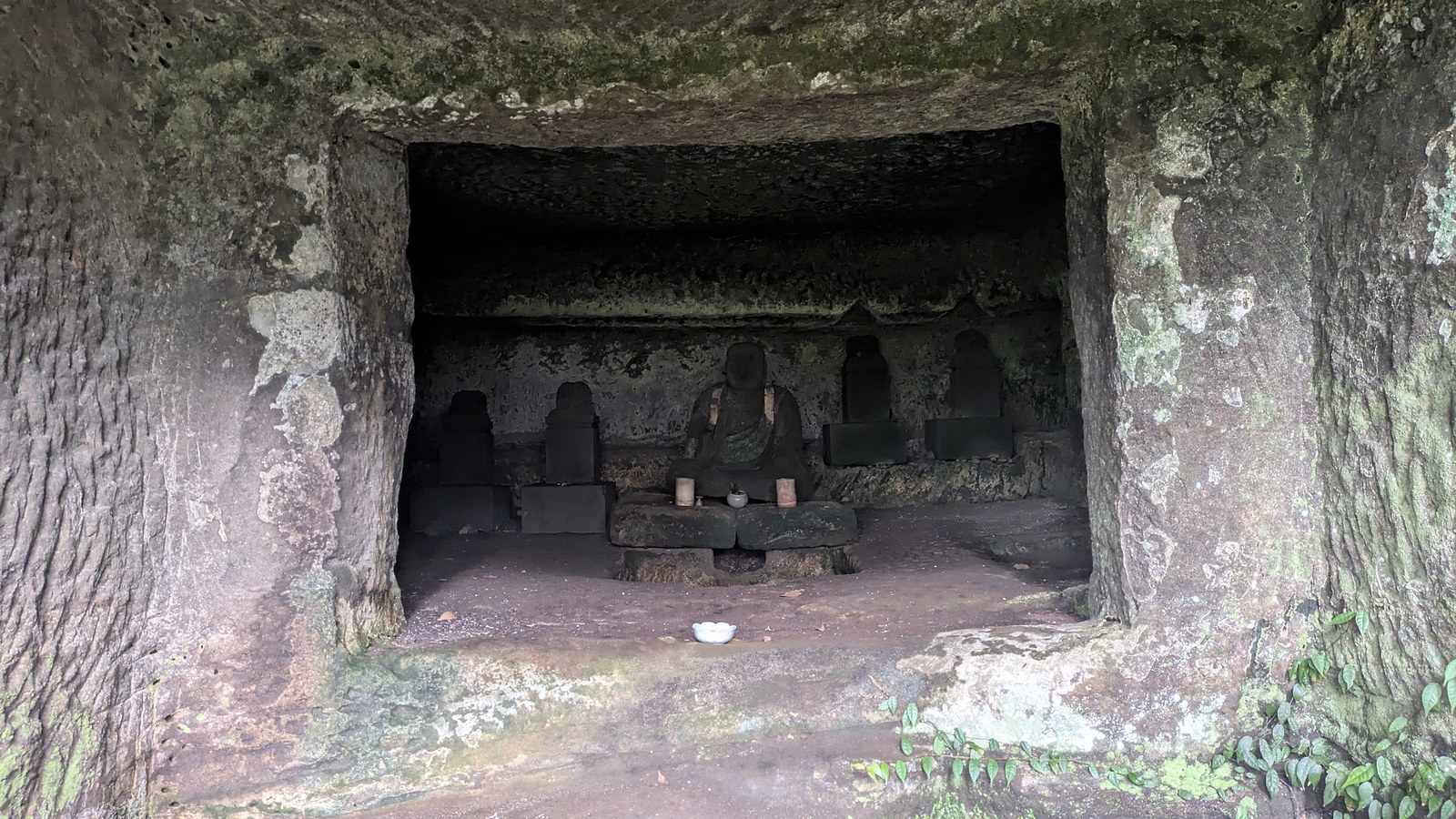
Three things follow, and they are all about conduct. These are graves, so walk quietly and keep your voice down. Do not go inside, and do not touch or move anything, offerings included. And do not expect to be told what you are looking at, because there is no explanation board at the caves in any language. The official English page for the trail does name the group in a single line, but it describes the caves as something seen while climbing up from the Kakuonji entrance, so a walker coming along the ridge from Kencho-ji is never told to turn off.
The ground does not dry out here
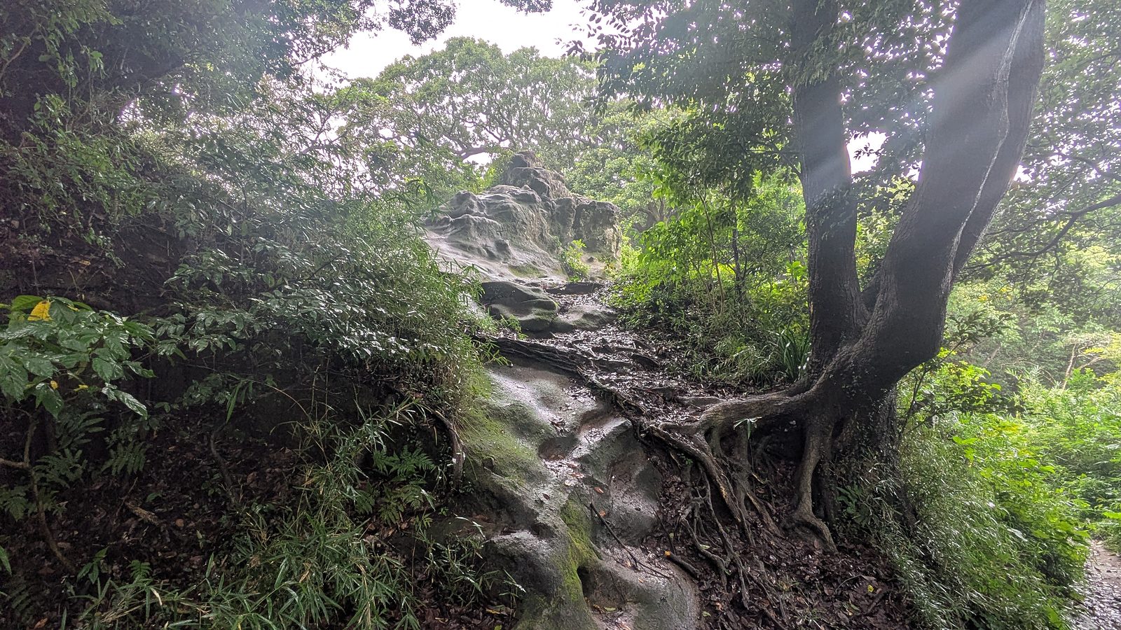
The morning of this walk followed overnight rain. The rock slabs were dark and slick, the roots were wet, and the mossy stone steps around Hansobo were the kind of surface that punishes a flat sole.
That much is unremarkable. Here is the part that is worth carrying away.
The same pair of boots walked the other Kamakura trail that afternoon, under a clear sky, six hours later. It was still mud. Churned channels with standing water in them, and bare rock slabs polished smooth. The weather on the day tells you very little about the ground under a closed canopy on these hills, and a forecast of sunshine is not a reason to change your footwear.
The first-hand version, stated plainly because it is more useful than a warning. The writer of this page was wearing hiking boots, slipped repeatedly on the descent from Ten-en, and went down twice. That descent took 39 minutes and is the longest continuous stretch of downhill on the route. No blame attaches to the trail, and no particular spot is named here, because the problem is not one bad corner. It is the surface, more or less throughout.
The official English page for this trail says the same thing in its own way, and it is easy to skim past. It calls the trail accessible even to beginners, and it also asks for extra caution after rainfall because the path can become muddy and especially slippery. Both halves are true. A 159 metre ridge with signposts at every junction is genuinely a beginner walk. It is a beginner walk that will put a beginner on the ground if they arrive in smooth-soled shoes the day after rain.
Affiliate link. This site earns a commission if you book through it, at no extra cost to you. Photo from our own walk.
Where the trail puts you down
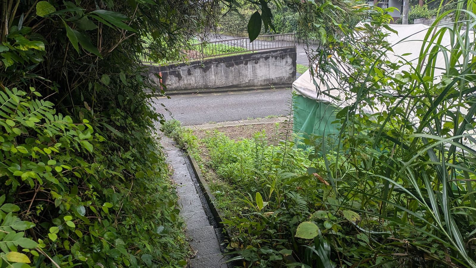
There is no ceremony at the Zuisenji end. At 11:16 the path simply arrives beside the retaining wall of a house, with an information board and a yellow manners sign, and the forest is behind you.
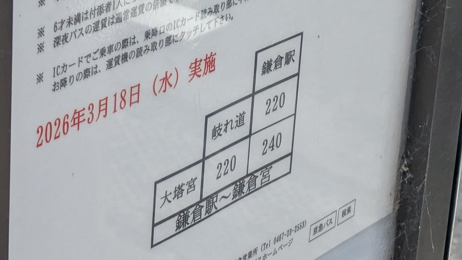
From there the walking is streets. Twelve minutes down through a residential area brings you to Kamakura-gu, a shrine with a white torii, and just outside it is the Daitonomiya bus stop. Buses from there run to Kamakura Station for 240 yen, on a fare table revised on 18 March 2026. The fare table and the notice of how to ride are in Japanese only.
That notice is worth one more look, because of what it says. Among the Japanese lines is an instruction on where to touch an IC card when boarding and where to touch it again when getting off. The bus takes the card in your wallet. The temple gate, two and a half hours earlier, does not. On this walk there is exactly one place where cash is compulsory, and it is at the start.
If you would rather walk, the station is 32 minutes away on foot through the town, which is what this day did, coming out at Kamakura Station at 12:00.
Two practical notes. The first vending machines after the descent are in the residential street at 11:21, so the ridge itself is dry in the other sense as well. And Zuisenji stands close to the exit but was not visited on this day, so no admission figure for it appears on this page.
If the bus is the part that worries you, the mechanics of paying and riding are set out here: how to ride a Japanese bus.
The gate closes at 16:30, and that governs the whole day
Kencho-ji is open from 08:30 to 16:30. Read as an opening time that is generous, and it is. Read as a deadline, and it changes how the day has to be planned, because the trailhead is inside.
Walking in from Kita-Kamakura, the gate is 11 minutes from the station and the trailhead is 22 minutes beyond the gate. The dirt then runs for 92 minutes, and the streets at the far end add another 12 minutes to a bus stop. Station to bus stop, without lingering, is a little over two and a quarter hours.
Walking the ridge in the other direction has the harder constraint, and it is the one worth thinking about carefully. Coming from Zuisenji, the descent finishes inside Kencho-ji, and the board at the top of the steps directs people arriving that way to buy a ticket at the Hansobo reception about three minutes down. A shop and a temple both keep temple hours. Arriving at that end of the ridge late in the afternoon is therefore a planning decision, not a detail.
This is the same rule that governs any walk with a timetable at the end of it, and this site keeps running into it: departure times are adjustable, arrival times are not. The longer version of that argument, learned on a very different ridge, is here: Mount Takao to Lake Sagami.
One more thing belongs in the planning, and it is checked in a browser rather than on the ground. Sections of the Ten-en ridge do close after storms, sometimes for a long time, and the Kamakura City Tourism Association posts those notices in English: notices from the tourism association.
Questions people actually ask
Can the 500 yen be avoided? Not from the Kita-Kamakura end. The temple states on two boards that people passing through pay the same as visitors. From the Zuisenji end there was no ticket window and no notice on the day, and a signpost on the ridge points to a further entrance at Imaizumidai 4-chome about 0.2 km away. The full comparison of the two ends is in the Kamakura hub article.
How long does it really take? Dirt only, 92 minutes. Kencho-ji main gate to the Zuisenji end, 1 hour 54 minutes. Kita-Kamakura Station to Kamakura Station on foot, 2 hours 49 minutes. Pick the one that matches what you are actually walking.
Are trainers enough? They will get you round in dry conditions on a dry week. The honest answer from this walk is that hiking boots slipped repeatedly and went down twice on the descent, after overnight rain. Tread matters more than ankle support here, because the hazard is polished rock and wet root rather than loose stone.
Is it suitable for children? The fee board prices elementary and junior high school students at 200 yen, so children clearly do this walk. The climbing is mild and the distance is short. The stone steps around Hansobo are long and steep, there is one toilet on the ridge, and the descent is 39 minutes of uneven ground, so the day is longer than the distance suggests.
Where are the toilets? Kita-Kamakura Station, then inside Kencho-ji once you have paid, then one public toilet at Ten-en near the golf club. The official English page describes that last one as the only toilet on the trail, which matches what was found.
Where is the last water? Seven vending machines stand on the road before Kencho-ji. After that there is nothing until the residential street at the far end of the ridge, which on this day was reached 2 hours and 3 minutes later.
Can I walk it in reverse? Yes, and reversing it is what removes the 500 yen, which is what the suggested route on the official English map does. Note the closing time of the temple if you do, because that direction ends inside it.
Is it worth walking the day after rain? It is walkable and it is beautiful, and it is slippery. The stronger warning is the one that surprised this walk: the other Kamakura trail was still muddy that same afternoon under a clear sky. Dress for mud regardless of the forecast.
How do I check the trail is open? Sections close after storms. The Kamakura City Tourism Association posts closures and reopenings in English at the notices page.
Where exactly are the caves? About 100 metres down the branch that drops towards Kakuonji, at the junction that the ridge reaches some 25 minutes of walking before Ohirayama. They are not visible from the ridge. Allow five minutes for the detour and take the same path back up.
Is it Tenen, Ten-en, or Tienen? All three refer to the same ridge. The spelling on the ground is Ten-en, on the information board at the top and on the trail signposts. English articles usually write Tenen, search engines often suggest Tienen, and some tour listings write Tennen. None of them will get you lost, because the signposts also carry the Japanese and the destinations.
Can I pay by card or IC? Not at Kencho-ji. The fee board carries a cash only pictogram, and the notice on the ridge repeats it in the only two words of English on the board. The bus at the far end does take IC cards, so the cash is needed for the entrance and nothing else. Bring coins or a note.
If you would rather walk the ridge with a guide, one private Kamakura hiking day with a nationally licensed guide can continue from Kencho-ji onto the Ten-en trail. The 500 yen at the window is still yours to pay, in cash.
Affiliate link · Private, with a nationally licensed guide · About 6 hours · Starts at your hotel or the nearest station · Free cancellation up to 24 hours before
What to decide before you reach the window
One decision, and it is not about money.
The 500 yen is an ordinary temple admission in this town, and what it opens is not a turnstile onto a path. It opens the Sanmon, a painted dragon on a hall ceiling, a shrine guarded by tengu, a lookout with the sea in it, and 22 minutes of walking to get through all of that. The people who regret paying are not the ones who found it expensive. They are the ones who did not know the trailhead was at the back of a temple, and who were still thinking about a free hike when they reached the window.
So decide at the station, not at the window. If a temple morning sounds good, walk in from Kita-Kamakura with 500 yen in cash and let the ridge be the second half of the day. If you came to walk and only to walk, start the ridge from the other end and keep the money.
Either way, bring shoes with tread on them. The ground here does not care what the sky is doing.
Where to next
- The other end, the other trail, and how the choice of end sets the price: Kamakura hiking trails
- The free one, from Kita-Kamakura to the Great Buddha: the Daibutsu trail
- If the decision is still a whole town rather than a trail: Mount Takao or Kamakura
- The bus at the far end of this ridge, and every other bus: how to ride a Japanese bus