Some links on this site are affiliate links. If you book through one, Tokyo Trailhead earns a commission at no extra cost to you. It never decides what appears here.
The Daibutsu trail is free from end to end, and the reason is not generosity. It is geography. The trail begins on a piece of hillside that no temple gate stands in front of.
That single fact is also the thing most likely to go wrong on the day. Guides send you to Jochi-ji, and Jochi-ji has a beautiful entrance: a stone bridge, an old well, and a flight of steps up to a bell gate. Climb those steps and you arrive at a ticket window. The trail is not up there. It is a few dozen metres further on, past the front of the temple, beside two traffic cones, at the foot of a smaller flight of mossy steps with a bamboo handrail and no sign announcing what it is.
This page walks the whole thing in order, from the ticket gate of Kita-Kamakura Station to the platform at Hase, on Sunday 13 September 2026. Kita-Kamakura at 12:12, the steps at 12:23, Kuzuharaoka Shrine at 12:36, Zeniarai Benten at 12:55, the road at the far end at 13:48, the Great Buddha at 13:54, Hase Station at 14:05.
The morning of that same day was spent on the other trail, in the rain that had stopped overnight. The afternoon described here was blue sky. The ground did not care.
What this guide covers13 sections
- The Daibutsu trail, in figures
- Kita-Kamakura Station to the steps, in eleven minutes and three turns
- A few dozen metres decides whether you pay
- What the first ten minutes are made of
- Two and a half hours, or fifty-four minutes
- The ground does not dry out here
- The one place on the trail with a tap and a roof
- The cave where people wash money
- English on the heading, Japanese on the map
- Where it puts you down, and what the Great Buddha costs
- Hase to Kita-Kamakura
- Questions people actually ask
- What to settle before you leave the station
The Daibutsu trail, in figures
| Official English name on the board | Daibutsu Hiking Trail |
| Cost | Free, end to end |
| Entrance from Kita-Kamakura | Mossy steps past the front of Jochi-ji, 11 minutes from the station |
| Trail only, steps to the road at Daibutsu-zaka | 3.59 km, 85 minutes |
| The same, without the detour to Zeniarai Benten | About 54 minutes |
| Station to station, Kita-Kamakura to Hase | 5.17 km, 1 hour 52 minutes |
| Climbing, trail only | About 198 metres |
| Climbing, station to station | About 226 metres |
| High point | About 100 metres |
| Water | The station, then one vending machine at Kuzuharaoka Shrine, then nothing |
| Toilets | The station, then one block in Genjiyama Park, then nothing |
| On the way | Kuzuharaoka Shrine, Genjiyama Park and the statue of Minamoto no Yoritomo, Zeniarai Benten |
| Exit | Steps onto the road at Daibutsu-zaka, then 6 minutes to Kotoku-in and 11 more to Hase Station |
| Surface | Earth, exposed roots, churned mud, and bare rock slabs |
| Weather on the day | Clear, after rain that had stopped overnight |
Two notes on those numbers. The climbing figures come from the terrain model that the GPS application reads rather than from a barometer, so they are approximate, and the trail-only figure and the station-to-station figure are different things. The 85 minutes includes a 31 minute detour down to Zeniarai Benten and back up, which is why the working figure of 54 minutes is given separately.
Kita-Kamakura Station to the steps, in eleven minutes and three turns
This is the part that other pages leave out, so it is the part this page does in full. Times are the clock in the camera.
12:11, the station. Kita-Kamakura has a small ticket gate that opens straight onto the street, not into a concourse. Come out of it and you are already outside.
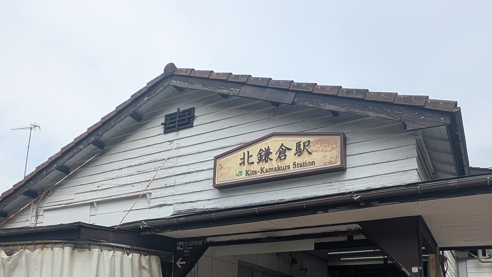
12:11, the board outside the gate. A large map stands beside the exit, headed for major tourist destinations in Japanese and English, with distances and walking times listed. It is worth ten seconds, because it is the last free map you get.
12:13, the main road. Turn away from the level crossing and walk south along the prefectural road, the one with an orange centre line. The pavement is narrow and traffic uses this road, so walk in single file.
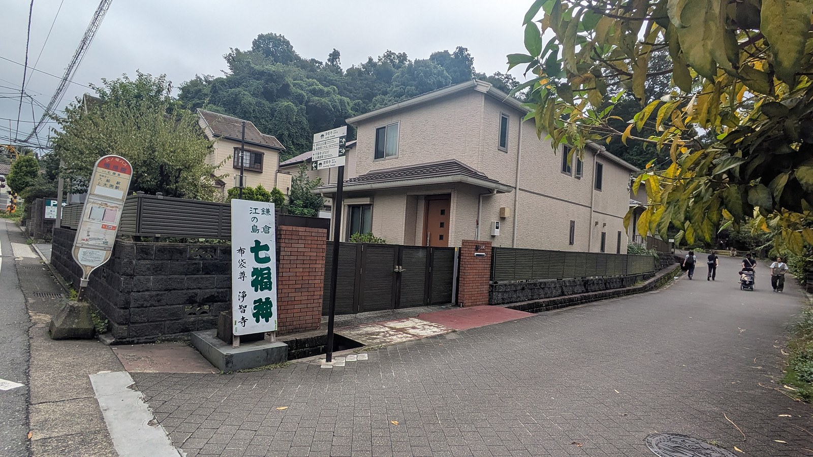
12:17, the corner with the stone marker. A stone post for the Kamakura and Enoshima Seven Lucky Gods stands at a corner on the right. This is the turn. The road you take is a narrow residential lane, and it does not look important.
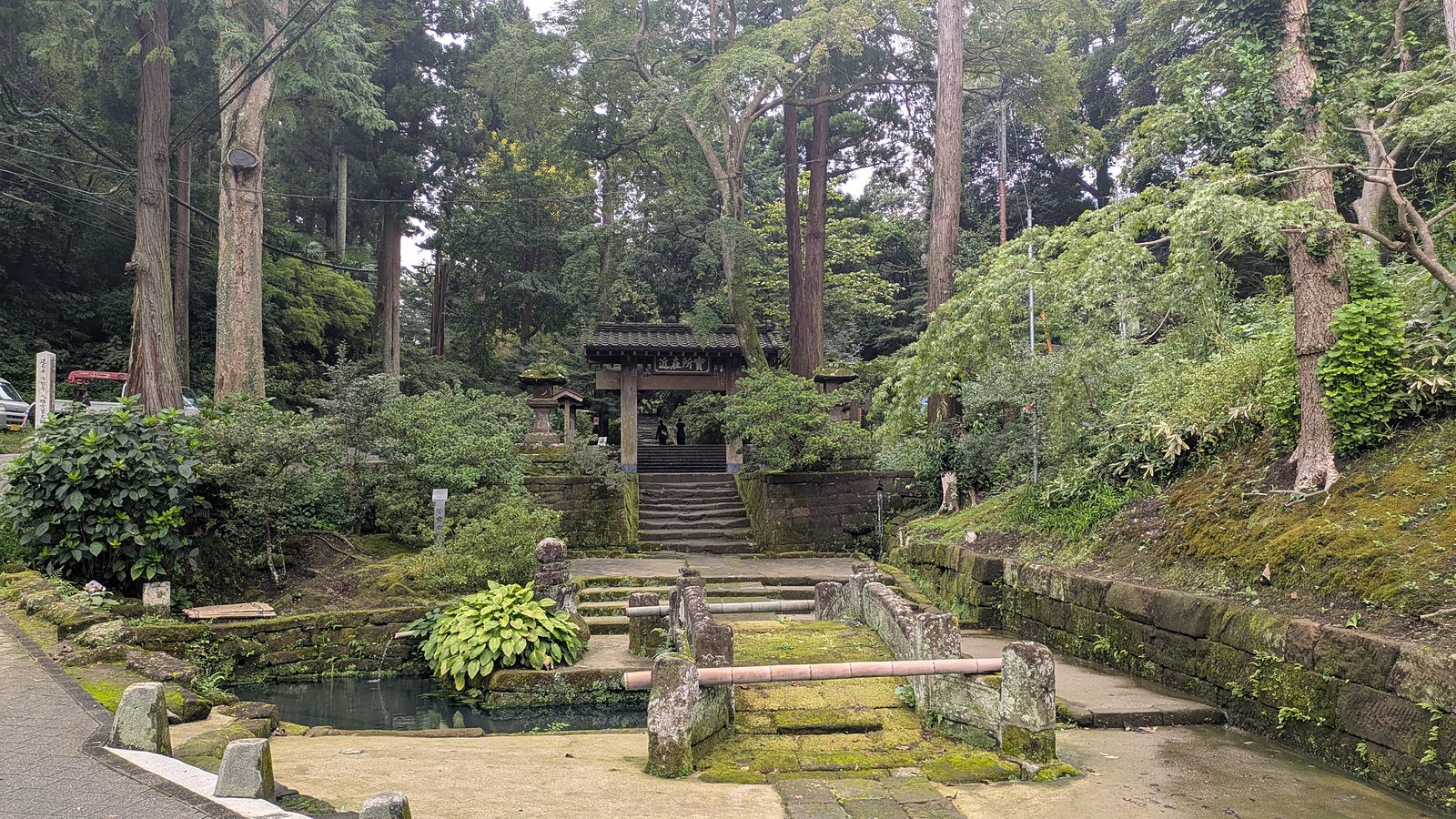
12:17, the front of Jochi-ji. Sixty seconds later the lane reaches a stone bridge, an old covered well, and a flight of steps going up to a bell gate. This is the temple. It is worth seeing and it costs money, and either way, this is not the trail.
12:19 to 12:23, past the front. Keep the temple on your left and carry straight on along the paved lane. It narrows, passes a small open space, and runs on towards the hill.
12:23, the cones. The lane ends in a gravel parking area on the right and a pair of traffic cones ahead. This is the last moment when nothing in sight announces a trailhead.
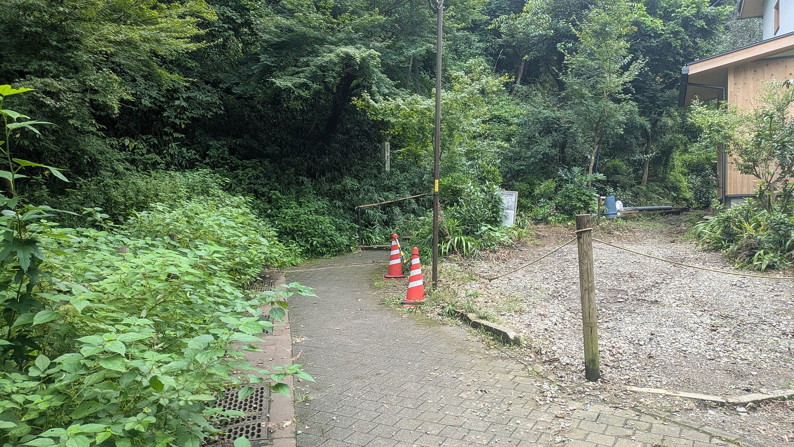
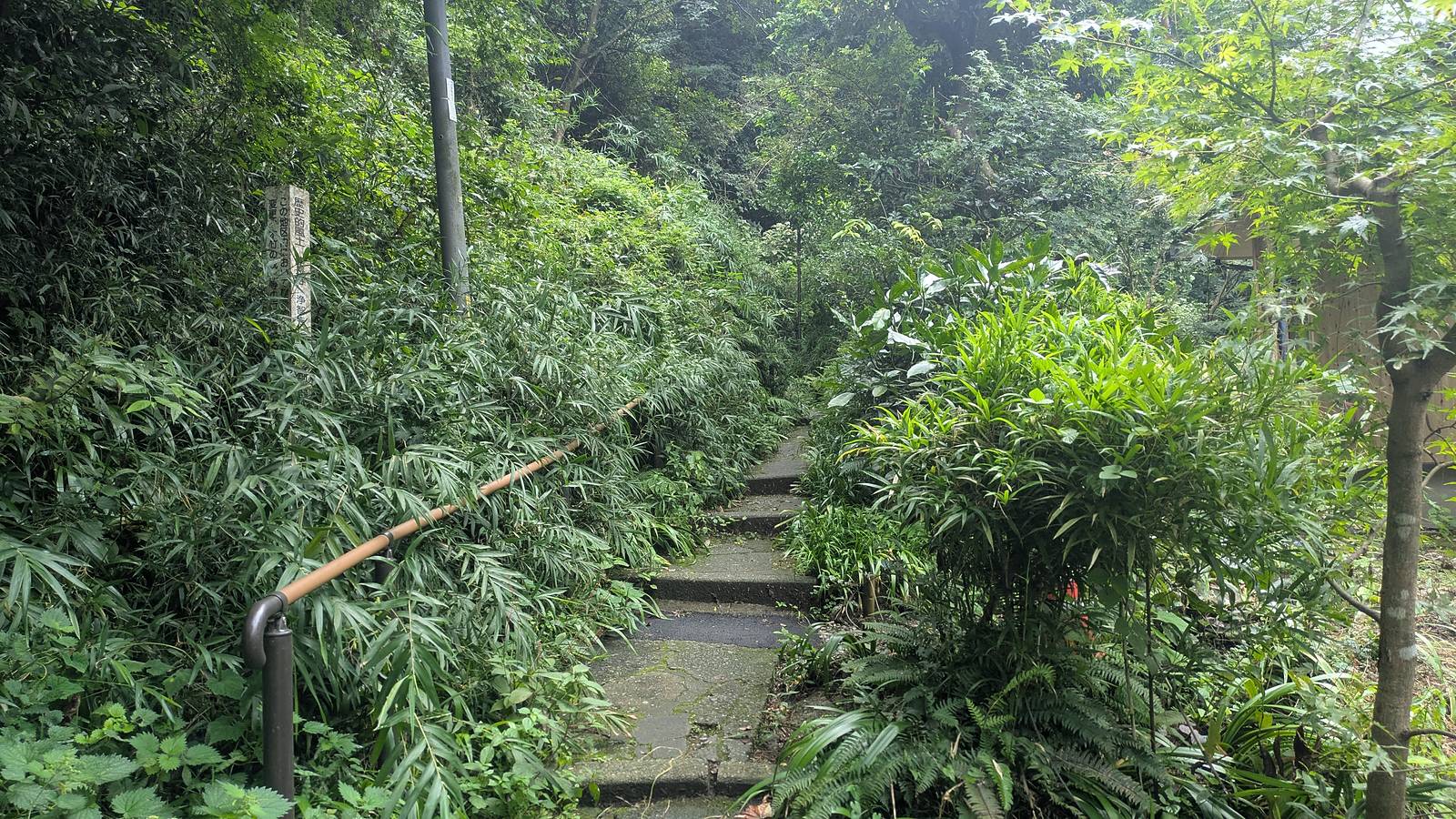
12:23, the steps. Beside the cones, a flight of mossy stone steps goes up into bamboo, with a plain bamboo handrail and a small stone marker on the left. That is the trailhead. There is no gate, no ticket window and no barrier of any kind.
A few dozen metres decides whether you pay
Put the two entrances side by side, because they are close enough to be mistaken for one another and they are not the same kind of place at all.
The gate of Jochi-ji is an entrance to a temple. It has a bridge over a small watercourse, a roofed well beside it, steps, a bell gate, and at the top of those steps, a window where admission is taken. Everything about it is built to be walked into.
The trailhead has none of that. It is a cut in the hillside with steps in it. The land it climbs is not temple ground with a charge on it, so there is nobody to pay and nothing to pay for.
That is the whole reason this trail is free while the Ten-en ridge, one valley over, is not. It has nothing to do with the trails themselves and everything to do with what sits in front of each one. The full comparison of the two, and how the end you enter from sets the price of a day here, is in the hub: Kamakura hiking trails.
For the day in front of you, it reduces to one instruction. Do not go up the steps with the bell gate at the top. Go past them.
What the first ten minutes are made of
The official English description of this trail calls the start the initial gentle ascending stairs near Jochiji Temple. The stairs are gentle. What follows them is not.
Three minutes above the steps the ground turns to bare earth with tree roots standing proud of it, arranged by erosion into something that works as a staircase if you place your feet on the roots and does not if you place them in the gaps. This is the steepest sustained climbing on the whole route and it comes first, within fifteen minutes of a railway station.
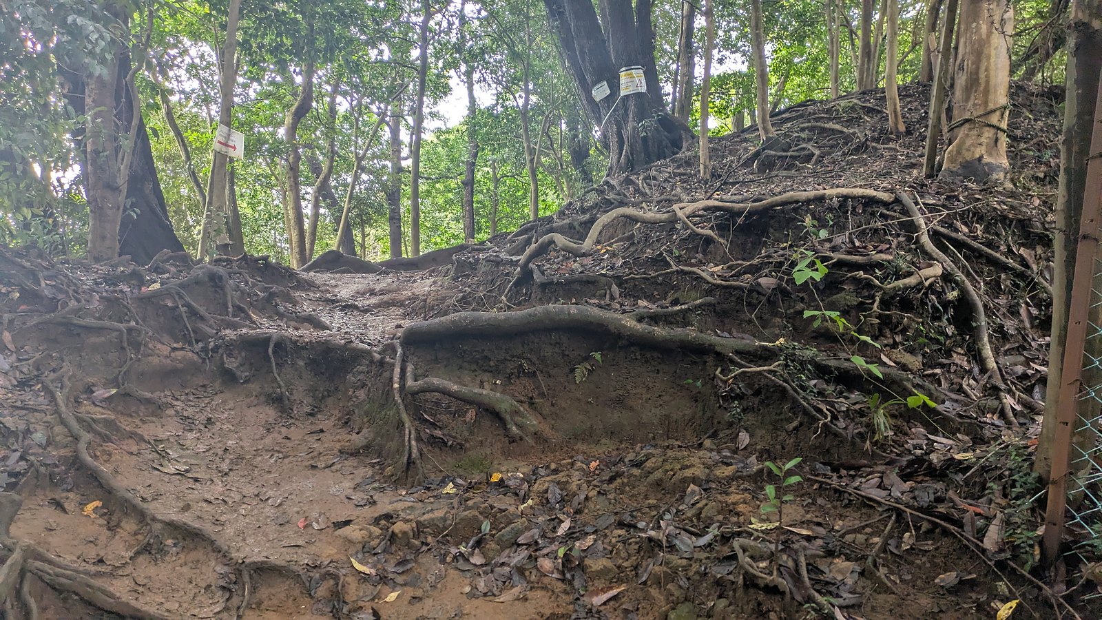
It does not last. Thirteen minutes from the steps the gradient gives up and the trail arrives at Kuzuharaoka Shrine, and from there the route is mild for the rest of the day. But arriving at the steps expecting a paved temple walk and meeting that instead is the second surprise this trail hands out, after the entrance itself.
Two and a half hours, or fifty-four minutes
The official English page for this trail gives it as approximately 3 kilometres with an estimated walking time of 2.5 to 3 hours (Kuzuharaoka–Daibutsu Hiking Trail). Measured on the day, the trail is 3.59 km and the walking took 85 minutes, of which 31 minutes was a detour down to Zeniarai Benten and back. Take the detour out and the walking is about 54 minutes.
So the official figure is roughly three times the moving time. That is not an error, and it is worth understanding rather than dismissing, because the gap is the whole character of this walk.
| Kita-Kamakura Station to Jochi-ji | 12:12 to 12:19, 7 min, 0.49 km |
| Jochi-ji to the steps | 12:19 to 12:23, 4 min, 0.13 km |
| The steps to Kuzuharaoka Shrine | 12:23 to 12:36, 13 min, 0.58 km |
| Kuzuharaoka down to Zeniarai Benten | 12:36 to 12:55, 19 min, 0.89 km |
| Zeniarai Benten back up to the ridge | 12:55 to 13:07, 12 min, 0.42 km |
| The ridge to the road at Daibutsu-zaka | 13:07 to 13:48, 41 min, 1.61 km |
| The road to Kotoku-in | 13:48 to 13:54, 6 min, 0.30 km |
| Kotoku-in to Hase Station | 13:54 to 14:05, 11 min, 0.53 km |
| Trail only | 85 min, 3.59 km |
| Trail only, without the detour | About 54 min |
| Station to station | 1 h 52 min, 5.17 km |
Read the table and the official estimate stops being generous and starts being accurate about something else. This is a trail with a shrine, a park, a statue and a cave full of running water hanging off it. Two and a half hours is what the day takes if you stop at those, which is what most people come for. Fifty-four minutes is what the walking takes if you do not.
Decide which of those two days you are having before you leave the station, because they need different amounts of afternoon.
The ground does not dry out here
This afternoon was blue sky. The rain had stopped overnight, some fourteen hours earlier. The ground was still wet.
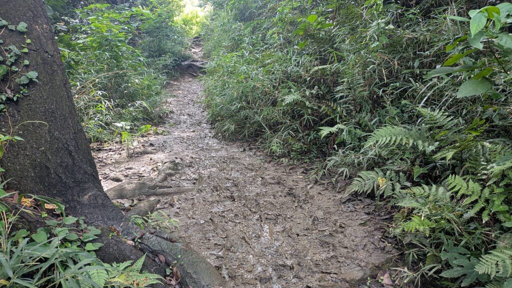
Not damp in places. Wet. On the descent from the ridge towards Daibutsu-zaka the trail runs through churned mud channels with standing water in the bottom of them, holding the shape of every boot that has gone through since the rain.
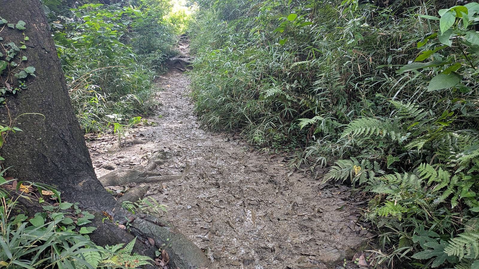
And where the mud stops, bare rock starts. Long slabs of it, tilted down the line of the slope, polished smooth, wet enough to shine, with tree roots along the top edge and nothing to hold.
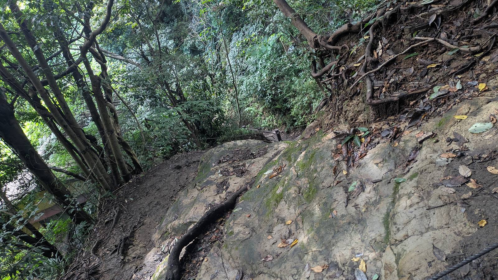
The first-hand version, stated plainly because it is more useful than a warning. The writer of this page was wearing hiking boots, slipped repeatedly, and went down twice over the course of the day. The descent from the ridge to the road takes 41 minutes and is the longest continuous stretch of downhill on the route. No particular spot is named here, because the problem is not one bad corner. It is the surface, on and off, throughout.
The official English page says the same thing in its own words, and it is easy to skim past: please use extra caution after rainfall as the path can become muddy and especially slippery. That sentence is doing more work than it looks. The rain it refers to does not have to be falling, or recent, or on the forecast. It can be yesterday, under a clear sky, with the sun out all afternoon.
Tread matters more than ankle support here, because what catches you out is polished rock and wet root rather than loose stone.
Affiliate link. This site earns a commission if you book through it, at no extra cost to you. Photo from our own walk.
The one place on the trail with a tap and a roof
Thirteen minutes above the steps the climbing ends and the trail opens into a broad flat area with picnic tables and benches under trees. This is Kuzuharaoka Shrine, and the practical importance of it is out of proportion to its size.
At 12:38 there is a vending machine under a green awning beside a rest shelter. Taped to the side of it is a small notice in Japanese and English saying that the toilet is 100 metres up the stairs, and at 12:44, a few minutes further on in Genjiyama Park, there it is. Those two things are the entire infrastructure of this walk. After them the trail runs for the better part of an hour with nothing at all, and the next vending machine is on a street in Hase.
The shrine itself has a stone torii, a short approach and a hall, and Genjiyama Park beyond it has lawns and wide gravel paths. At 12:49 the path passes a seated bronze figure on a rock base, looking out over the town below. This is Minamoto no Yoritomo, the first shogun, who set up his government here in the twelfth century.
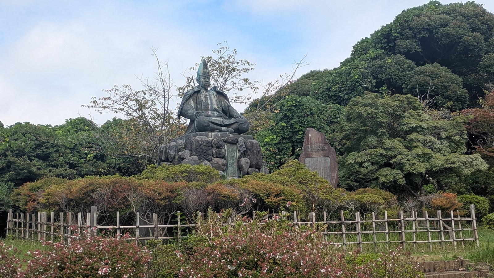
Keep him in mind for six minutes, because the cave described next exists because of a dream he had.
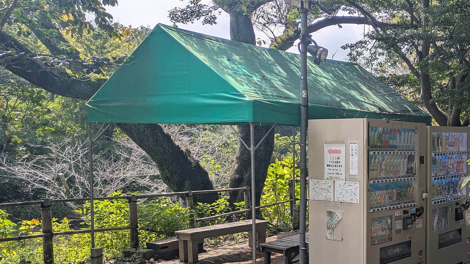
This is also the natural place to eat, and on a Sunday in September it was busy without being crowded.
The cave where people wash money
Nineteen minutes down a side path from Kuzuharaoka, the route reaches a stone torii standing in front of a tunnel driven straight through a rock face. Go through the tunnel and you are inside a small valley with shrine buildings around it, and in one wall of it, a cave with a spring running in it.
This is Zeniarai Benzaiten Ugafuku Shrine. Entry is free. The detour from the ridge and back cost 31 minutes.
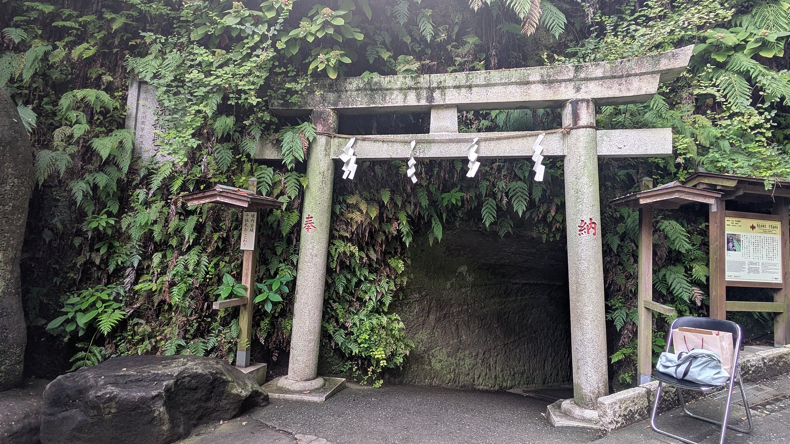
What people do here is wash money in the spring, and if nobody has told you that, the scene inside the cave does not explain itself. So here is the whole of it.
Why the water, and why money
Two men and two dreams, six hundred years before anybody thought of tourism.
The first is Minamoto no Yoritomo, the statue back in the park. The city tells the story in English and in Japanese, and the Japanese version is fuller. The end of the Heian period was disordered, famine followed famine, and people were suffering badly. Yoritomo prayed. A deity called Ugafukujin came to him in a dream and told him to draw the water that sprang in this valley and use it constantly in honouring the gods. He found the spring, cut a cave into the rock and built a shrine there. The year was 1185, and the tradition places the dream in the year, month, day and hour of the snake, which is why snake days are still the days people choose to come.
The washing came later. In 1257, also a snake year, the fifth regent Hojo Tokiyori washed coins in this spring and prayed for the prosperity of his house. The city records what he said about it, and this is the part that answers the question the water asks: wash money in this water and it becomes blessed money, and then the household will prosper and the descendants will long be at peace.
So the wish is not that the coins themselves multiply, whatever the modern signage around Kamakura suggests. The money is being cleaned. What is washed off it is impurity, and what is asked for is a family that holds together and keeps going. Read that way, a cave full of people rinsing coins in a basket stops being strange.
What happens to the money afterwards
This is the question everybody asks second, and the shrine answers it sideways rather than directly.
There is no instruction anywhere in the precinct to keep the money, and the official pages do not tell you to either. What there is, on a small board beside the pool, is a rule about wet notes: dampen only a corner of a note, and do not put a wet note into a ticket machine or a vending machine.
Read that twice. A rule about not feeding damp notes into machines is a rule written for people who are going to spend it. The money is meant to go back out into the world, and the notice is simply asking you to let it dry first.
The tourism association for the city says the same thing in its own guide to visiting the shrine, and says it as advice rather than as doctrine: money you have washed here is money to use well. It adds the identical practical warning, that freshly washed money jams ticket machines, so keep hold of it until it is dry (Kamakura City Tourism Association).
That is this shrine. Elsewhere in Japan the custom runs the other way and a washed coin is kept as seed money rather than spent, and plenty of people do that here too. But nothing at this shrine, and nothing in what the city publishes about it, asks you to hoard it. If you want one rule that covers both, it is this: coins are the easy version, a note needs one damp corner and an hour in a warm pocket, and the money is supposed to move.
The three notices, all in Japanese
Every instruction inside the cave is in Japanese, and there are three of them.
Used baskets go back into the box on the left. That is the one visitors most often get wrong.
Notes are to be dampened at the edge, and wet notes are not to be used in ticket machines or vending machines.
And on the fence beside the water: do not pick up the money in the pool.
The legend, as told above, is published in English by the city. The four steps and the three rules are published in neither language, which is why they are drawn and listed here.
One correction to something this site nearly printed. An early draft described the people washing money here as mostly foreign visitors. That was a misreading of a photograph. On the day, the people at the water were Japanese.
English on the heading, Japanese on the map
Back up on the ridge, at 13:07, stands the large green board for this trail. The heading on it is bilingual and gives the official English name, Daibutsu Hiking Trail. The legend has English on it. The map itself, the part with the place names and the route on it, is in Japanese only.
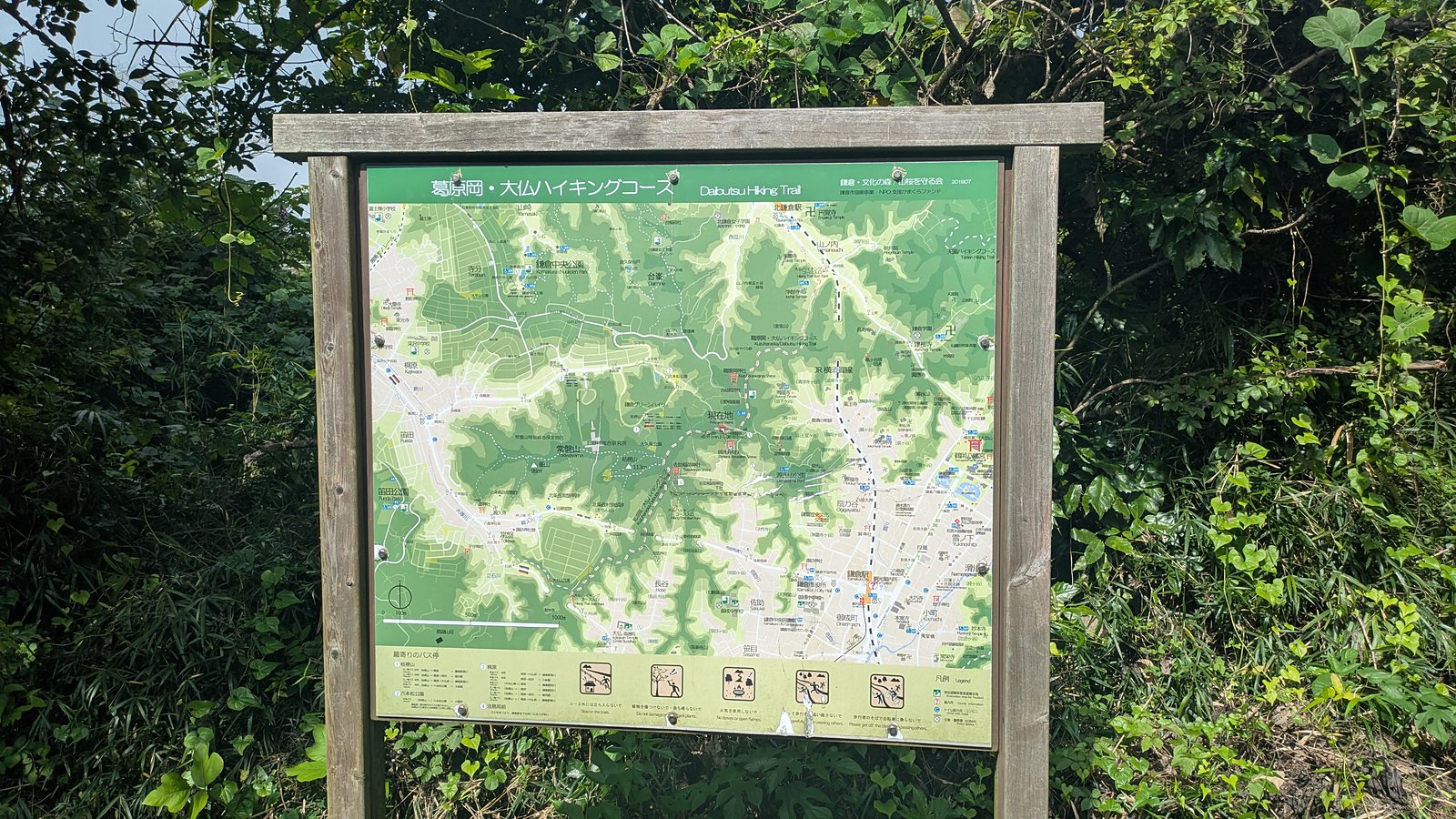
The signposts are better than the board. The ones on this route carry Japanese, English and Korean, with distances, and they stand at the junctions where a decision is actually needed.
So the common complaint that Kamakura hides its hiking from foreign visitors does not survive contact with the trail. The naming is there, the directions are there, and they are in three languages. What is not carried across is the detail inside things: the map on the board, the notices in the cave, the fare table at a bus stop on the other trail.
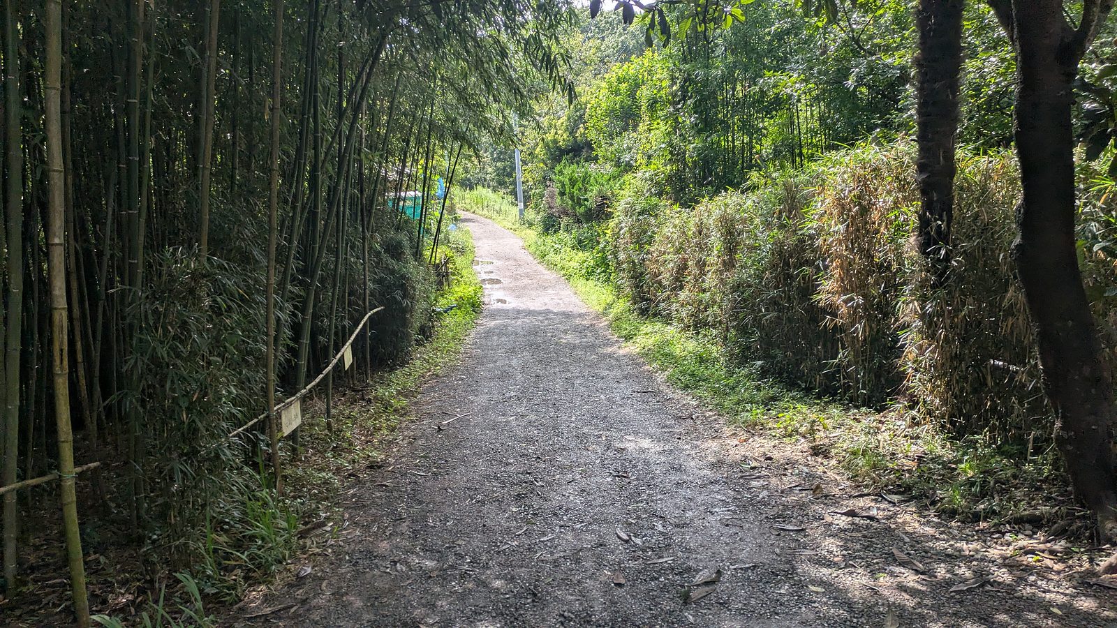
From the board the trail runs through a wide bright stretch of bamboo, which is the best-looking part of the walk and the easiest walking on it.
Where it puts you down, and what the Great Buddha costs
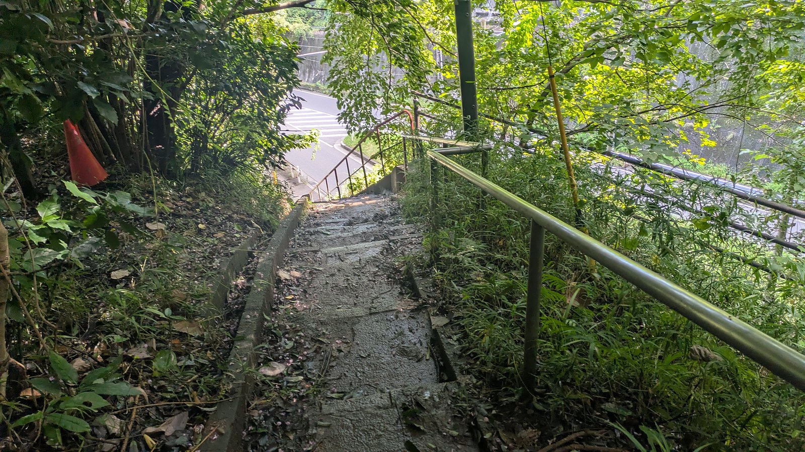
The end is abrupt. At 13:47 a steep flight of steps with a handrail drops straight onto a road, with a pedestrian crossing at the bottom of it.
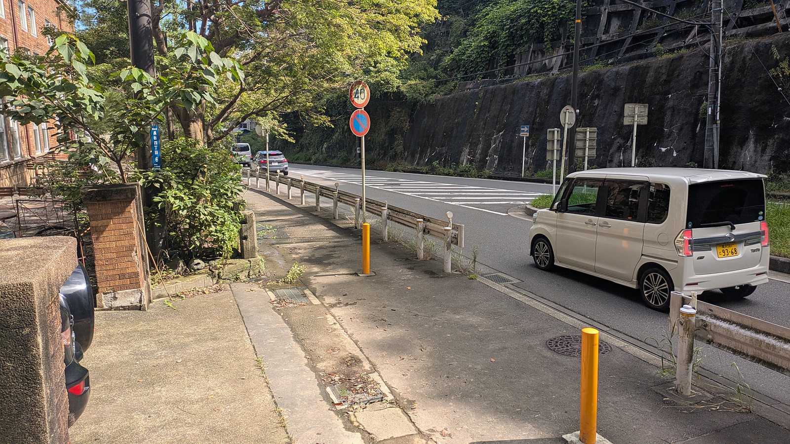
That road is Daibutsu-zaka, and it is the least pleasant six minutes of the day: retaining walls, crash barriers, a narrow pavement and traffic. Walk it carefully and it delivers you to the Nio gate of Kotoku-in at 13:54.
Here is the second charge of the day, and it is optional. The trail is free. The Great Buddha is not.
The figures below are taken from the official English page for the temple rather than from the ticket window, because this walk went past the gate and did not go in (Kotoku-in). Admission is given as 300 yen for adults, meaning junior high school students and above, and 150 yen for elementary school students, with a further 50 yen to go inside the statue itself. Opening is given as 8:00 to 17:30 from April to September and 8:00 to 17:00 from October to March, with entry until 15 minutes before closing.
And the part worth knowing before you decide: you do not have to. The hike is complete at the road. From the gate of Kotoku-in it is 11 minutes on foot to Hase Station, so a day that ends with a look at the outside of the gate and a train is a perfectly ordinary way to finish this walk.
Hase to Kita-Kamakura
This walk was done from Kita-Kamakura outwards, so what follows is inference stated as inference.
Reversed, the long descent becomes the long climb, and the short steep section above Jochi-ji becomes a descent at the end of the day, when legs are tired and the surface is at its worst. That is the trade.
What reversing does remove is the problem this whole page is about. The entrance at the Daibutsu end is a flight of steps with a handrail, directly on a road, opposite a pedestrian crossing. It is difficult to walk past without noticing. The entrance at the Kita-Kamakura end is the one that hides.
Questions people actually ask
Where exactly is the entrance? Past the front of Jochi-ji, not up its steps. Follow the paved lane until it ends at a gravel parking area and two traffic cones, and the mossy steps with the bamboo handrail on the left of that are the trailhead. Eleven minutes from Kita-Kamakura Station, three turns.
Is the trail free? Yes, end to end, with no gate and no ticket window at either entrance. The other Kamakura ridge is not, and the reason is set out in the hub article.
How long does it take? The walking is about 54 minutes without stops, 85 minutes with the detour to Zeniarai Benten, and 1 hour 52 minutes station to station. The official estimate of 2.5 to 3 hours is a day that stops at the shrine, the park and the cave.
Are trainers enough? In a dry week, yes. The honest answer from this walk is that hiking boots slipped repeatedly and went down twice, on an afternoon of clear sky after rain the night before. Tread matters more than ankle support.
Is it suitable for children? The climbing is short and the distance is small, and the shrine and the park in the middle are good places to stop. The descent at the far end is 41 minutes of uneven ground, and it is the part to plan around.
Where are the toilets? Kita-Kamakura Station, then one block in Genjiyama Park about 21 minutes from the steps, then nothing until Hase.
Where is the last water? The vending machine at Kuzuharaoka Shrine, about 15 minutes from the steps. After that there is nothing on the trail.
Can I walk it in reverse? Yes. The entrance at the Daibutsu end is easy to find, and the long climb replaces the long descent.
Is it worth walking the day after rain? It is walkable and it is pleasant, and it is slippery. Clear sky on the day tells you very little. Dress for mud regardless of the forecast.
How do I check the trail is open? Sections close after storms. The Kamakura City Tourism Association posts closures and reopenings in English at the notices page.
Can I skip the Great Buddha? Yes. The hike finishes at the road, and it is 11 minutes on foot from the gate of Kotoku-in to Hase Station.
Is Zeniarai Benten free, and what happens there? Free. People wash money in a spring inside a cave. What the washing asks for, in the words the city records, is that the money becomes blessed money, the household prospers and the descendants are long at peace. The four steps are drawn above. The detour from the ridge and back took 31 minutes.
Should the washed money be spent, or kept? Spent, on the evidence at the shrine. Nothing there asks you to keep it, the only written rule is that a wet note must not go into a ticket machine, and the city guide to the shrine says the money is to be used well. Elsewhere in Japan people do keep a washed coin as seed money, and that custom is real, but it does not come from this place. Coins are simple. Let a note dry first.
The same walk can be done with a guide. One private Kamakura hiking day with a nationally licensed guide is built around this trail, from Jochi-ji to the Great Buddha, and starts at your hotel or the nearest station. Admission at the Great Buddha is paid separately.
Affiliate link · Private, with a nationally licensed guide · About 6 hours · Starts at your hotel or the nearest station · Free cancellation up to 24 hours before
What to settle before you leave the station
Two things.
The first is the entrance, and it is the whole reason this page exists. Do not go up the steps at Jochi-ji. Walk past the front of the temple, carry on to the traffic cones, and take the mossy steps on the left. Eleven minutes from the gate, three turns, and no money changes hands.
The second is your shoes. This ridge holds water under a closed canopy for a long time after the sky has cleared, the descent at the far end is 41 minutes long, and the surface runs from churned mud to polished rock and back. That is not a reason to stay away. It is a reason to bring tread.
Everything else about this walk is gentle. It is under four kilometres of trail, the climbing is over inside fifteen minutes, there is a shrine and a park and a cave with running water hanging off the middle of it, and it finishes at one of the most famous statues in Japan, which you are free to ignore.
Where to next
- The paid one, one valley over, and what the 500 yen buys: the Ten-en trail
- Both trails in one place, with the map and the decision: Kamakura hiking trails
- If the choice is still a whole town rather than a trail: Mount Takao or Kamakura
- Getting around at either end of the day: how to ride a Japanese bus