Some links on this site are affiliate links. If you book through one, Tokyo Trailhead earns a commission at no extra cost to you. It never decides what appears here.
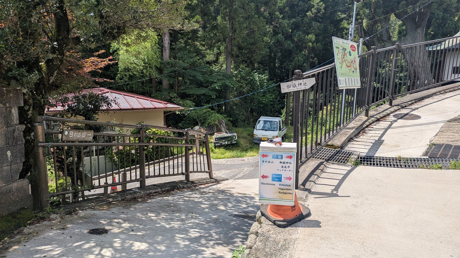
In the village on top of Mount Mitake there is a traffic cone with a signboard sitting on it.
The board has two arrows on it, one pointing left and one pointing right. They are the same size, in the same red, on the same blue-and-cream background. Under the arrows the board repeats itself in English, because somebody here understood that visitors come who cannot read the kanji.
Left: Hinodeyama.
Right: Mitkejinja, Nagaodaira, Rockgarden.
That is the whole of the English. Four place names, one of them missing a letter.
Take the right arrow and you are back at the cable car station in about twenty-five minutes, on the train you came in on, with the afternoon still yours.
Take the left arrow and you are committing to two hours of walking, a summit, a descent down the far side of the ridge, a stretch of public road, and a bus that runs ten times a day to a railway line you have not used yet. There is no station at the other end of that arrow with the name you arrived at.
The board does not say any of this. It gives you two names and lets you choose.
So here is the other half of that signboard. Not a map of the route, because the route is easy to follow and the metropolitan signposts are good. What is missing is a number, and the number is what this article is for.
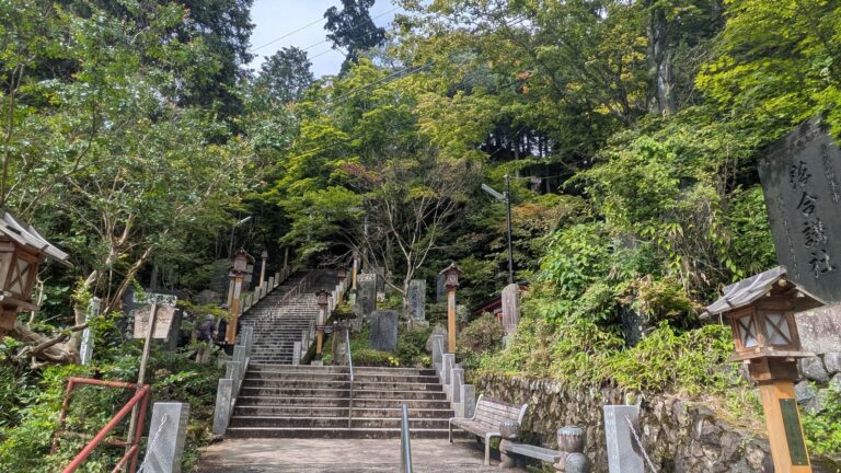
Affiliate link. This site earns a commission if you book through it, at no extra cost to you. Photo from our own walk.
What this guide covers12 sections
- Two hours, and one time to remember
- The ridge is a walk, not a second climb
- The lower summit is the open one
- The best place on this mountain to eat lunch
- The forty-nine minutes you pay for it
- The first sign on the other side is about bears
- Why no single authority describes this walk
- Then seventeen minutes of road
- The bath at the bottom
- The payment trap at the bottom of the mountain
- The bus, and why the two-hour gap is not a trap
- What to carry up the mountain
Two hours, and one time to remember
Here is what the walk actually took, measured on a Thursday in August 2026.
| Section | Measured |
|---|---|
| Fork in the village to the summit of Mount Hinode | 35 minutes |
| Time spent on the summit | 12 minutes |
| Summit to the trailhead where the path meets the road | 49 minutes |
| Road walk to Tsurutsuru Onsen | 17 minutes |
| Fork to the hot spring, rest included | 1 hour 53 minutes |
Round it up. Two hours from the fork to the bath.
That single number is the whole planning problem, because everything at the far end runs on a timetable. The bus from Tsurutsuru Onsen to Musashi-Itsukaichi Station goes ten times a day on weekdays. So the question is never how fit you are. The question is what time it is when you reach the fork.
Work backwards. Allow eighty minutes at the hot spring, which is what a bath, a change of clothes and a sit down actually took.
| Bus you want (weekday) | Be at the hot spring by | Leave the fork by | If you also eat lunch on the summit |
|---|---|---|---|
| 14:35 | 13:15 | 11:15 | 10:45 |
| 15:35 | 14:15 | 12:15 | 11:45 |
| 16:35 | 15:15 | 13:15 | 12:45 |
| 18:19 | 16:59 | 14:55 | 14:25 |
If you do not want the bath at all and only want the bus, the rule is simpler still. Subtract two hours from the departure time. That is your deadline at the fork.
Nothing else about this mountain has to be decided in advance. Mount Mitake is a mountain you plan on arrival, and this walk is no exception. Stand at the cone, look at your watch, and you have your answer.
The ridge is a walk, not a second climb
The word traverse makes this sound harder than it is.
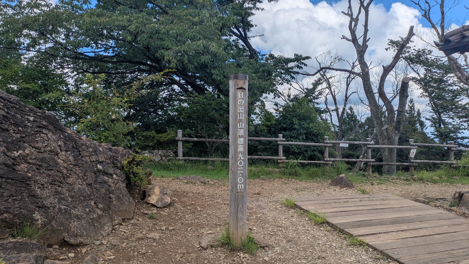
The village sits at about 910 metres (2,986 ft). The path drops to around 819 metres (2,687 ft), runs along the ridge, and comes back up to the summit of Mount Hinode at 902 metres (2,959 ft). Thirty-five minutes, and the net change in height is minus eight metres.
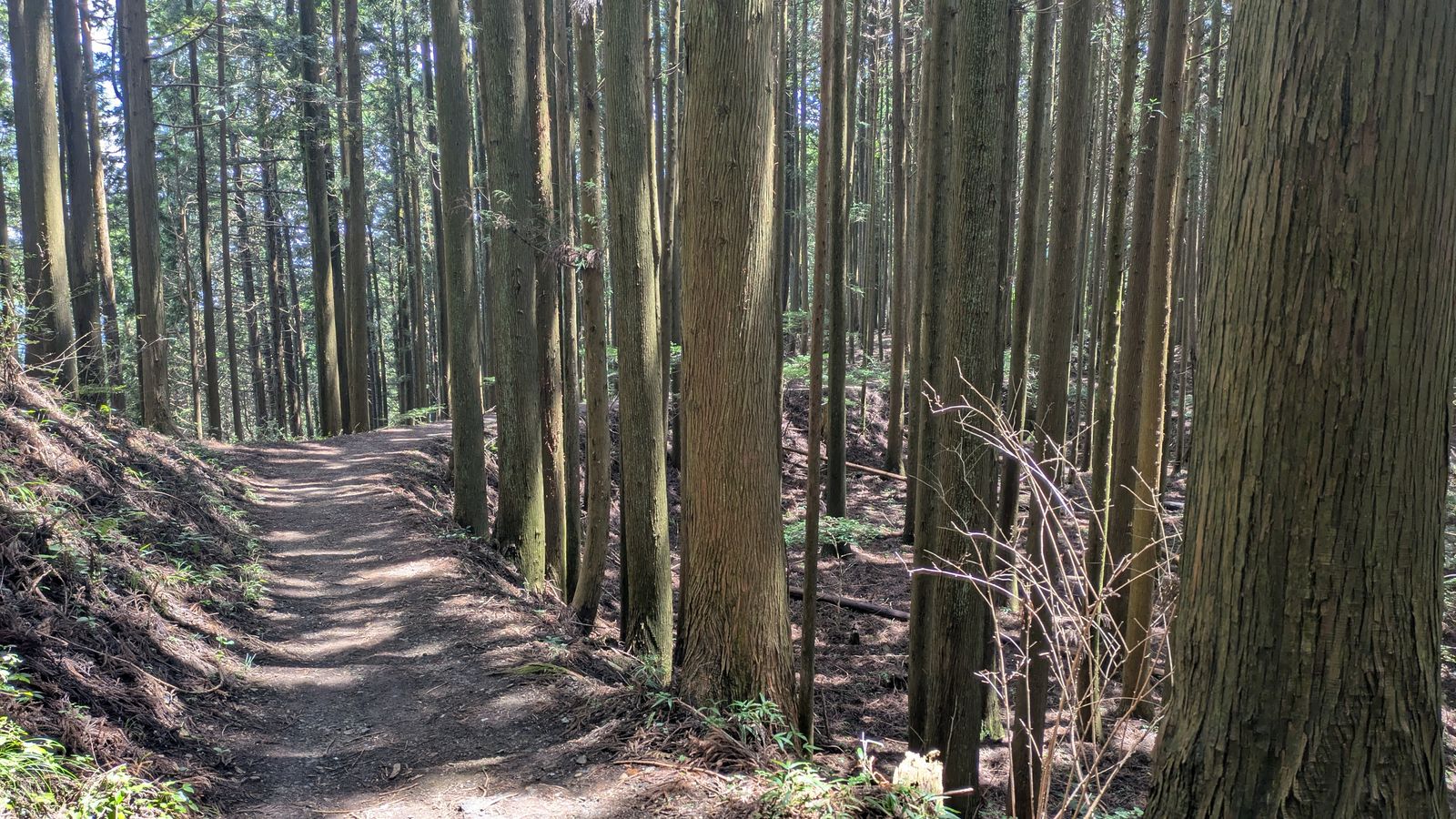
On the ground it feels exactly as that description sounds. It is a ridge walk under trees, with roots and some easy rises, and it never turns into the sort of climb that makes you stop and breathe. If you have already done the Rock Garden loop that morning, which takes about an hour and a half, this still does not feel as though you are starting a second mountain.
That matters for the timetable more than it matters for your legs. A path with no hard sections is a path where your estimate holds. You can plan the two hours and trust them. The Rock Garden is the opposite case: ladders, a chain, wet rock, and a schedule that stretches depending on what you decide to do when you get there.
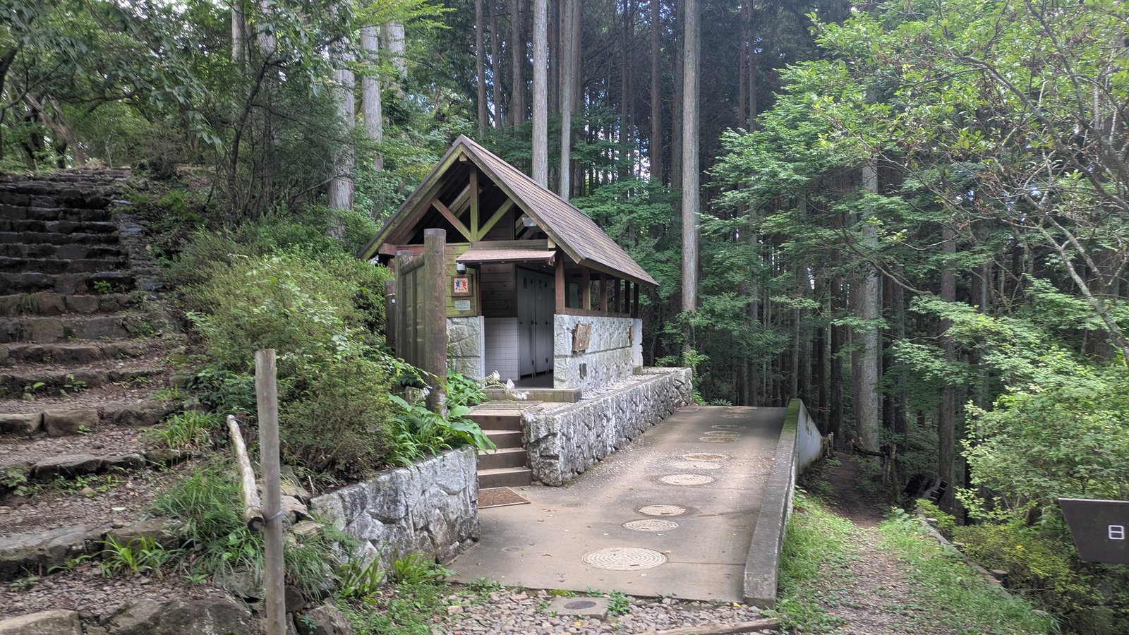
There is a toilet just below the summit, which is the last one before the hot spring.
The lower summit is the open one
Mount Mitake is 929 metres (3,048 ft) at the shrine. Mount Hinode is 902 metres (2,959 ft). The second one is twenty-seven metres lower, and it is the one with the view.
That needs saying carefully, because it would be wrong to tell you the shrine has nothing to look at. It does. Stand on the terrace in front of the worship hall and Tokyo is there, out past the ridges. But you are looking through a gap. There are cedars on one side, a bronze guardian on a granite pedestal on the other, roofs and railings below. It is a window, and it is a beautiful one.
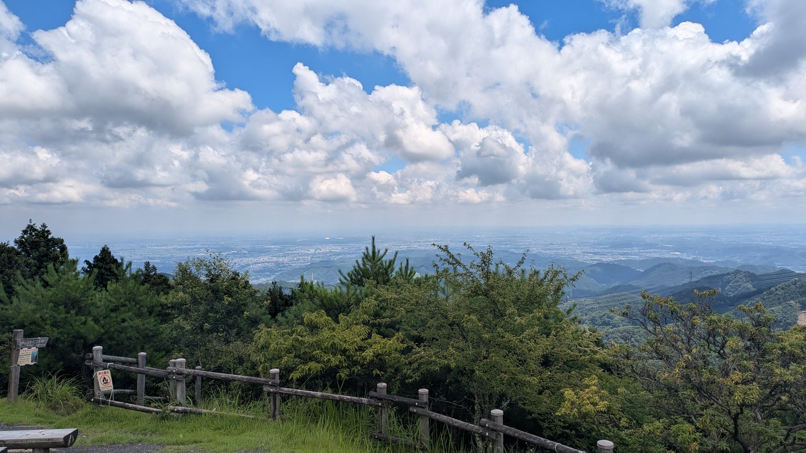
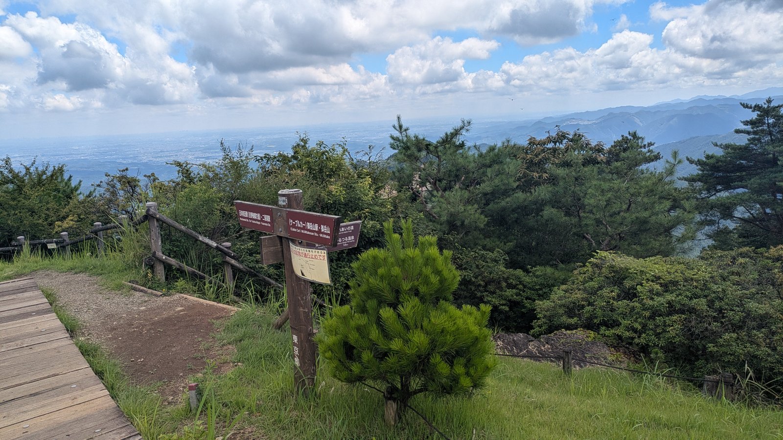
The summit of Mount Hinode has no frame at all. The Kanto plain runs from one edge of your vision to the other, flat and pale and enormous, with the ridges of the Okutama hills folding down into it in the foreground. There is a wooden fence and then there is the whole of it.
Hinode Town writes that on a clear day you can pick out Tokyo Skytree from up here, that the Tanzawa range shows to the south, and that the shrine and pilgrim lodgings of Mount Mitake are visible back to the west (Hinode Town, Mount Hinode hiking course). On the day we walked it, in early August after rain, the plain was visible from end to end and the far city was a pale grey band under cloud.
So the summit you have been walking towards all morning is not the high point of the day. The high point of the day is the shrine, and the view is twenty-seven metres below it, thirty-five minutes further on.
The best place on this mountain to eat lunch
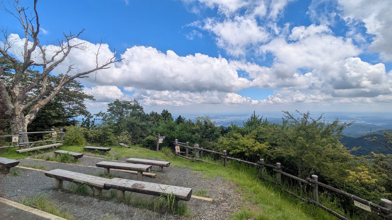
There are at least six long wooden benches on the summit of Mount Hinode, spread across the open ground, and every one of them faces the plain.
This is worth planning around. The village on Mount Mitake has shops, and they are good shops that take six kinds of credit card and four QR payment systems. But the village is under trees and among buildings. If you buy your lunch there, carrying it another thirty-five minutes gets you a table with the whole Kanto plain in front of it.
Two warnings. There is no shade over the benches. The summit is open ground with low scrub around the edges, which is the reason the view exists, and in July or August that means a hat, sunscreen and more water than you think. And this is a summit, so it is exposed to wind in the colder months in a way the sheltered village is not.
The toilet is a few minutes below the summit on the path you came up.
The forty-nine minutes you pay for it
From the summit, the path down the far side took forty-nine minutes to reach the road.
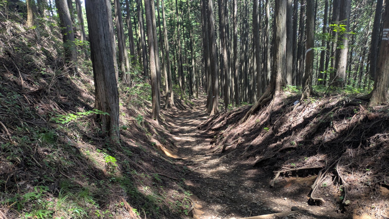
It is not a hard descent. It is not steep enough to be memorable as steep, there is no scrambling, and the surface is earth rather than rock. What it is, is a corridor. The path runs through planted cedar, sunk down into the hillside so that the banks come up on both sides at shoulder height, with roots crossing it and log steps set into the steeper parts. The trees are in rows, because somebody planted them in rows.
There is nothing to look at. That is the honest description. After the Rock Garden with its mossy boulders and its stream, and after the summit with the plain laid out in front of it, this section is forty-nine minutes of green shade and brown earth, and it exists to lose you four hundred metres of height.
So the price of the left arrow is not difficulty. Nobody is going to be defeated by this descent. The price is time, and the fact that once you are down it you are not walking back up.
For comparison, Hinode Town allows about two and a half hours of walking for its own Mount Hinode course, which goes up from the bus stop below and returns the same way (Hinode Town, Mount Hinode hiking course).
The first sign on the other side is about bears
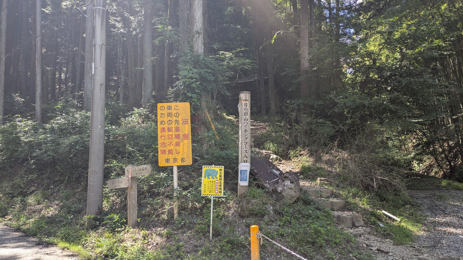
The path ends at a small trailhead where it meets the road, and there are four signs standing there together.
One is a wooden fingerpost giving Tsurutsuru Onsen as about 1.5 km and Mount Hinode as about 3.5 km, in Japanese. One is a yellow metropolitan notice about the road being narrow. One is a post reading Mount Hinode Hiking Course Entrance. And one is a small yellow board with a picture of a bear on it.
It reads: Wild animal habitat. Caution, bears. Please carry something that makes noise, such as a bell or a radio. Hinode Town.
There is no English on it.
Two things about that sign are worth knowing before you walk this way.
The first is where it is. On the Mount Mitake side of the ridge, which is Ome City, we did not see a single bear notice all morning. Not at the cable car station, not in the village, not at the shrine, not at the Rock Garden. The first one appears here, after you have crossed into Hinode Town, and it is placed to face people walking up. Coming over from Mount Mitake, you read it at the end.
The second is what other people are doing. Roughly half of the hikers we passed on this side were wearing bear bells.
This is not a claim about whether there are bears on the path you just walked. It is a statement about signs and about equipment, and those are two different things. The Tokyo Metropolitan Government publishes advice for going into the hills, and the advice is to make yourself audible: a bell, a radio, conversation, clapping. It also notes that early morning and dusk are the times to be careful, and that places with poor visibility or loud running water are where you are most likely to meet one (Tokyo Metropolitan Government, Bureau of Environment). Hinode Town gives the same advice on its own page (Hinode Town, notice about bears).
A bear bell costs a few hundred yen in any outdoor shop in Tokyo and weighs nothing. If you are walking this ridge, the local half of the traffic has decided it is worth carrying.
Why no single authority describes this walk
Once you notice the bear sign appearing on one side only, the rest of the signage on this route starts to make sense.
Hinode Town publishes a Mount Hinode hiking course. It starts at the Matsuo bus stop, goes up through Mitsuzawa, follows either an old route or a newer one to the summit, and comes back down the same way to the hot spring. About two and a half hours of walking, out and back (Hinode Town).
Ome City, on the other side of the ridge, describes Mount Mitake: the cable car, the shrine, the Rock Garden, the waterfalls.
The walk this article is about crosses from one to the other. It is the most interesting thing you can do with a day here, and it does not belong to either of them. Each side publishes its own half.
What that produces on the ground is a route with two different layers of information sitting on top of each other.
The metropolitan signposts do cross the boundary, and they are bilingual. The brown post on the summit of Mount Hinode gives Cable Car Mt.Mitakesan Sta. and Mt.Mitake in one direction, Hinatawada Sta. and Futamatao Sta. in another, and Tsurutsuru Onsen Hot spring 3.6 km in a third, all with English underneath the Japanese. If you are standing at that post, you are being served well.
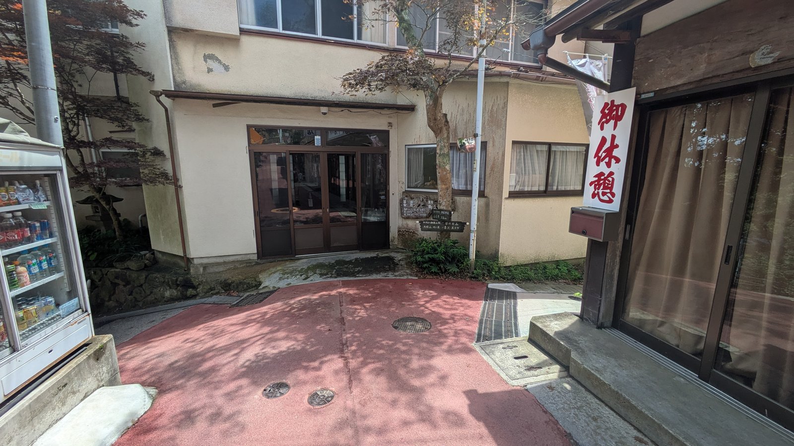
The local layer does not cross it. The homemade board at the fork in the village, the hand-painted wooden signpost on the wall opposite, the bear notice at the trailhead, the banner on the road with the remaining distance to the hot spring, the notices at the hot spring itself: all Japanese, or four romanised place names, and no more.
That is the same pattern the rest of this site keeps finding. English is attached to what a place is. It is not attached to what you should do about it.
Then seventeen minutes of road
From the trailhead to the hot spring is seventeen minutes on tarmac.
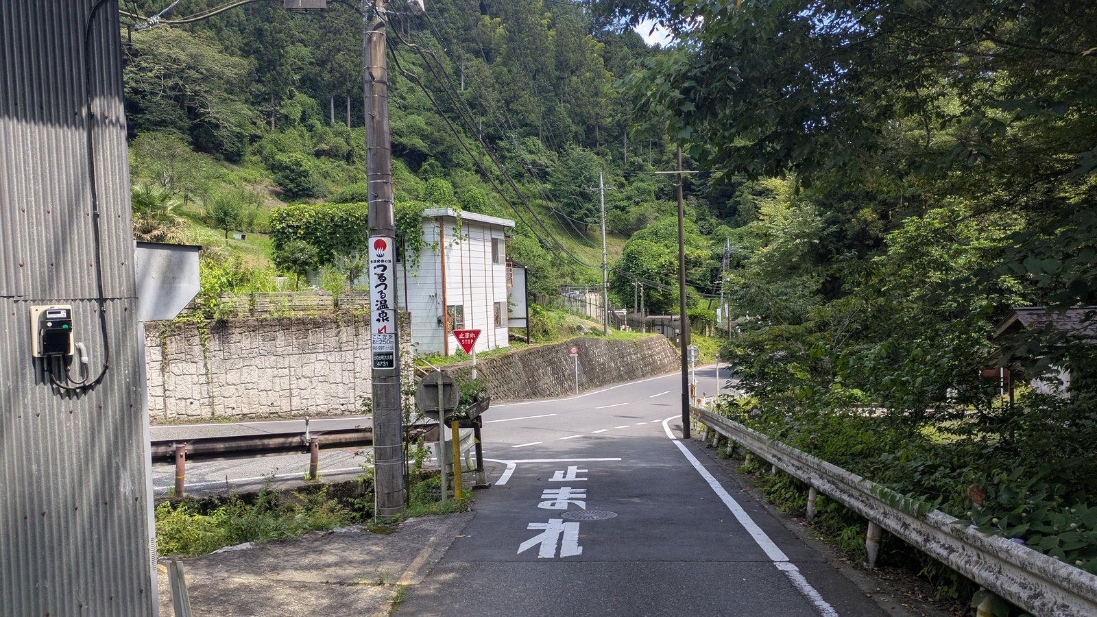
It is a proper road with a white edge line and a guard rail, running down a narrow valley with houses and vegetable plots on the slopes above it. There is no separate footway, so you walk on the edge of the carriageway. Traffic on a weekday lunchtime was very light, but the metropolitan sign at the top says the road ahead is narrow and that vehicles cannot turn round on it, which tells you what sort of road it is.
There is one piece of navigation to do, and it is signed. A vertical banner on a utility pole reads Tsurutsuru Onsen, turn left here, 250 m to go. It is in Japanese only, but it carries the hot spring logo and a number followed by the letter m, which is enough to act on.
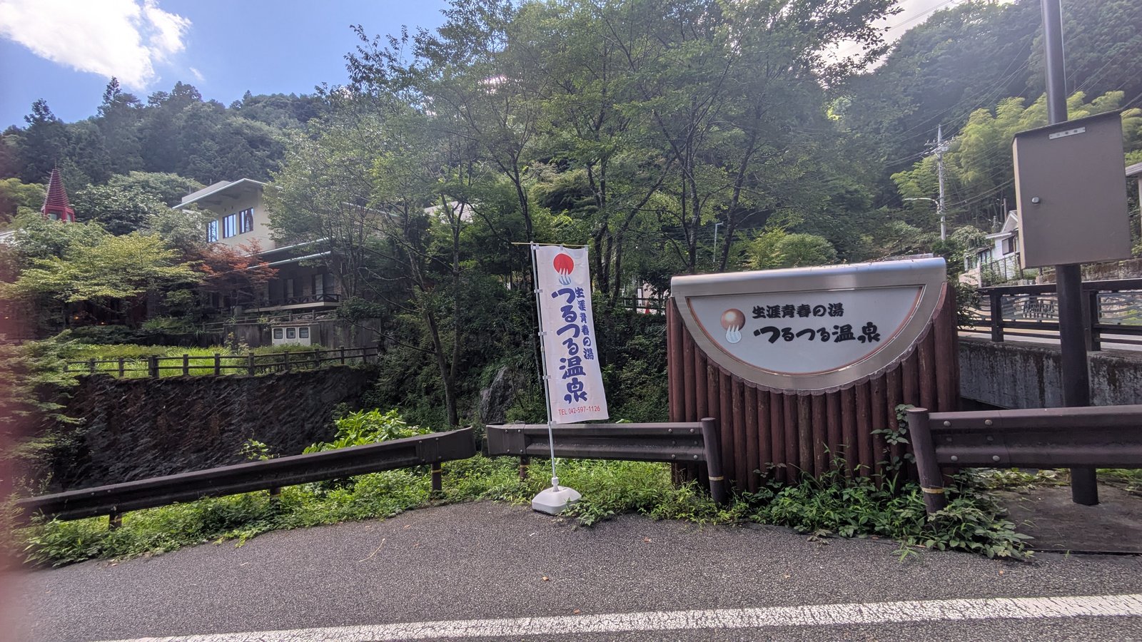
After that the road bends, and the building is on the left.
The bath at the bottom
Tsurutsuru Onsen is a municipal-style day bathhouse at the foot of the descent, and after four hours of walking it is a very good reason to have come down this side rather than gone back to the cable car.
The practical facts, from the official site (Tsurutsuru Onsen, prices and opening information):
| Open | 10:00 to 20:00, last admission 19:00 |
| Closed | the third Tuesday of each month, plus two maintenance closures a year |
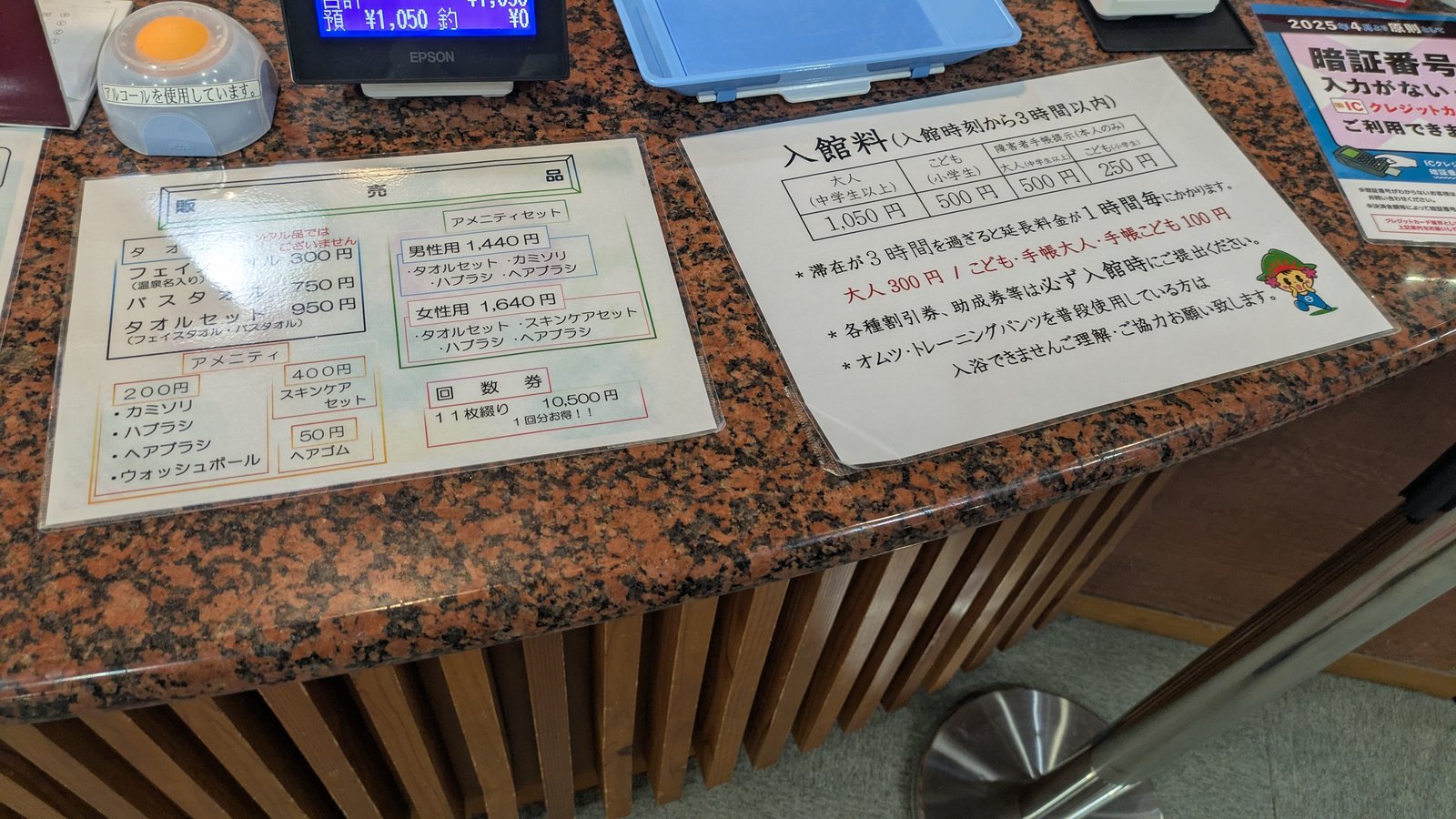
| Adult, weekday | 1,050 yen |
| Adult, weekend, holiday or peak day | 1,150 yen |
| Included | three hours from the time you go in |
| Over three hours | 300 yen for each additional hour |
| Weekday entry after 18:00 | 850 yen |
The adult price includes the 50 yen bathing tax levied by Hinode Town.
Now the part that catches people out. Towels are sold here, not lent. A face towel is 300 yen, a bath towel is 750 yen, and the pair together is 950 yen. Razors, toothbrushes, hairbrushes and wash balls are 200 yen each.
This is a real difference from the hot spring at the foot of Mount Takao, where a towel set can be rented, and it is worth knowing before you decide to travel light. You can arrive at Tsurutsuru Onsen carrying nothing at all and still get clean. You cannot do it for free. Budget about a thousand yen on top of the admission if you have brought no towel.
Rental does exist here for other things: indoor wear for 500 yen, a mobile battery for 500 yen, and for guests using a private room, a hairdryer or a hair iron for 200 yen. There are free hairdryers in the changing room as standard.
Two rules that matter specifically to people arriving on foot off a mountain.
The official rules page states that people whose clothes or body are heavily soiled, including badly muddy or soaked through from rain, cannot be admitted (Tsurutsuru Onsen, notes on use). There is a handwritten Japanese notice at the entrance saying the same thing in the local way: there is nowhere indoors to dry things, so take your rain gear off in the waiting room to the left and put it away, and wipe your feet before you come in. If you have walked down in weather, deal with yourself outside the door.
The same page states that photography of any kind is prohibited in the bathing areas, and that mixed bathing is not permitted from the age of seven under a Tokyo ordinance.
On tattoos, three separate things are true and it is worth keeping them separate. The official rules page does not mention tattoos at all, in either direction. There was no notice about them anywhere we saw in the building. And there was a person with visible tattoos bathing on the day we were there. None of that adds up to a published policy, so if this matters to your plans, the honest answer is that the house has not said.
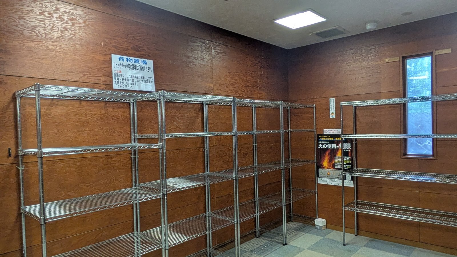
There is a rack for rucksacks, so you are not carrying a wet pack around the building.
The payment trap at the bottom of the mountain
The shop in the village on top of Mount Mitake takes six kinds of credit card and four QR payment systems. The one at the bottom of this descent does not work the same way, and the difference runs in the direction nobody expects.
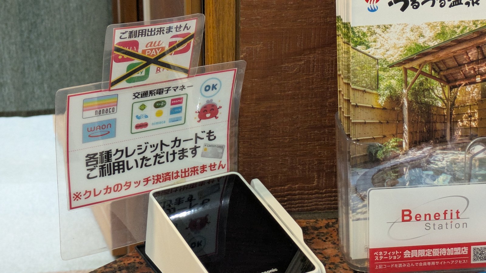
At the front desk of Tsurutsuru Onsen you can pay with transport IC cards, with nanaco and WAON, and with credit cards.
Then there are two exceptions, both on a laminated card standing on the counter, both in Japanese only.
Contactless credit card taps are not accepted. The notice says so in red: the tap-to-pay function of a credit card cannot be used here. The card itself is fine. The tap is not.
QR payments are not accepted either. PayPay, au PAY and Rakuten Pay are shown crossed out.
And the shop inside the building, which is where the souvenirs are, is cash only. No cards, no electronic money. The front desk and the shop have different rules under the same roof.
For a visitor from outside Japan this is the single most likely place on the whole walk to get stuck, because a card issued in Europe, North America or Australia is very often used by tapping and nothing else. Here you need it inserted, and you need to know that before you are standing at a counter in a towel.
Two things solve it. Carry enough cash to cover admission plus a towel, which is about two thousand yen, and expect to hand your card over rather than wave it.
The bus, and why the two-hour gap is not a trap
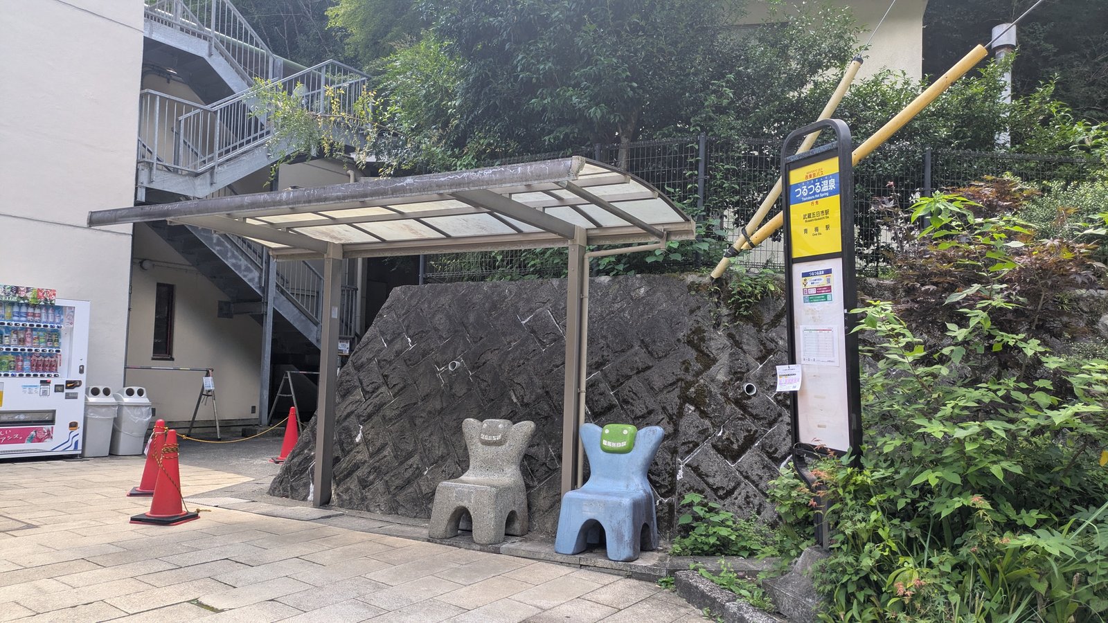
The bus stop is outside the front door, under a shelter, with two stone chairs beside it.
From here, buses go to Musashi-Itsukaichi Station on the Itsukaichi Line. That is not the station you arrived at. You came in to Mitake Station on the Ome Line, and this walk hands you back to the railway network somewhere else entirely. Work out your route home from Musashi-Itsukaichi, not from Mitake.
Departures for Musashi-Itsukaichi, from the timetable posted at the stop, revised 1 April 2026:
| Departures | |
|---|---|
| Weekdays | 7:01, 7:49, 9:55, 10:59, 12:40, 14:35, 15:35, 16:35, 18:19, 19:32 |
| Saturdays, Sundays and holidays | 7:38, 8:40, 10:15, 11:55, 12:54, 14:55, 15:45, 16:20, 17:55, 18:46, 19:32 |
Ten departures on a weekday. Look at the middle of that row: 12:40, and then nothing until 14:35. Almost two hours.
On Saturdays, Sundays and holidays there is a second option that weekdays do not have. A separate route runs from this stop to Ome Station, at 9:22, 13:53, 15:16 and 17:00. It opened in October 2024 after a new tunnel was completed, and the bus company describes the area it serves as one of the trailheads for Mount Mitake and Mount Hinode (Nishi Tokyo Bus, new Ome Station to Tsurutsuru Onsen route). It runs on weekends and holidays only. On a weekday, Musashi-Itsukaichi is your only way out by bus.
Now, the gap. We came down at 13:12, which is thirty-two minutes after the 12:40 has gone, and took the 14:35. That is eighty-three minutes of waiting, and it was exactly right: enough for the bath, a change of clothes and a sit down, without hurrying any of it.
That is worth saying plainly, because a two-hour hole in a timetable looks alarming when you are planning at home. It is not, and the reason is that this particular bus stop is attached to a building you want to be inside. There is a restaurant in the main hall serving until 19:00 for last orders, a panorama dining room open until 16:00, and rest space. You can also come in for food only without paying admission, although if you stay over an hour the admission fee applies (Tsurutsuru Onsen).
So if your two hours from the fork slip to two and a half, you do not miss anything except an earlier bus. You sit down instead. The one thing that does not forgive you is the last departure, so before you start walking, photograph the timetable.
If you want the mechanics of the bus itself, which entrance to use, how the numbered ticket works and why the fare box does not give change, that is set out in how to ride a Japanese bus. At Musashi-Itsukaichi Station, buses for this stop use platform 3.
The guided day on Mount Mitake does not walk out over Mount Hinode. If the shrine and the Rock Garden are enough for you, one private Mitake day tour covers both with an English-speaking guide and drives you back to your hotel.
Affiliate link · Pickup inside the 23 wards · About 10 hours · Free cancellation up to 24 hours before
What to carry up the mountain
Not a route. The route is signed, and the metropolitan signposts are bilingual and well kept.
Carry the number. Two hours from the fork in the village to the hot spring. Eighty minutes for the bath. Subtract from the bus you want, and that is the time you have to be standing at the cone with the two red arrows on it.
Then you do not have to decide anything at home. You walk up out of the cable car station in the morning, you do whatever the day turns out to be worth, and when you get back to that fork you look at your watch.
That is the whole mountain, really. Mount Mitake does not set the difficulty of your day. You do, and this is the largest of the choices it hands you.
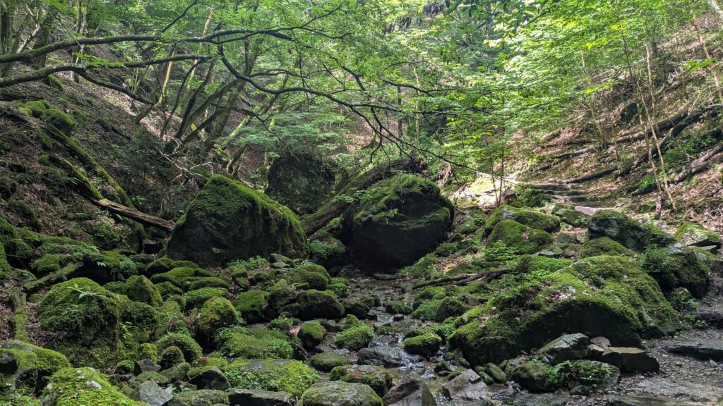
Affiliate link. This site earns a commission if you book through it, at no extra cost to you. Photo from our own walk.
Where to next
- The rest of the day above the cable car station, and the loop most people choose instead of this one: the Rock Garden
- The village, the shrine, the wolf deity and the dogs: Musashi Mitake Shrine
- Getting there in the morning, and why the return cable car ticket saves you nothing: how to reach Mount Mitake
- The bus mechanics, for this route and every other mountain bus: how to ride a Japanese bus
- The other hot spring at the foot of another mountain, where towels can be rented: the onsen at Mount Takao
- The whole day this walk belongs to, measured end to end: Mount Mitake, the hike you decide after you arrive
The same pattern appears on a far larger scale on Mount Fuji, where the descent you choose decides which prefecture you finish in: Mount Takao or Mount Fuji.