Some links on this site are affiliate links. If you book through one, Tokyo Trailhead earns a commission at no extra cost to you. It never decides what appears here.
English guides put these two mountains on the same table and rank them by difficulty. Mount Fuji is the hard one. Mount Takao is the easy one. From there the reader does a simple piece of arithmetic. If I have the time and the legs, Fuji. If not, Takao.
That arithmetic does not work, and the reason has nothing to do with fitness.
I have walked every numbered trail on Mount Takao. I climbed Mount Fuji on the twenty second and twenty third of July 2026, up the Yoshida trail on the Yamanashi side, and down the far side into a different prefecture. Both mountains are reachable from central Tokyo. Both were within reach of one person with an ordinary pair of legs. What separated them was the deadline.
What this guide covers8 sections
- The short answer
- The first difference is not the mountain. It is the paperwork.
- The second difference is what the clock is doing
- The third difference is where you are standing when it ends
- What actually happened, hour by hour
- Which one is yours
- If you have chosen Fuji, three things from the climb
- What this article does not cover
The short answer
Mount Takao leaves the decisions in your hands until the morning of the walk. Mount Fuji takes all of them away before you leave Tokyo.
That is the whole comparison. It is not a difference of difficulty. It is a difference of deadline.
On Mount Takao you can wake up, look at the sky, and go. You buy nothing in advance. You choose your route while standing at the foot of the mountain, and if the route turns out to be wrong for the day you are having, you change it partway up. Eight numbered routes lead to one summit at 599 metres (1,965 feet), roughly fifty minutes from Shinjuku, and every one of them returns you to the same station.
On Mount Fuji, by the time you are standing at the trailhead, every meaningful choice has already been made. Which entrance. Which night. Where you will sleep. Where you will come down. Most of it was decided in May.
Affiliate link. This site earns a commission if you book through it, at no extra cost to you. Photo from our own climb.
The first difference is not the mountain. It is the paperwork.
Here is what each mountain asked of me before I could start walking.
| Mount Takao | Mount Fuji, 2026 season | |
|---|---|---|
| Transport | Keio line. No booking. Tap an IC card | A reserved seat on an express bus from Shinjuku |
| Entry | Free, no procedure | ¥4,000 per person, per climb, with advance registration |
| Accommodation | Not needed | A mountain hut, booked separately from the entry permit |
| Gate | There is none | Closed from 2 p.m. until 3 a.m. to anyone without a hut booking |
| Daily cap | There is none | The Yoshida trail closes at 4,000 climbers |
| Order of booking | There is no order | Hut first, then the bus |
| Season | All year | Yoshida, Subashiri: 1 July until 10 September. Fujinomiya, Gotemba: 10 July until 10 September |
| Who chooses the date | You do | The huts do |
That last row is the one worth sitting with.
I did not choose a date and then look for a bed. I looked for a bed in early July, found that every hut was full, and worked backwards from whichever nights still had space. The mountain gave me a date. I accepted it.
The entry fee itself was straightforward. I paid the ¥4,000 through the advance reservation system with a credit card, rather than in cash at the window on the day. What is not obvious from the outside is that the entry permit and the hut are two separate systems with two separate opening days. For the 2026 season, registration on the Shizuoka side opened on 8 May at 10 a.m. The hut I eventually slept in, Fuji Ichikan on the Yoshida trail, opened its bookings for the entire season on 17 May at 10 a.m.
Miss those, and you are not choosing a date any more. You are taking what is left.
Mount Takao has none of this. There is no permit, no cap, no gate, and no season. There is nothing to be late for.
The second difference is what the clock is doing
Compare the shape of the two days.
| Mount Takao | Mount Fuji, measured | |
|---|---|---|
| Tokyo to trailhead | About fifty minutes from Shinjuku | About two and a half hours by bus |
| Time spent walking uphill | The Inariyama trail takes 80 to 100 minutes | 1 hr 26 min, then 3 hr 19 min the following night |
| Time spent waiting | None | 9 hr 14 min in the hut, then 1 hr 13 min at the summit |
| Trailhead to trailhead | A morning | 20 hr 25 min |
| Can you stop | Yes. There is a cable car | No. Not at 3,400 metres at one in the morning |
The waiting is the part the English articles get wrong, and they get it wrong in a specific way. They call it rest.
I was inside the hut for nine hours and fourteen minutes. I did not sleep.
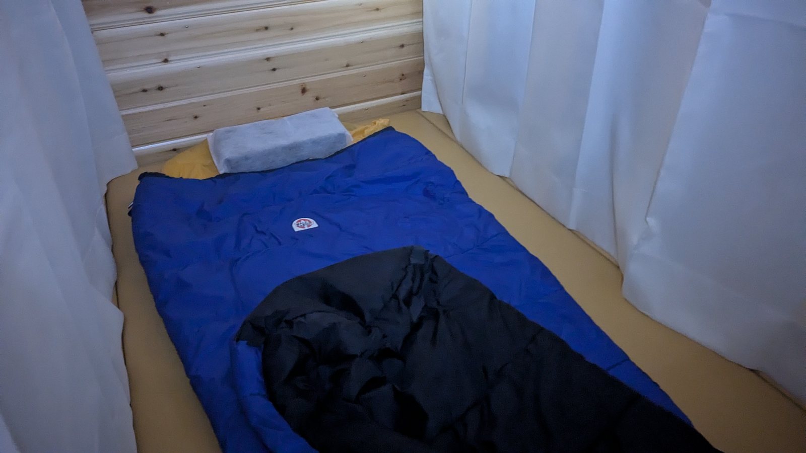
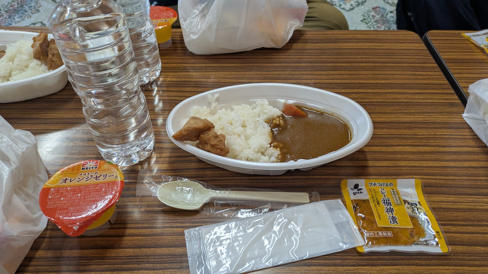
This was not a matter of the hut being unpleasant. The sleeping space was a single berth with a mat, a sleeping bag, a pillow, and a white curtain on each side. It was cleaner and more private than the descriptions in English had led me to expect. The food was a plate of curry and rice with a piece of fried chicken and a small orange jelly, handed out at half past four in the afternoon. None of that was the problem. The problem was that it was still daylight when the meal was served, the air was thin, and the night was going to end at eleven.
So I got up and left early. That single decision, made because I could not sleep, moved everything that came after it.
One thing to lower your expectations about
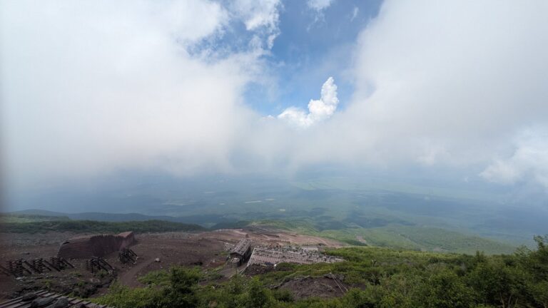
There is a photograph from just after two in the afternoon, taken from the deck outside the hut. It shows a wooden railing, a shrub, the corner of the next building, and then nothing at all. White. The hut sat inside the cloud for most of the afternoon.
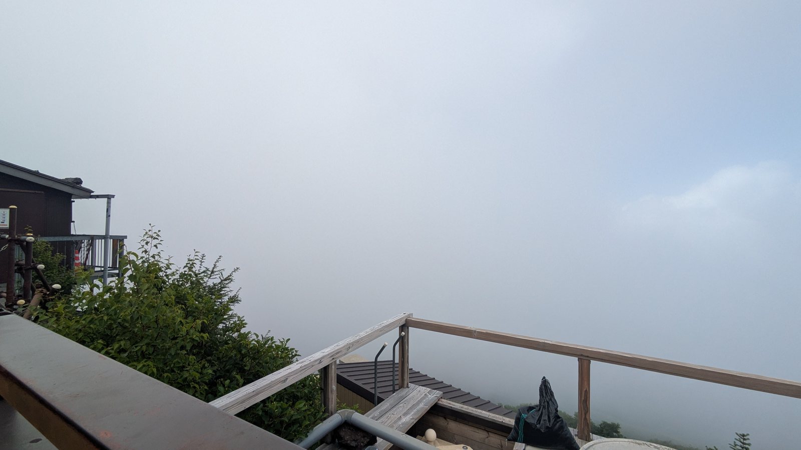
This site has said the same thing about the view of Mount Fuji from the summit of Mount Takao, and it is worth repeating here in the other direction. An afternoon at 2,800 metres is not guaranteed to be an afternoon above the clouds. Sometimes you are simply in them, and the hours before dark are spent looking at a white wall. Plan the afternoon as time to get horizontal, not as scenery.
The shrub in that photograph is worth noticing too. There were still plants growing around the hut. Higher up there were none, and there were none for the whole of the night walk and the whole of the crater rim. It was only well down the far side, at somewhere around 2,500 metres, that green started appearing again in the volcanic gravel.
That is a thing Mount Takao cannot do. On Takao you are inside forest from the station to the summit and back. On Fuji you walk up out of the living part of the mountain, spend the important hours on bare rock and ash, and then walk back down into it.
The third difference is where you are standing when it ends
On Mount Takao this question does not exist. Eight routes, one summit, one station at the bottom. Whichever way you come down, you end up back at Takaosanguchi, where the train is, and where the hot spring happens to be next door. You do not have to think about it, which is exactly why nobody writes about it.
On Mount Fuji, coming down is a decision, and it has to be made before you go up.
I went up on the Yamanashi side and came down on the Shizuoka side. Up the Yoshida trail from the fifth station at 2,305 metres, and down the Gotemba trail, across the Hoei crater, to the Fujinomiya fifth station. Different trail, different prefecture, different bus, different town at the end of the day.
There were three reasons, and only one of them was about the mountain.
The first was speed. I expected the southern descent to be quicker than the Yoshida descent. The second was crowds, and I wanted to be away from the tour groups. The third was the one that actually decided it: I wanted to take a bus down to Mishima station and go and sit in a hot spring in Atami.
That is worth saying plainly, because it is the honest shape of the decision. I chose which side of Mount Fuji to descend based on where I wanted to take a bath. And because the descent route determines which bus you catch and which town you end the day in, that bath had to be decided before I ever got on the bus at Shinjuku.
Readers of this site have seen this pattern before. On Mount Mitake, the fork in the village decides whether you finish at the cable car or walk on to a hot spring in the next valley. Fuji is the same idea, stretched across two prefectures and moved forward by two months.
There is a trap hidden in the words here, and it is worth spelling out. Both ends of my day were called the fifth station. They are not the same place, they are not near each other, and no road connects them over the top. The Yoshida fifth station is in Yamanashi, served by buses from Shinjuku and the lakes. The Fujinomiya fifth station is in Shizuoka, served by buses down to Mishima and the coastal cities. Walking over the summit from one to the other is a one way move. The bus you arrived on is now on the wrong side of a 3,776 metre mountain.
So the return leg is part of the decision, not an afterthought. Mine ran from the Fujinomiya fifth station down to Mishima station by bus, and then to Atami for the hot spring, which put me back toward Tokyo along an entirely different line from the one I had left on. If you plan to descend on the other side, work out the last bus of the day before you book anything, because the descent is where the tiredness is, and a missed connection at the bottom is a missed connection at the end of twenty hours.
Compare that with the shape of a day on Mount Takao. Whatever happens, you walk back into Takaosanguchi station, and the trains run late. There is nothing to miss.
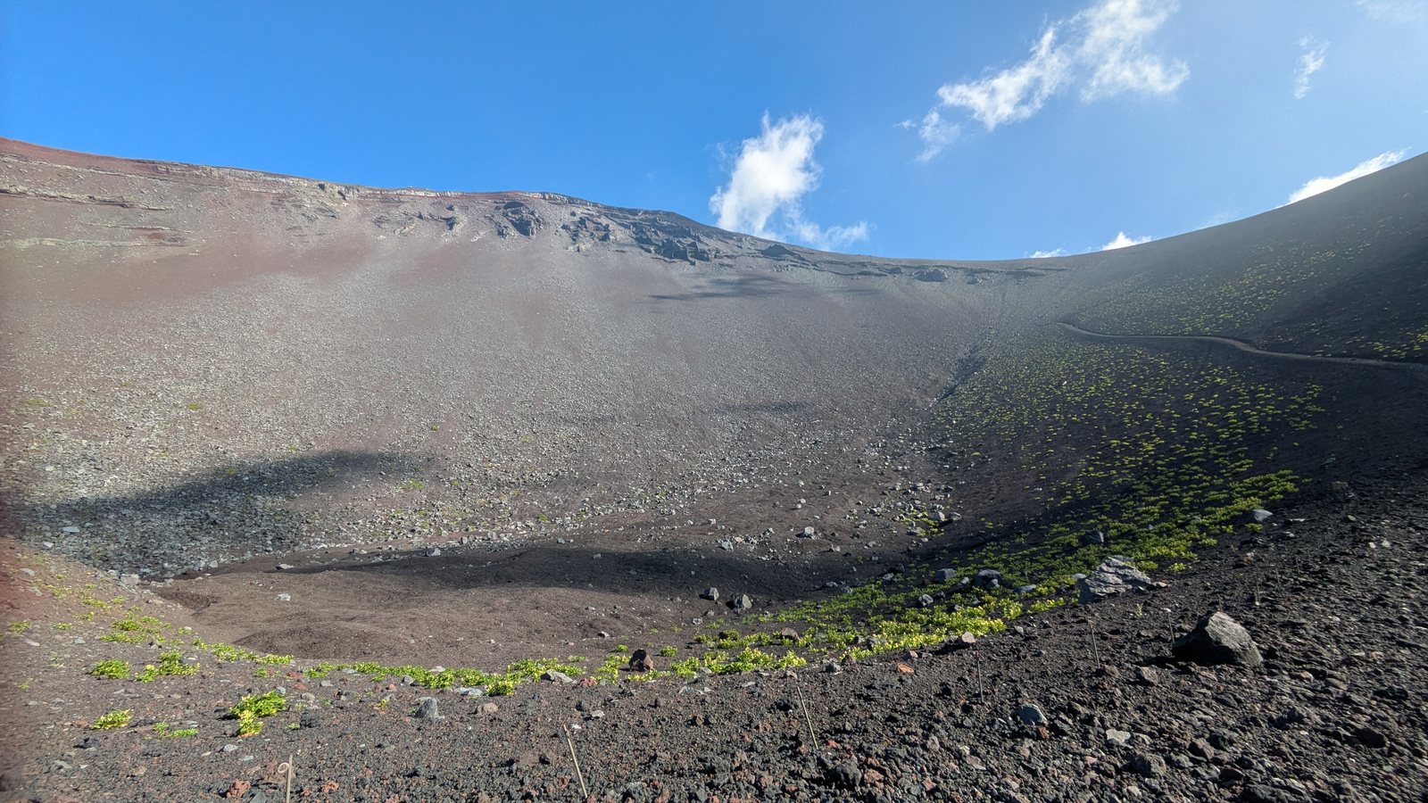
One honest note about the first reason. The published time for the Yoshida descent is about 3 hours 35 minutes. My descent, from the true summit down to the Fujinomiya fifth station, took 3 hours 57 minutes, and that included time spent looking at the Hoei crater. The two are not directly comparable, because I started from a point further round the rim, and because there is no published standard time for the route I actually took. It is not one of the four official trails.
What I can say is why it was slow, and it is the single most useful thing in this article.
I was slow because I had been awake for twenty hours.
Published route times assume a rested walker. On Mount Takao that assumption holds, because you started walking two hours ago after a night in your own bed. On Mount Fuji the descent begins after a night that was not a night. The time it takes you to come down is decided less by the trail than by how long you have been awake when you start.
What actually happened, hour by hour
The photographs from the climb carry timestamps and GPS altitude, so this is the measured day rather than the remembered one.
| Time | Altitude | Where |
|---|---|---|
| 22 July, 12:02 | 2,339 m | Yoshida fifth station |
| 12:26 | Start walking | |
| 13:52 | 2,854 m | Seventh station. Fuji Ichikan |
| 16:26 | Dinner | |
| 23:06 | 2,957 m | Leave the hut |
| 23 July, 00:13 | 3,251 m | Eighth station |
| 00:49 | 3,402 m | Main eighth station |
| 02:25 | 3,689 m | Yoshida summit |
| 02:46 – 03:34 | 3,749 – 3,796 m | Round the crater rim, heading west |
| 03:41 | 3,818 m | Kengamine, the highest point in Japan |
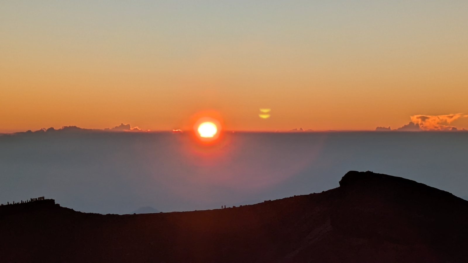
| 04:41 | 3,822 m | Sunrise |
| 04:54 | Start down | |
| 05:52 | 3,701 m | Top of the Gotemba trail |
| 06:07 – 07:42 | 3,330 – 2,595 m | Descent, then the Hoei crater |
| 08:51 | 2,414 m | Fujinomiya fifth station |
The altitudes above are the GPS readings recorded by the camera, so they run a few tens of metres above the published heights of the stations. The published height of the Yoshida fifth station is 2,305 metres, and the hut at the seventh station gives its own height as 2,800 metres. It is the times that matter here, not the metres.
Look at the gap in the middle of that table. I reached the Yoshida summit at 02:25. The sun came up at 04:41 by the timestamp on the photograph. That is two hours and sixteen minutes of darkness at nearly 3,700 metres, standing still.
Most people would call that arriving too early. In my case it was the only reason the day worked.
I had decided in advance that I wanted to see the sunrise from Kengamine, the true summit and the highest point in Japan. Kengamine is on the opposite side of the crater from the place where the Yoshida trail arrives. Getting there means walking half of the crater rim in the dark, which took me 1 hour 16 minutes. Then I stood at the top for another 1 hour 13 minutes and waited.
And this is the part that surprised me. When the sun finally came up, I looked across the crater and there was a line of people standing along the far rim, silhouetted against the light. That is where the Yoshida trail arrives, and that is where almost everybody watches the sunrise. On my side of the crater there were a handful of us.
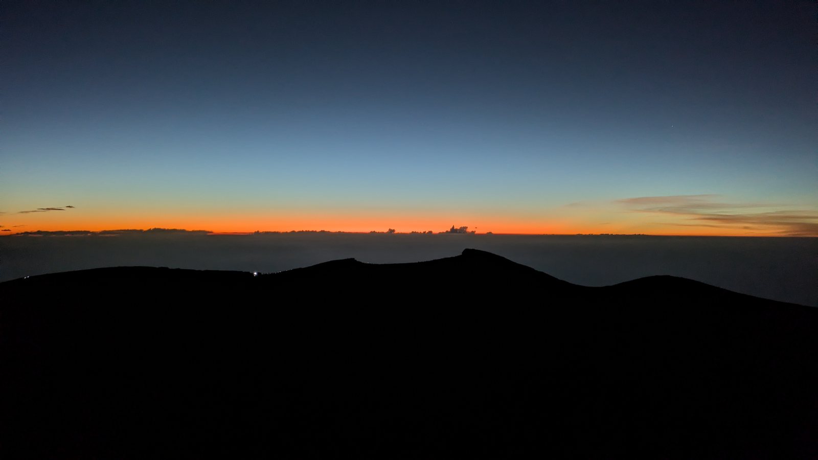
The half circuit of the crater is usually described in English as an optional extra, something to add if you have energy left. On this route it was not an extra at all. It was the connection. Going up the Yoshida trail and down the Gotemba side means crossing the crater whether you want to or not, and Kengamine sits on the way.
But I want to be accurate about how that two hour margin came into being, because it was not planning. The margin existed because I could not sleep and left the hut early. If you want the same thing on purpose, you have to build it in deliberately, and you have to be willing to stand still in the cold and the dark for an hour or more before anything happens. Do not count on insomnia to deliver it for you.
Which one is yours
| Your situation | Go to |
|---|---|
| You are deciding your plans after arriving in Tokyo | Mount Takao. Fuji has probably already closed for you |
| You are visiting outside early July to early September | Mount Takao. Fuji is shut |
| You have one free day | Mount Takao |
| You are walking with someone whose stamina you cannot predict | Mount Takao. You can turn around. There is a cable car |
| You want to be above the city by nine in the morning | Mount Takao |
| Your dates were fixed months ago and fall inside the season | Mount Fuji, if you booked in May |
| You want to walk through the night and watch the sun come up | Mount Fuji |
| You want the sunrise from the highest point in Japan | Mount Fuji. Plan two extra hours past the Yoshida summit |
Notice what is missing from that table. Fitness. It barely matters. What matters is when your plans became fixed.
This is also why the two mountains are not really alternatives. They answer different questions. Mount Fuji answers a question you asked several months ago. Mount Takao answers a question you asked this morning, over breakfast, looking out of a window at the weather.
If you have chosen Fuji, three things from the climb
These are the three things I would tell the version of myself who was booking this.
Book in May. The entry registration and the hut are separate systems with separate opening dates. In 2026 the Shizuoka side opened on 8 May, and the hut I stayed in opened its season on 17 May. If you book in July, you are not picking a date. You are picking whatever is left, and everything downstream of that changes.
Take the highest hut you can get. I slept at the seventh station, which is four to five hours below the summit by the reckoning of the hut itself. The hut closest to the summit on the Yoshida trail sits at the eight and a half station, and gives its own figure as roughly ninety minutes below the top. That difference of three hours or more lands entirely on your second day, when you are tired and it is dark. Which hut you get is decided in May.
Do not plan around sleeping. Plan around not sleeping. Published walking times assume a rested body, and on the second day you will not have one.
If the answer is Mount Takao and you would rather go with a guide, one small-group guided day on Mount Takao covers the temple, the summit and a hot spring at the end, in about eight hours.
Affiliate link · Small group of up to 7 · About 8 hours · Free cancellation up to 24 hours before
What this article does not cover
I climbed one route, on one date, in good weather. I did not run into the queues that other writers describe, so I have no measurements of them and I am not going to guess at how bad they get. I have not climbed the Fujinomiya, Subashiri, or Gotemba trails upward. I did not attempt this without a hut booking, and I have nothing useful to say about altitude sickness beyond the fact that I did not sleep.
The rules on Mount Fuji change every year. Everything above with a number attached to it is the 2026 season, taken from the official sources listed below rather than from my memory of the day. Check them again for the year you are going.
Sources: Mount Fuji Climbing Official Site, Yoshida trail regulations / Mount Fuji Climbing Official Site, Shizuoka side regulations / Mount Fuji Climbing Official Site, comparison of routes / Shizuoka Prefecture, climbing restrictions / Fuji Ichikan, seventh station / Goraikokan, eight and a half station
Related: Mount Takao or Mount Mitake / Mount Takao or Kamakura / Which trail up Mount Takao / Trail 1, walk or cable car / Mount Mitake to Mount Hinode / The hot spring at Takaosanguchi
For what the night on that mountain actually involves, there is now a full account of one climb: Is climbing Mount Fuji worth it?
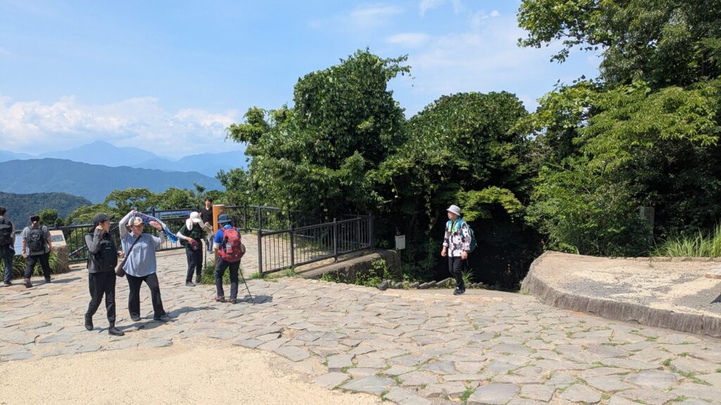
Affiliate link. This site earns a commission if you book through it, at no extra cost to you. Photo from our own walk.