Some links on this site are affiliate links. If you book through one, Tokyo Trailhead earns a commission at no extra cost to you. It never decides what appears here.
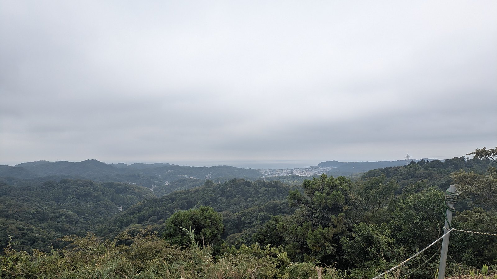
The hiking in Kamakura is not a stroll from one temple to the next. It is ridge walking. The high point of the two trails described here is 159.2 metres (522 feet), a figure taken from the sign on top of Ohirayama, which also states that this is the highest ground in Kamakura. That is lower than a mid-size office tower, and from up there you can see the sea.
That is the odd pleasure of this place. The hills are small enough that the walking never becomes mountaineering, and steep enough that within twenty minutes of a railway station you are on a dirt path under closed forest, a short step away from caves cut into the rock and used as graves seven hundred years ago.
Both trails described here were walked on 13 September 2026, one in the morning and one in the afternoon, on the same pair of legs. The distances, the timings and the surface conditions on this page are measured, not collected from other pages.
The two are not versions of one another. They begin in different places, they finish at different stations, and one of them, entered from the station that most guides send you to, wants 500 yen in cash before you reach the trail at all.
What this guide covers8 sections
- The two trails, side by side
- The two lines, drawn from our own track
- The end you enter from decides the price
- Everything here is in English except one sentence
- It is slippery even when the sun is out
- Closures here are normal, not exceptional
- Questions people actually ask
- What to settle before you leave the station
The two trails, side by side
Everything in this table was measured on 13 September 2026. The trail-only rows are the walking on dirt; the station-to-station rows include the streets at each end and the time spent inside temples and shrines.
| Kuzuharaoka–Daibutsu | Ten-en | |
|---|---|---|
| Official English name | Daibutsu Hiking Trail | Ten-en Hiking Trail |
| Entrance used | Stone steps beside Jochi-ji, 11 minutes from Kita-Kamakura | Kencho-ji, then up through Hansobo, 33 minutes from Kita-Kamakura |
| Cost to start | Free | 500 yen, cash only, from the Kita-Kamakura end |
| What the money is for | Nothing is charged | The Kencho-ji precinct, which the entrance sits at the back of. The ridge itself is free |
| Exit | Daibutsu-zaka, then Kotoku-in and Hase Station | Zuisenji side, then Kamakura-gu and a bus |
| Trail only | 3.59 km, 85 minutes | 3.74 km, 92 minutes |
| Station to station | 5.17 km, 1 hour 52 minutes | 8.35 km, 2 hours 49 minutes |
| Climbing | About 226 metres of climbing, high point about 100 metres | About 319 metres of climbing, high point 159.2 metres at the sign on Ohirayama |
| Water | The station, then one vending machine at Kuzuharaoka Shrine | The station, then seven vending machines before Kencho-ji, then nothing |
| Toilet | The station, then Kuzuharaoka Shrine | The station, then inside Kencho-ji once you have paid, then one public toilet at Ten-en |
| On the way | Zeniarai Benten, Genjiyama Park, Kuzuharaoka Shrine | Kencho-ji, Hansobo and its tengu, Ohirayama, and the Hyakuhachi Yagura burial caves on a short branch off the ridge |
| Surface | Earth, roots, mud, bare rock slabs | Earth, roots, wet rock, cuttings through rock |
| After rain | Slippery. Both of them. | Slippery. Both of them. |
The 85 minutes on the Daibutsu trail includes a 31 minute detour to Zeniarai Benten. Without that detour the walking is about 54 minutes.
One note on the heights in that table. The climbing figures come from the terrain model that the GPS app reads, not from a barometer, so they are given as approximate. The 159.2 metres is the exception, because it is painted on the sign at the top.
One row in that table carries a condition, and it is the money row.
The two lines, drawn from our own track
Both lines above come from a GPS track recorded while walking, 281 points on the Ten-en trail and 181 on the Daibutsu trail. The markers are the entrances, the exits, the point where the sea comes into view, and the places where the price changes.
One note on the heights. The elevation figures in the track are read from a terrain model, not from a barometer, so they are treated here as approximate. The times are from the clock in the phone and the timestamps on the photographs, and those are exact.
The end you enter from decides the price
There is no ticket gate on the Ten-en trail. What there is instead is an entrance that sits at the back of a temple, and the temple charges admission.
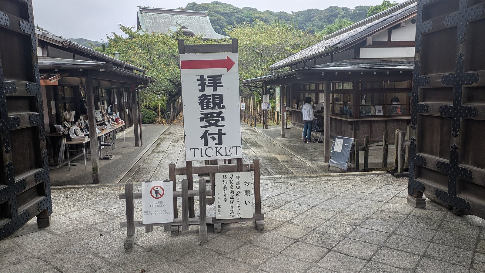
Walking in from Kita-Kamakura, the way to that entrance runs through the main gate of Kencho-ji, past the ticket window, across the precinct, up through Hansobo and its tengu statues, and out at the top of a flight of stone steps. The trail starts above all of that. The 500 yen is therefore not a charge for the path. It is admission to the temple you have to cross in order to reach the path.
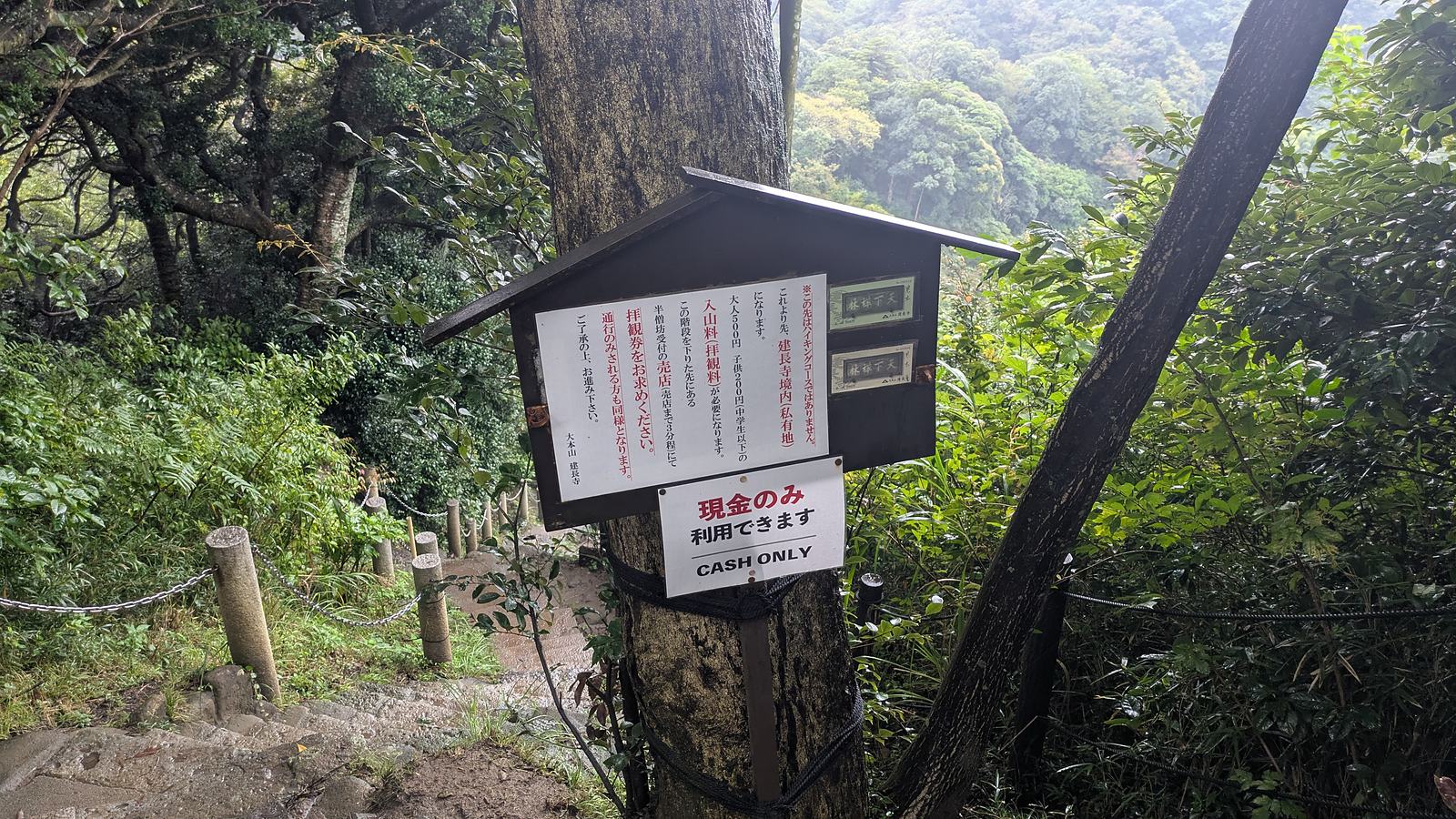
Kencho-ji states this directly. A board stands at the ticket window, and it says that people going through to the Ten-en hiking trail by way of Kencho-ji are also passing across the precinct, and so admission is required. A second board, at the top of the steps where the dirt begins, goes further: beyond this point is not the hiking trail, it is the precinct of Kencho-ji, which is private land, and the admission of 500 yen for adults and 200 yen for children applies to those who are only passing through as well.
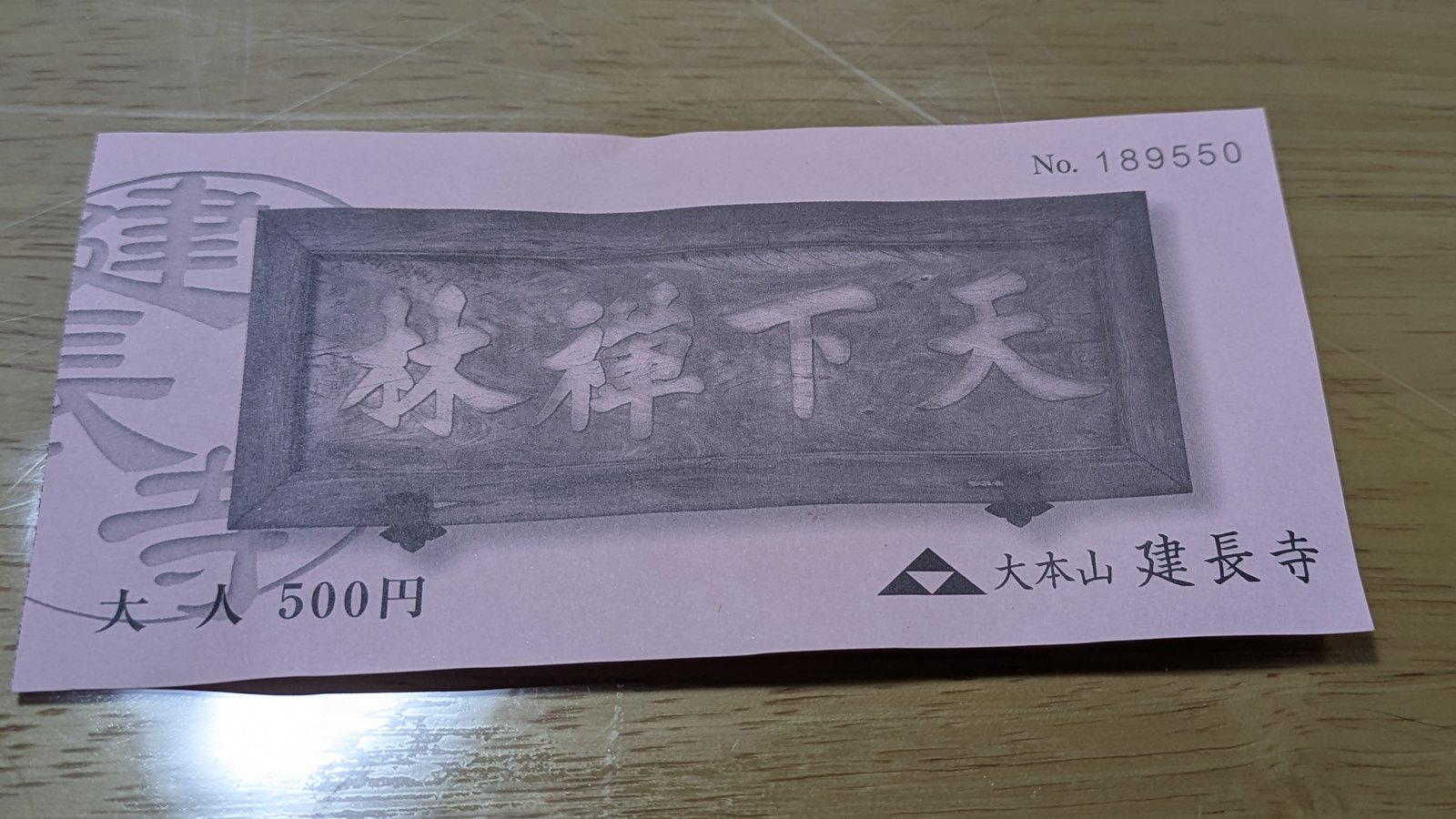
Adult 500 yen, junior high school age and below 200 yen, no group discount. Cash only.
Now the other ends of the same trail.
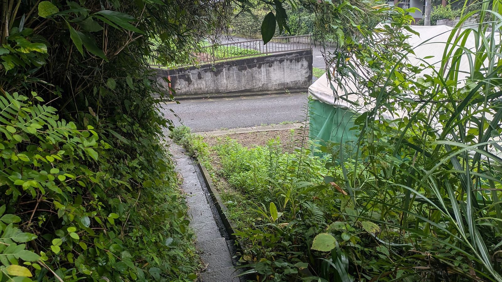
We came off the ridge on the Zuisenji side at 11:16, after 92 minutes on dirt. There is no ticket window there. There is no notice there. The path simply arrives at the retaining wall of a house and becomes a residential lane.
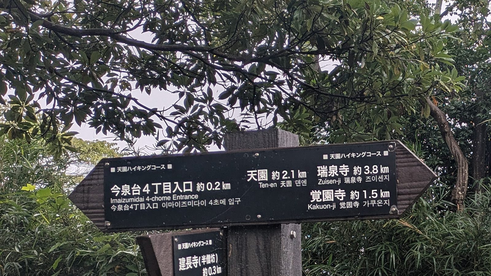
Further back along the ridge, a signpost carries a third option: Imaizumidai 4-chome Entrance, 0.2 km. We did not use it, so it is offered here as a fact about the signpost and not as a description of a walk.
And there is a fourth piece of evidence, from the city itself. The official English tourist map prints a suggested hiking route, and that route enters Ten-en at the Zuisenji entrance. No reason is given for the choice.
The Daibutsu trail has none of this. Its entrance is a flight of mossy stone steps at the side of the lane that runs past the front of Jochi-ji, a few metres beyond two traffic cones. There is no gate. There is no booth. There is not even a sign that announces a trailhead, only a small stone marker.
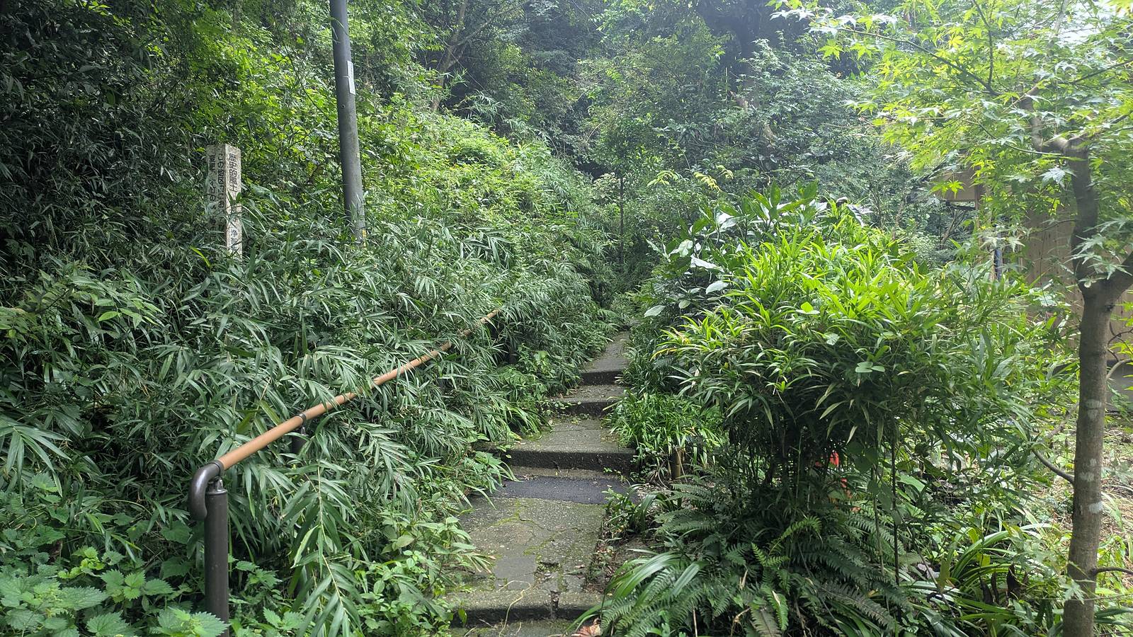
So the question to settle before you leave the station is not which trail. It is which end.
Everything here is in English except one sentence
It would be easy to write that Kamakura hides its hiking from foreign visitors. That is not what is going on, and it is worth setting the record straight before the useful part.
The signage is genuinely multilingual. The tourist board outside Kita-Kamakura Station draws the Ten-en trail as a dotted line and labels it in English. The signposts on the ridge are in Japanese, English and Korean. The large board at the Daibutsu trail carries an English title. The official tourist map for the city, in English, has a legend entry for hiking courses, names all of the trails, and prints a suggested hiking route with the minutes for each leg (Kamakura City Tourist Association, map downloads). That same map even carries a small note where Hansobo is drawn, saying that admission is charged at the entrance of Kencho-ji.
The amount is published in English as well. The official English site of the Kamakura City Tourism Association states the Kencho-ji admission of 500 yen twice, once on the page for the Ten-en trail and once on the page for the temple, together with the opening hours of 08:30 to 16:30 (Ten-en Hiking Course, Kencho-ji Temple). The fee board at the ticket window is bilingual, and it carries a CASH ONLY pictogram.
So the trail is documented and the number is available. What is missing is narrower than either of those, and much more practical.
The sentence that applies the charge to hikers is in Japanese only. Two boards state it, one at the ticket window and one at the top of the steps above Hansobo, and both of them are Japanese. The second one names people who are only passing through. The English on that board runs to two words, and those two words are CASH ONLY. No English source states this part at all. Two of the most read English pages on Kamakura hiking describe the Ten-en trail as running from Kencho-ji to Zuisenji and mention no fee of any kind (japan-guide.com, nippon.com).
The amount is missing from the map you carry. On the official English map, Hase-dera is given as 400 yen, Kotoku-in as 300 yen with a 50 yen surcharge to go inside the Great Buddha, and Hokoku-ji as 300 yen. For Kencho-ji there is no figure at all, only a note that admission is charged at the entrance.
Cash only reaches you at the gate and nowhere before it. The words are printed on the fee board and again on a sheet fixed below the notice on the ridge. Neither of the official English pages that give the 500 yen mentions them, which matters for a rule that has to be obeyed with whatever is already in a pocket.
The ticket is in Japanese only. Adult, 500 yen, the name of the temple, and a drawing of the plaque over the gate.
It continues past Kencho-ji. At Zeniarai Benten, the cave on the Daibutsu trail where people wash money in a spring, all three notices are in Japanese: put the used basket back in the box on the left, wet only a corner of a note, and do not pick coins out of the pool. The legend behind the custom is published in English by the city, and it is worth knowing before you stand there. Wash money in this water, a regent of Kamakura said in 1257, and it becomes blessed money, the household prospers and the descendants are long at peace. What is not published in either language is the part people ask about second, which is what to do with the money afterwards. Nothing at the shrine asks you to keep it, and the rule about wet notes and ticket machines is a rule for money that is going to be spent. The four steps and the reasoning are set out on the Daibutsu trail page. The fare board at the bus stop at Kamakura-gu, where the Ten-en trail sends you at the end, is in Japanese as well.
One more thing on the official map, offered as a correction rather than a complaint: it states that Hansobo has been closed since 27 March 2023 for major renovation. On 13 September 2026 the approach was in use, the banners were up, the hall was open, and the sign in the forest was directing people down to the Hansobo shop to buy a ticket.
None of this is a failure of hospitality. The city has done the hard part, which is drawing the trails and naming them. The remaining gap is small and it is entirely on the reader side: arrive knowing that the charge applies to people who are only walking through, and arrive carrying the number in cash.
It is slippery even when the sun is out
Both trails were walked on the same day. Ten-en in the morning, after overnight rain, with the rock black and the roots shining. Daibutsu in the afternoon, under a clear sky.
The afternoon trail was wet too.
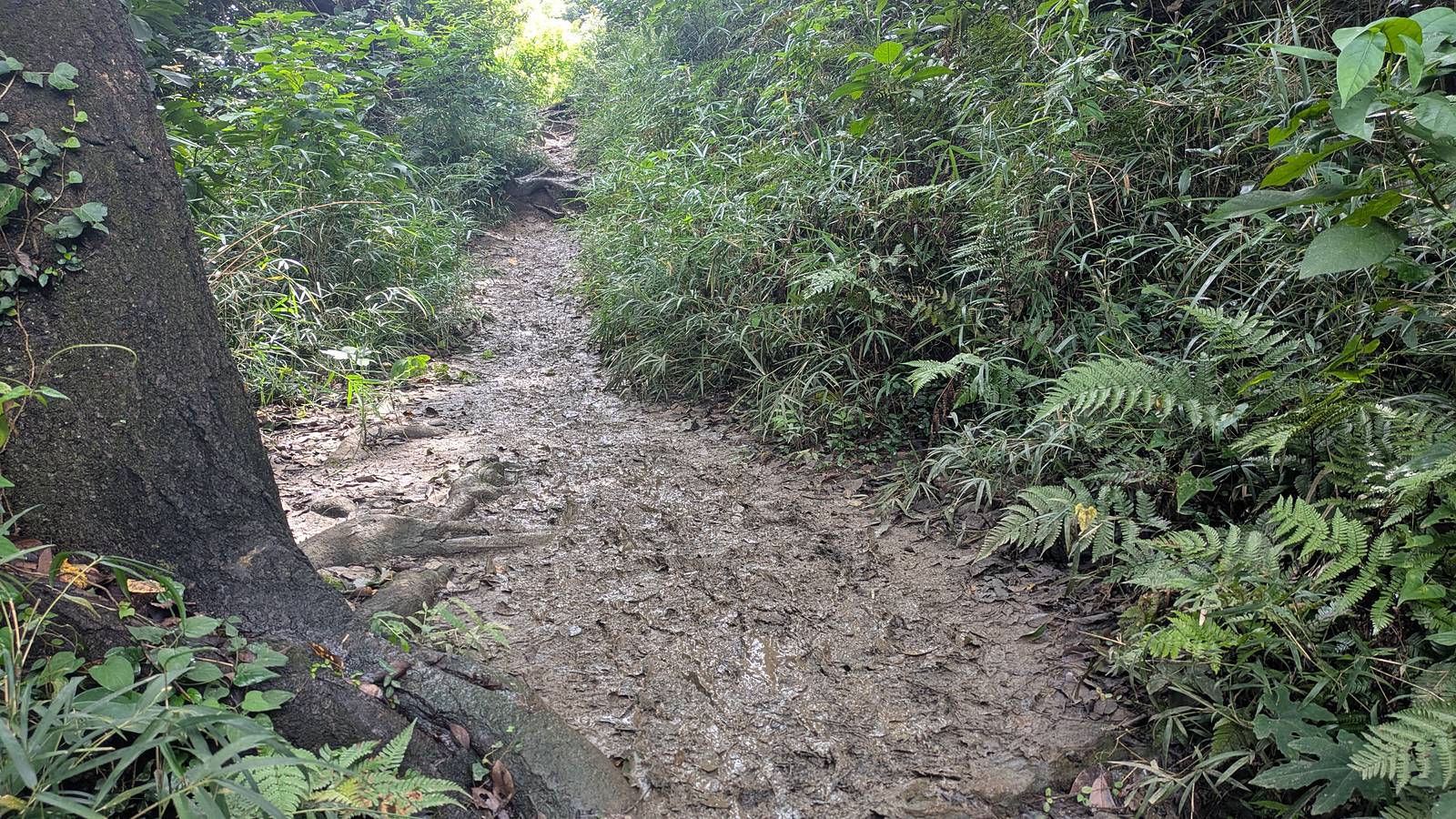
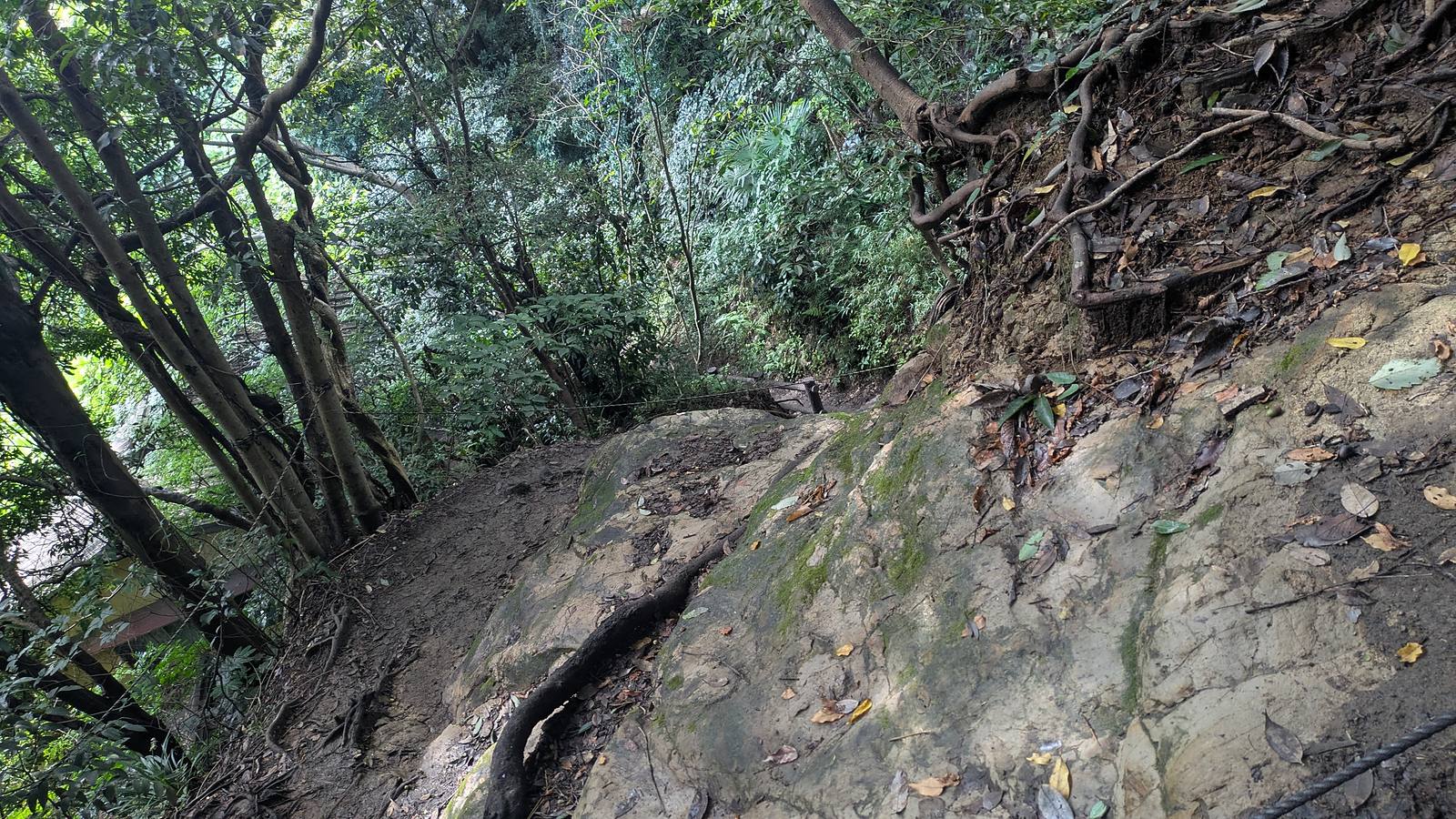
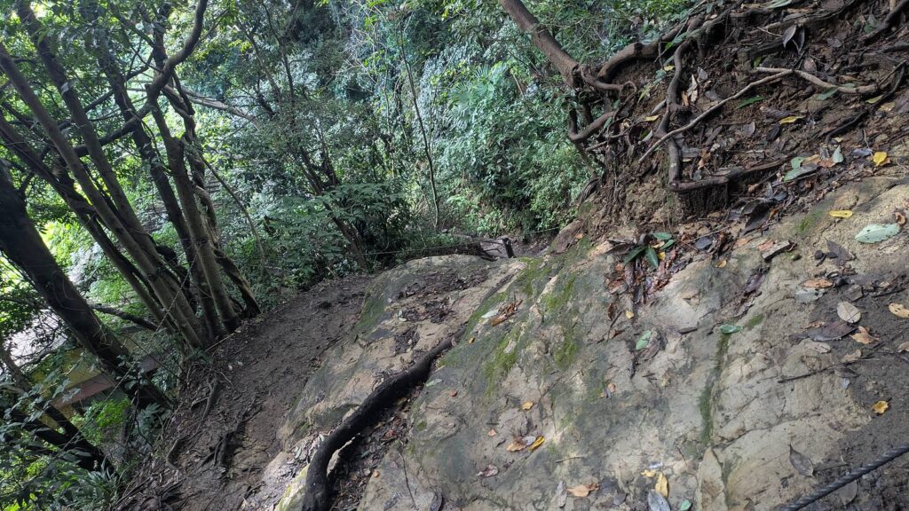
That is the single most useful thing on this page, and it took a full day of walking to find out, because the afternoon photographs look dry until you enlarge them. One stretch of the descent towards Daibutsu-zaka is a churned mud channel with standing water in it and boot prints pressed into the sides. Another is a slab of bare rock tilted down the slope, smooth, with roots running along its upper edge.
The reason sits in the ground. These ridges are low, the canopy closes over the path, and the rock underneath does not drain. Rain from the previous day is still there the following afternoon, in the shade, whatever the sky is doing.
To put it plainly: I walked both trails in hiking boots. I slipped repeatedly on both, and I went down twice. Both falls were on descents.
That is not a warning about one particular corner, and no attempt is made here to name the spot. The climbing on either trail is mild. The descents are where the trouble is, and they are long: 39 minutes down from Ten-en, and 41 minutes down to Daibutsu-zaka.
What this changes, in practice:
- Wear shoes with a real tread. Trainers with a flat sole will be working against you on the rock slabs.
- Take the descents slowly, and use the wooden steps and handrails where they have been put in.
- If it rained in the previous 24 hours, expect mud, and ignore the forecast for the day you are walking. The forecast was correct on 13 September, and the trail was still wet.
Affiliate link. This site earns a commission if you book through it, at no extra cost to you. Photo from our own walk.
Closures here are normal, not exceptional
The hiking trails in Kamakura close, and they close for long periods. The typhoons of 2019 shut them, and the Ten-en trail did not reopen fully until April 2023. A fallen tree closed a section for six days in March 2026.
On 13 September 2026 both trails described here were open end to end. No diversion, no tape, no fallen trunk across the path, and nothing that looked recent.
That is a report about one day. Check before you go, because the pattern above says that an open trail is a condition and not a property. The tourist association publishes the current state of the hiking courses, and it publishes it in English when a course is shut.
Questions people actually ask
Which one is easier? Daibutsu. It is shorter (3.59 km of trail against 3.74 km), it climbs less (226 metres against 319), it tops out lower (about 100 metres against 159.2), and it costs nothing to start. It is also the one with the mud channel on the descent, so easier does not mean dry.
How long does it take? On dirt, 85 minutes for Daibutsu and 92 minutes for Ten-en. Station to station, allow 2 hours for Daibutsu and 3 hours for Ten-en, and add whatever time you spend inside temples. Published figures vary widely, which is why the numbers here are measured.
Can I do it in trainers? You can walk it in trainers when the ground is dry. Here is the honest version: I was in hiking boots, and I fell twice. A flat sole on a wet rock slab is the specific problem.
Which one is free? The Daibutsu trail is free from end to end. The Ten-en trail is free as a path, but the entrance at the Kita-Kamakura end runs through Kencho-ji, and that costs 500 yen in cash. The Zuisenji end had no ticket window when we came out of it, and the signposts show a further entrance at Imaizumidai 4-chome.
What about the day after rain? Assume mud on both, on the descents in particular, and assume it whatever the sky is doing on the day.
Are they suitable for children? The gradients are gentle and the distances are short, so the walking itself is within range for a child who is used to a few kilometres. The wet rock is the thing to weigh, not the climb.
Where are the toilets? Start at the station, where there is one. On the Ten-en side there is also the precinct of Kencho-ji once you have paid to go in. After that it is one public toilet at Ten-en, and on the Daibutsu trail one at Kuzuharaoka Shrine. There is nothing else on either ridge.
Where is the water? The station first. After that, seven vending machines stand on the road just before Kencho-ji, and that is the last water on the Ten-en side. On the Daibutsu trail there is a vending machine at Kuzuharaoka Shrine, about 13 minutes in from the stone steps.
Can I walk them the other way round? Yes, and the Ten-en trail in reverse is the version that avoids the 500 yen, which is what the suggested route on the official English map does. Both trails here were walked from Kita-Kamakura outwards, so the descriptions run in that direction.
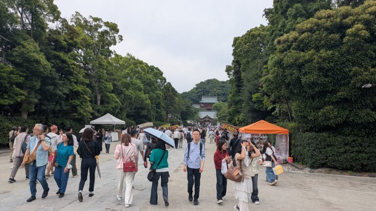
How crowded is it? The trails were not crowded on a Sunday in September. The crowds were at the sights, and the people in them had mostly not arrived on foot from the ridge. There is no need to start at dawn here. Pick your start time from the state of the ground, not from the queues.
Is it Tenen, Ten-en or Tienen? The board at the top spells it Ten-en. Searches often produce Tienen, and Tennen also turns up. They all refer to the same ridge.
Where do I check whether the trail is open? The Kamakura City Tourist Association publishes the current state of the hiking courses, and it posts closures in English.
Affiliate link. This site earns a commission if you book through it, at no extra cost to you. Photo from our own walk.
If you would rather walk either ridge with someone who knows it, one private Kamakura hiking day with a nationally licensed guide starts at your hotel or the nearest station and can be shaped around the Daibutsu trail, the Ten-en ridge, or both. Temple admission, including the 500 yen at Kencho-ji, is still paid by you, in cash.
Affiliate link · Private, with a nationally licensed guide · About 6 hours · Starts at your hotel or the nearest station · Free cancellation up to 24 hours before
What to settle before you leave the station
Two things, and both of them fit on one line.
The first is which end. If the day is going to include the Ten-en ridge and you are starting at Kita-Kamakura, put 500 yen in cash in a pocket, because the entrance is at the back of a paying temple and the card in your wallet is not going to work there. If you would rather not pay it, start the ridge from the other end. That is what the suggested route on the official English map does, and it does it without explaining why.
The second is your shoes, and that one does not care which trail you pick. These ridges hold water under a closed canopy, the descents are the long part of both walks, and a clear sky on the day tells you very little about the ground.
Everything else here is generous. The paths are signposted in three languages, the distances are short, the climbs are mild, and the sea shows up at 159 metres. Kamakura has drawn the map and put up the boards. It has simply left one sentence about one door written in one language, the sentence that says a walker passing through pays the same as a visitor, and that door happens to be the one most guides point you at.
Where to next
- The free one, and how to find an entrance with no gate on it: the Daibutsu trail
- The paid one, and what the 500 yen actually buys: the Ten-en trail
- If the choice is still a whole town rather than a trail: Mount Takao or Kamakura
- The bus at the far end of the Ten-en ridge, and every other bus: how to ride a Japanese bus